World Heritage Identification Number: 251
World Heritage since: 1983
Category: Cultural Heritage
WHE Type: Buildings & Architectural Ensembles
Transboundary Heritage: No
Endangered Heritage: No
Country: 🇮🇳 India
Continent: Asia
UNESCO World Region: Asia and the Pacific
Map
Agra Fort: A Testament to Mughal Architecture and Power
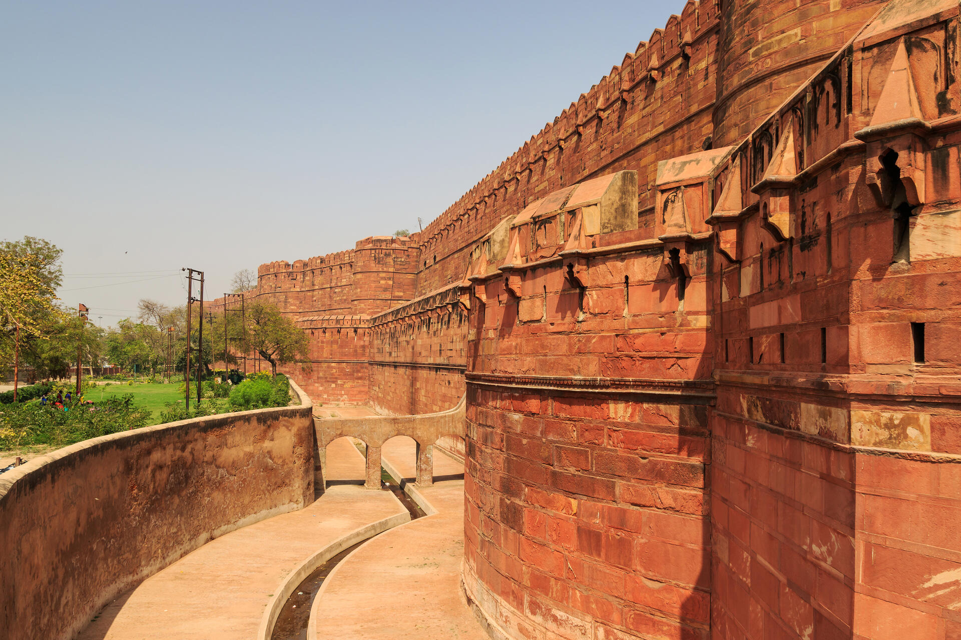
The Agra Fort, officially recognized as the Red Fort of Agra, stands as a significant historical monument in the city of Agra, India. This grand fortress, enclosed within 2.5-kilometer-long red sandstone walls, has been a witness to the rise and fall of the Mughal Empire. Inscribed as a UNESCO World Heritage Site in 1983, the Agra Fort offers a glimpse into the opulence, power, and architectural prowess of the Mughals.
More to come…UNESCO Description of the World Heritage Site
Near the gardens of the Taj Mahal stands the important 16th-century Mughal monument known as the Red Fort of Agra. This powerful fortress of red sandstone encompasses, within its 2.5-km-long enclosure walls, the imperial city of the Mughal rulers. It comprises many fairy-tale palaces, such as the Jahangir Palace and the Khas Mahal, built by Shah Jahan; audience halls, such as the Diwan-i-Khas; and two very beautiful mosques.
Encyclopedia Record: Agra Fort
The Agra Fort is a historical Mughal fort in the city of Agra, also known as Agra's Red Fort. Mughal emperor Humayun was crowned at this fort in 1530. It was later renovated by the Mughal emperor Akbar from 1565 and the present-day structure was completed in 1573. It served as the main residence of the rulers of the Mughal dynasty until 1638, when the capital was shifted from Agra to Delhi. It was also known as the "Lal-Qila" or "Qila-i-Akbari". Before being captured by the British, the last Indian rulers to have occupied it were the Marathas. In 1983, the Agra fort was inscribed as a UNESCO World Heritage Site because of its importance during Mughal rule. It is about 2.5 kilometers (1.6 mi) northwest of its more famous sister monument, the Taj Mahal. The fort can be more accurately described as a walled city. It was later renovated by Shah Jahan.Additional Site Details
Area: Not available
Number of Components: 1
Coordinates: 27.179806 , 78.021528