World Heritage Identification Number: 1563
World Heritage since: 2018
Category: Cultural Heritage
WHE Type: Cultural Landscapes
Transboundary Heritage: No
Endangered Heritage: No
Country: 🇸🇦 Saudi Arabia
Continent: Asia
UNESCO World Region: Arab States
Map
Al-Ahsa Oasis: An Enduring Testament to Human Adaptation and Resilience
The Al-Ahsa Oasis, a sprawling expanse of verdant greenery nestled within the arid landscapes of eastern Saudi Arabia, stands as a testament to human ingenuity and resilience. Inscribed as a UNESCO World Heritage Site in 2018, this evolving cultural landscape offers a captivating glimpse into the rich history, culture, and environmental adaptations that have shaped the Gulf region over millennia.
More to come…UNESCO Description of the World Heritage Site
In the eastern Arabian Peninsula, the Al-Ahsa Oasis is a serial property comprising gardens, canals, springs, wells and a drainage lake, as well as historical buildings, urban fabric and archaeological sites. They represent traces of continued human settlement in the Gulf region from the Neolithic to the present, as can be seen from remaining historic fortresses, mosques, wells, canals and other water management systems. With its 2.5 million date palms, it is the largest oasis in the world. Al-Ahsa is also a unique geocultural landscape and an exceptional example of human interaction with the environment.
UNESCO Justification of the World Heritage Site
Criterion (iii): The continuity of the oasis agricultural tradition is represented by an organically evolved cultural landscape with an agricultural organization based upon the distribution of the spring water through a network of open-air canals. Al-Ahsa Oasis cultural landscape materializes the vivacity and modernity of this specific land-use tradition and shows its continuing relevance at the local and regional scale.
Criterion (iv): This large cultural landscape is composed of different zones covering the oasis’ gardens, mountains, caves, villages, mosques and springs, but also archaeological sites and a small section of the historic centre of Al-Hofuf with the main monuments embodying the political control over the area and its commercial role throughout the past centuries. The vestiges of the villages, fortresses, mosques, markets and houses, though often in a ruinous shape, preserve a complete catalogue of the architectural elements composing the urban settlement of Al-Ahsa from the early Islamic period to the Saudi Kingdom.
Criterion (v): The oasis is an outstanding example of traditional human settlement developed in a desert environment exemplifying the intimate link between landscape, natural resources and the human efforts to settle the land. The rich water table close to the surface permitted the growth of a large oasis settlement. Water was originating from surface springs and drawn from wells reaching the shallow water table. Some of these springs and wells are still visible in the site, living memory of the traditional farming techniques.
Encyclopedia Record: Al-Ahsa Oasis
Al-Ahsa Oasis, also known as al-Ḥasāʾ (الْحَسَا) or Hajar (هَجَر), is an oasis and historical region in eastern Saudi Arabia. Al-Ahsa Governorate, which makes up much of the country's Eastern Province, is named after it. The oasis is located about 60 km inland from the coast of the Arabian Gulf. Al-Ahsa Oasis comprises four main cities and 22 villages. The cities include Al-Mubarraz and Al-Hofuf, two of the largest cities in Saudi Arabia.Additional Site Details
Area: 8,544 hectares
Number of Components: 12
(iv) — Outstanding example of a type of building or landscape
(v) — Outstanding example of traditional human settlement
Coordinates: 25.4021666667 , 49.6305694444
Image
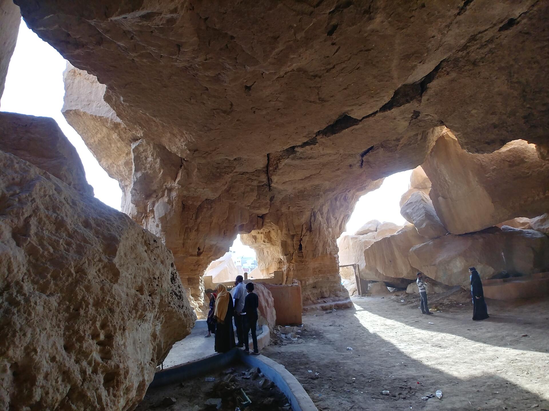
© Aqeel Khalid, CC BY-SA 4.0 Resized from original. (This derivative is under the same CC BY-SA license.)
World Heritage Research
Discover scientific research and academic studies that deepen our understanding of Al-Ahsa Oasis, an Evolving Cultural Landscape from its history and significance to its conservation, management, and contemporary challenges.
-
Assessment of radon levels and radiological risk in groundwater of Al-Ahsa Oasis, Eastern Saudi Arabia
Groundwater in Al-Ahsa Oasis, Saudi Arabia, exhibits low radon levels with no significant radiological risk for domestic use. A study measuring radon activity in 35 wells found concentrations ranging from 0.19 to 14.44 Bq/L, well below the USEPA safety threshold of 11.1 Bq/L. While spatial variability and depth dependence were observed, with higher levels in deeper wells, correlations with pH, salinity, or TDS were weak. Annual ingestion doses for infants and adults remained negligible, as did inhalation risks indoors. Lifetime cancer risk estimates, though variable, averaged at 20.66 × 10⁻⁴, indicating overall safety but necessitating continued monitoring in deeper wells. The study used a RAD7 detector with RAD-H2O accessories to measure radon and applied UNSCEAR and ICRP dose models for risk assessment.
Al-Hamad, S. S., Alsaleh, W. M., Hassan, R. A., Abu-Zeid, H. M., Nada, A., Talaat, S. M., & Almatani, T. (2026). Assessment of radon levels and radiological risk in groundwater of Al-Ahsa Oasis, Eastern Saudi Arabia. Journal of Radiation Research and Applied Sciences, 19(1), 102237. https://doi.org/10.1016/j.jrras.2026.102237
View Publication Record | Read Publication -
Spatial–Temporal Evapotranspiration Dynamics in the Al-Ahsa Oasis Based on a Remote Sensing Approach for Sustainable Water Management
A study reveals pronounced seasonal variability in evapotranspiration (ET) within the Al-Hofuf region of Al-Ahsa Oasis, Saudi Arabia, with peak ET occurring during summer months at 7.2–7.5 mm/day and minima in winter at 2.0–2.6 mm/day. This finding underscores the close link between vegetation activity and atmospheric demand, providing critical insights for sustainable water management in arid environments. Researchers utilized a cloud-based remote sensing approach, combining Landsat 9 Level-2 imagery with ERA5-Land meteorological data to quantify spatial and temporal ET variations over a 25 km buffer. Vegetation dynamics were characterized using the Normalized Difference Vegetation Index (NDVI) to derive crop coefficients within a Kc–ET0 framework. The study's model performance was validated against MODIS MOD16A2, demonstrating strong statistical agreement (R² = 0.82, NSE = 0.71, PBIAS = +8.3%). This approach offers a reliable, cost-effective method for ET monitoring in data-scarce, groundwater-dependent regions, supporting precision irrigation and long-term water sustainability planning in alignment with Saudi Arabia's Vision 2030 and National Water Strategy.
Elhag, M., Alqarawy, A., Psilovikos, A., Tian, W., & Benmakhlouf, I. (2026). Spatial–Temporal Evapotranspiration Dynamics in the Al-Ahsa Oasis Based on a Remote Sensing Approach for Sustainable Water Management. Hydrology, 13(5), 138. https://doi.org/10.3390/hydrology13050138
View Publication Record | Read Publication -
Spatiotemporal Assessment of Environmental Change and Palm Tree Dynamics in Al-Ahsa Oasis Using Multi-Temporal Landsat Data and Machine Learning Approaches
A 35-year study of Al-Ahsa Oasis reveals significant environmental shifts driven by urban expansion and climate change. Using multi-temporal Landsat data (1990–2025) and machine learning, researchers found that while palm tree coverage increased by 16.23%—suggesting resilience in vegetation—the oasis experienced a 67.19% rise in urban development, leading to higher land surface temperatures (LST) and reduced soil exposure. The study highlights how urban growth impacts critical environmental indicators like the Normalized Difference Vegetation Index (NDVI), which fluctuated between −0.19 and 0.75, and LST, which rose from 28.7–48.34°C in 1990 to 34.7–54.6°C by 2025. These findings underscore the need for sustainable urban planning to balance development with agricultural preservation and ecosystem resilience.
Solangi, Y. A., Alyamani, R., Solangi, F., & Solangi, K. A. (2026). Spatiotemporal Assessment of Environmental Change and Palm Tree Dynamics in Al-Ahsa Oasis Using Multi-Temporal Landsat Data and Machine Learning Approaches. Land, 15(7), 1124. https://doi.org/10.3390/land15071124
View Publication Record | Read Publication -
Bias Correction of Satellite Precipitation Products Near the Data-Scarce Region of Al-Ahsa, Saudi Arabia
A novel bias correction algorithm using machine learning models effectively improves the accuracy of satellite precipitation products in arid regions, such as Al-Ahsa Oasis in Saudi Arabia. The study found that a one-dimensional ConvLSTM model outperformed Random Forest and XGBoost, reducing relative bias from 50.8% to -1.71% for CMORPH and from 282.2% to +1.15% for IMERG datasets. This approach is particularly suitable for regions with limited topographical variation and prominent temporal variability, offering a valuable tool for sustainable water resource management, agricultural planning, and drought mitigation in data-scarce arid areas.
Abdullah, M., & Al-Areeq, A. M. (2026). Bias Correction of Satellite Precipitation Products Near the Data-Scarce Region of Al-Ahsa, Saudi Arabia. IEEE Journal of Selected Topics in Applied Earth Observations and Remote Sensing, 19, 22685–22694. https://doi.org/10.1109/jstars.2026.3708749
View Publication Record | Read Publication -
Governing Sustainable Tourism in Al-Ahsa Oasis: An Adaptive Framework for a Living Cultural Landscape
Sustainable tourism in living cultural landscapes, such as Al-Ahsa Oasisrequires adaptive governance that integrates water systems, agriculture, rural livelihoods, heritage values, and climate stress. This study introduces a six-dimensional framework for sustainable tourism governance, emphasizing interdependent dimensions like cultural landscape stewardship, water-sensitive ecological governance, agricultural continuity, community benefit, climate-responsive visitor management, and institutional accountability. Unlike conventional checklists, this approach reframes oasis tourism as an adaptive governance challenge, providing actionable indicators, data sources, and mechanisms for planning, monitoring, and policy refinement. It offers a novel, evidence-based model applicable to arid cultural landscapes, bridging theory with practical implementation.
Alrawaf, T. I., & Al-Hagla, K. (2026). Governing Sustainable Tourism in Al-Ahsa Oasis: An Adaptive Framework for a Living Cultural Landscape. Sustainability, 18(14), 7226. https://doi.org/10.3390/su18147226
View Publication Record | Read Publication -
Aspergillus flavus and Soil Fungi Aflatoxin Production Potential Using Coconut Medium in Al Ahsa Oasis, Saudi Arabia
Aflatoxins, potent carcinogenic mycotoxins produced by Aspergillus flavus, pose significant food safety risks. This study found that 82.4% of A. flavus isolates from Al-Ahsa Oasis, Saudi Arabia, were aflatoxigenic, with production levels classified as high, medium, or low. The research used Coconut Agar Medium (CAM) to screen for aflatoxin production and identified A. flavus as a prevalent fungus in the region's agricultural soils. No significant association was found between aflatoxin production and geographical origin, suggesting strain-specific toxigenicity rather than environmental factors. The study highlights the need for integrated soil-management strategies to mitigate pre-harvest contamination risks, particularly for date palms, and supports CAM as an effective screening tool.
Alhilal, J., Alhumam, N. A., & Fadlelmula, A. (2026). Aspergillus flavus and Soil Fungi Aflatoxin Production Potential Using Coconut Medium in Al Ahsa Oasis, Saudi Arabia. International Journal of Pathogen Research, 15(5), 66–72. https://doi.org/10.9734/ijpr/2026/v15i5485
View Publication Record | Read Publication -
Integrated Remote Sensing and Time Series Analysis for Long-Term Assessment of Vegetation Resilience: Synthesizing Climatic Variables and Land-Use/Land-Cover Trajectories in Al-Ahsa Oasis, Saudi Arabia
A comprehensive 41-year analysis of Al-Ahsa Oasis reveals that while overall vegetation cover has improved, significant degradation persists in urban and water-dominated areas, accounting for nearly half of the oasis. The study, combining remote sensing data from three Landsat sensors with climatic variables, found no strong interannual climate-vegetation relationships after detrending, indicating long-term trends drive observed changes rather than short-term climate variations. High accuracy in land-use/land-cover trajectory classification underscores robust mapping performance. These findings provide critical insights for sustainable urban planning and agricultural management in this fragile arid ecosystem.
Aljaddani, A. H. (2026). Integrated Remote Sensing and Time Series Analysis for Long-Term Assessment of Vegetation Resilience: Synthesizing Climatic Variables and Land-Use/Land-Cover Trajectories in Al-Ahsa Oasis, Saudi Arabia. Land, 15(9), 1758. https://doi.org/10.3390/land15091758
View Publication Record | Read Publication