World Heritage Identification Number: 102
World Heritage since: 1980
Category: Cultural Heritage
WHE Type: Historic Cities & Urban Areas
Transboundary Heritage: No
Endangered Heritage: No
Country: 🇩🇿 Algeria
Continent: Africa
UNESCO World Region: Arab States
Map
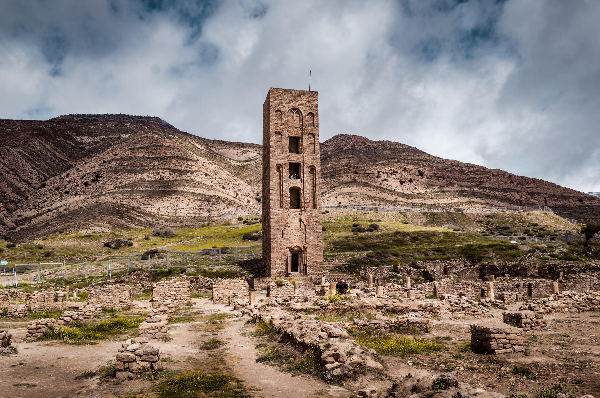
Al Qal'a of Beni Hammad: A Fortified Palatine City in Algeria
The Al Qal'a of Beni Hammad, located in the Hodna Mountains northeast of M'Sila, Algeria, stands as a testament to the architectural prowess and political power of the Hammadid dynasty during the Middle Ages. This fortified palatine city, now in ruins, was the first capital of the Hammadids, established in 1007 and abandoned in 1152.
More to come…UNESCO Description of the World Heritage Site
In a mountainous site of extraordinary beauty, the ruins of the first capital of the Hammadid emirs, founded in 1007 and demolished in 1152, provide an authentic picture of a fortified Muslim city. The mosque, whose prayer room has 13 aisles with eight bays, is one of the largest in Algeria.
UNESCO Justification of the World Heritage Site
Criterion (iii): The Qal'a of Beni Hammad bears exceptional testimony to the Hammadid civilization now disappeared. Founded in 1007 as a military stronghold, it was elevated to the level of metropolis. It has influenced the development of Arab architecture as well as other civilizing influences, including the Maghreb, Andalusia and Sicily. The archaeological and monumental vestiges of the Qal'a of Beni Hammad, among which are included the Great mosque and its minaret as well as a series of palaces, constitute the principal resources that testify to the wealth and influence of this Hammadid civilization.
Encyclopedia Record: Qal'at Bani Hammad
Qal'at Bani Hammad, also known as Qal'a Bani Hammad or Qal'at of the Beni Hammad, is a fortified palatine city in Algeria. Now in ruins, in the 11th century, it served as the first capital of the Hammadid dynasty. It is in the Hodna Mountains northeast of M'Sila, at an elevation of 1,418 metres (4,652 ft), and receives abundant water from the surrounding mountains. The site is near the town of Maadid, about 225 kilometres (140 mi) southeast of Algiers, in the Maghreb.Additional Site Details
Area: 150 hectares
Number of Components: 1
Coordinates: 35.81844 , 4.78684
Image
© R hakka, CC BY-SA 4.0 Resized from original. (This derivative is under the same CC BY-SA license.)
