World Heritage Identification Number: 193
World Heritage since: 1982
Category: Cultural Heritage
WHE Type: Archaeological Sites
Transboundary Heritage: No
Endangered Heritage: No
Country: 🇩🇿 Algeria
Continent: Africa
UNESCO World Region: Arab States
Map
Tipasa: A Unique Group of Ancient Ruins in Algeria
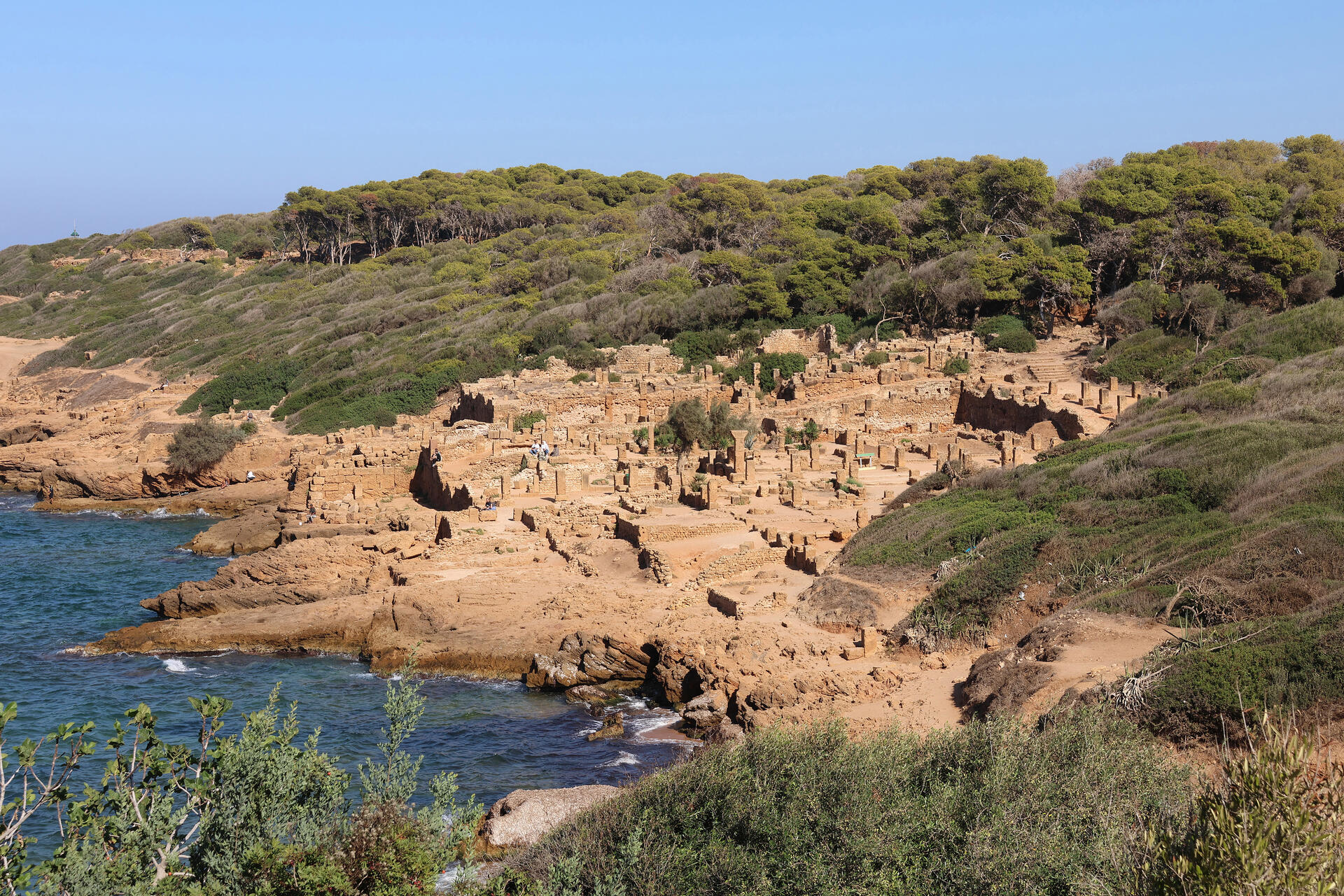
Tipasa, also known as Tipasa in Mauretania, is a historical site situated along the Mediterranean coast in central Algeria. This ancient city, which dates back to the Punic era, has been recognized as a World Heritage Site by UNESCO since 1982. The site's rich history spans various periods, including Phoenician, Roman, paleo-Christian, and Byzantine, making it a unique blend of cultures and architectural styles.
More to come…UNESCO Description of the World Heritage Site
On the shores of the Mediterranean, Tipasa was an ancient Punic trading-post conquered by Rome and turned into a strategic base for the conquest of the kingdoms of Mauritania. It comprises a unique group of Phoenician, Roman, palaeochristian and Byzantine ruins alongside indigenous monuments such as the Kbor er Roumia, the great royal mausoleum of Mauretania.
UNESCO Justification of the World Heritage Site
Criterion (iii): Tipasa bears exceptional testimony to the Punic and Roman civilizations now disappeared.
Criterion (iv): The architectural and archaeological vestiges of Tipasa reflect in a significant manner the contacts between the indigenous civilizations and the Punic and Roman waves of colonization between the 6th century B.C. and the 6th century A.D.
Encyclopedia Record: Tipasa
Tipasa, sometimes distinguished as Tipasa in Mauretania, was a colonia in the Roman province Mauretania Caesariensis, nowadays called Tipaza, and located in coastal central Algeria. Since 1982, it has been declared by UNESCO a World Heritage Site. It was declared a World Heritage Site in danger in 2002, but was removed from the danger list in 2006 following conservation efforts.Additional Site Details
Area: 52.16 hectares
Number of Components: 3
(iv) — Outstanding example of a type of building or landscape
Coordinates: 36.55 , 2.383333333
World Heritage Research
Discover scientific research and academic studies that deepen our understanding of Tipasa from its history and significance to its conservation, management, and contemporary challenges.
-
History as a Barrier to Climate Change Adaptation and Conservation at the World Heritage Site, Tipasa, Algeria
Tipasa, a UNESCO World Heritage Site on Algeria's Mediterranean coast, faces significant risks from climate change-driven coastal erosion and sea-level rise, exacerbated by historical colonial barriers that hinder effective conservation. Despite repeated warnings and requests for action from UNESCO, the site remains vulnerable due to lack of local engagement, mismanagement, and disregard for expert advice. This study highlights how Tipasa's unique challenges—rooted in its complex Punic/Roman/Byzantine history and modern urban integration—differ from other Algerian heritage sites, placing it at greater risk of irreversible damage.
Clarke, J. (2026). History as a Barrier to Climate Change Adaptation and Conservation at the World Heritage Site, Tipasa, Algeria. Bridging History and Policy, 325–339. https://doi.org/10.1007/978-3-032-24379-9_18
View Publication Record | Read Publication -
How to manage and enhance archeology and landscape at the Royal Mausoleum of Mauretania (Tipasa, Algeria)
A coherent strategy for managing and enhancing both archaeology and landscape at the Royal Mausoleum of Mauretania in Tipasa, Algeria, has been proposed. The study emphasizes that archaeological sites and landscapes are interdependent, with each contributing unique values—archaeological significance, ecological richness, natural beauty, symbolic meaning, and emotional resonance—that should be preserved and promoted together rather than treated separately. By integrating landscape as a valuable resource for heritage development, the research advocates for responsible management practices that harmonize the mausoleum's architectural and archaeological importance with its surrounding environment. This approach aims to ensure the sustainable preservation of Tipasa's cultural and natural heritage while enhancing its global significance.
Aoudia, L. B., & Zebda, D. B. (2024). How to manage and enhance archeology and landscape at the Royal Mausoleum of Mauretania (Tipasa, Algeria). South Florida Journal of Development, 5(2), 546–564. https://doi.org/10.46932/sfjdv5n2-011
View Publication Record | Read Publication -
Restoration of Two Terracotta Fragments from an Amphora Found in a Marine Environment in Tipasa
Two terracotta fragments from a Dressel 1C amphora, likely used for transporting wine, were discovered near Tipasa's beaches and restored using innovative techniques. The terracotta was found to be highly porous due to low-temperature firing in an oxidizing atmosphere, with calcite presence indicating incomplete degassing. Restoration involved mechanical cleaning, chemical treatment with citric acid and EDTA, and reassembly. However, silica-based diatoms persisted as white film-like stains, posing a challenge for complete removal without damaging the fragile terracotta. The study highlights the effectiveness of non-invasive restoration methods while acknowledging the limitations in addressing organic residues.
BOUZETINE, K., BELAIDI, M., NAIT HALIMA, L., KHELLAF, R.,. (2024). RESTORATION OF TWO TERRACOTTA FRAGMENTS FROM AN AMPHORA FOUND IN A MARINE ENVIRONMENT IN TIPASA. International Journal of Conservation Science, 15(4), 1817–1826. https://doi.org/10.36868/ijcs.2024.04.14
View Publication Record | Read Publication -
The Territory of Ancient Tipasa, Algeria: Archaeological Survey, Material Culture, and Connectivity in Central Maghreb
A comprehensive archaeological survey of the UNESCO-listed Tipasa territory, previously underexplored since Gsell's 1911 atlas, reveals significant insights into the Punic, Hellenistic, Mauretanian, and Roman influences that shaped this central Maghreb landscape. The TIPASA Project, a Spanish-Algerian collaboration initiated in 2021, employs remote sensing, field surveys, and material culture analysis to uncover the city's connectivity with Iberia and its broader Mediterranean networks. This research challenges traditional narratives by emphasizing African-led networks in antiquity and provides a framework for understanding North African urban development before and after Roman administration.
Quevedo, A., García-Sánchez, J., Khellaf, R., & Bensaidani, Y. (2023). The Territory of Ancient Tipasa, Algeria: Archaeological Survey, Material Culture, and Connectivity in Central Maghreb. African Archaeological Review, 40(4), 673–709. https://doi.org/10.1007/s10437-023-09529-6
View Publication Record | Read Publication -
Tipasa - Carthago Nova: relaciones hispano-mauritanas a través de la pintura mural
A recent Hispano-Algerian archaeological project has uncovered evidence of previously undocumented connections between Tipasa, Algeria, and the Iberian Peninsula through Roman mural painting. Among the findings is a distinct incised decorative technique, characteristic of Southeast Spain's Carthaginian region but hitherto unseen in North Africa. This technique, attributed to a local workshop from the first half of the 1st century CE, suggests cross-Mediterranean artistic exchange and circulation of craftsmanship between Tipasa and Carthago Nova (modern Cartagena). The study employed systematic prospection along a coastal strip, including the UNESCO-listed Colonia Aelia Augusta Tipasensium and the Mauritania Caesarensis Mausoleum, revealing residential structures with thermal baths. This discovery sheds new light on understudied regions of Roman North Africa and challenges assumptions about artistic development in the Maghreb.
Khellaf, R., Quevedo, A., Bensaidani, Y., Castillo Alcántara, G., Fernández Díaz, A., & García Sánchez, J. (2023). Tipasa - Carthago Nova: relaciones hispano-mauritanas a través de la pintura mural. Lucentum, (42), 163–176. https://doi.org/10.14198/lvcentvm.23267
View Publication Record | Read Publication -
African heritage sites threatened as sea-level rise accelerates
A significant portion of Africa's UNESCO World Heritage Sites, including iconic ruins like Tipasa in Algeria and the North Sinai Archaeological Sites Zone in Egypt, are already at risk from coastal flooding and erosion due to a 1-in-100-year extreme event. Under high greenhouse gas emission scenarios (RCP 8.5), this risk is projected to more than triple by 2050, exposing nearly 200 sites. Mitigating emissions could reduce the number of highly exposed sites by 25%. The study analyzed a database of 213 natural and 71 cultural heritage sites using moderate (RCP 4.5) and high emission scenarios to assess vulnerability, emphasizing the urgent need for climate adaptation strategies, governance improvements, and site-specific protection measures.
Vousdoukas, M. I., Clarke, J., Ranasinghe, R., Reimann, L., Khalaf, N., Duong, T. M., Ouweneel, B., Sabour, S., Iles, C. E., Trisos, C. H., Feyen, L., Mentaschi, L., & Simpson, N. P. (2022). African heritage sites threatened as sea-level rise accelerates. Nature Climate Change, 12(3), 256–262. https://doi.org/10.1038/s41558-022-01280-1
View Publication Record | Read Publication -
‘Smiling Bravely at the Night’: Roberto Gerhard’s Symphony No. 3, ‘Collages’, and Albert Camus’s ‘Retour à Tipasa’
A hidden narrative, parallel to Roberto Gerhard's explicit program for his Symphony No. 3 'Collages' (1960), emerges from correspondences with Albert Camus's essay 'Retour à Tipasa'. Both works share a dramatic structure unfolding from dawn to night, mirroring themes of human suffering and defiance. This hermeneutic analysis reveals a 'secret program' in Gerhard's composition, enriching its interpretation through the lens of Camus's meditative reflection on Tipasa. The study employs comparative textual analysis to uncover these striking parallels, offering new insights into the interplay between music and literature.
White, J. (2022). ‘Smiling Bravely at the Night’: Roberto Gerhard’s Symphony No. 3, ‘Collages’, and Albert Camus’s ‘Retour à Tipasa’. Roberto Gerhard, 238–252. https://doi.org/10.5871/bacad/9780197267134.003.0014
View Publication Record | Read Publication