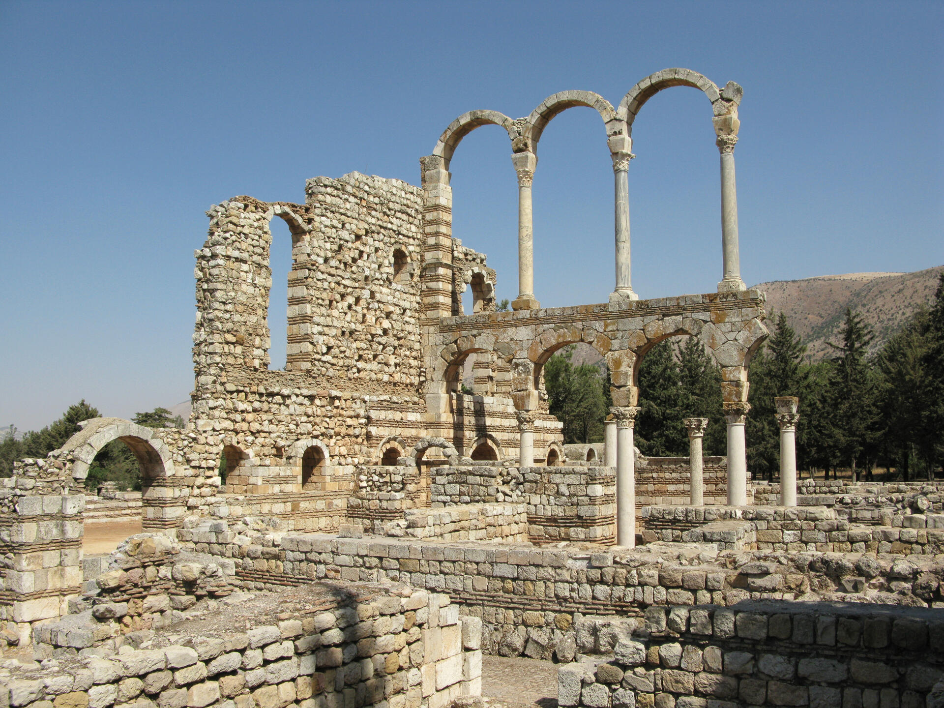
World Heritage Identification Number: 293
World Heritage since: 1984
Category: Cultural Heritage
WHE Type: Historic Cities & Urban Areas
Transboundary Heritage: No
Endangered Heritage: No
Country: 🇱🇧 Lebanon
Continent: Asia
UNESCO World Region: Arab States
Map
Anjar: A Unique Testimony to Umayyad City Planning
Anjar, officially known as 'Anjar, is a small town located in the Bekaa Valley of Lebanon, near the Syrian border. With a population of approximately 2,400, the town is predominantly inhabited by Armenians. Spanning over around twenty square kilometers, Anjar is most renowned for its UNESCO World Heritage Site status, granted in 1984, due to the well-preserved ruins of the Umayyad settlement that lies within its borders.
More to come…UNESCO Description of the World Heritage Site
The city of Anjar was founded by Caliph Walid I at the beginning of the 8th century. The ruins reveal a very regular layout, reminiscent of the palace-cities of ancient times, and are a unique testimony to city planning under the Umayyads.
UNESCO Justification of the World Heritage Site
Criterion (iii): Founded during the Umayyad period under the Caliphate of Walid Ibn Abd Al-Malak at the beginning of the 8th century, the excavated vestiges of the city of Anjar, which was abandoned after a short period, provide an eminent testimony, precisely dated, of the Umayyad civilization.
Criterion (iv): Architectural complex possessing all the true characteristics of the Umayyad civilization, the city of Anjar constitutes an outstanding example of 8th century town planning of the Umayyad caliphate. The evolution of certain protobyzantine styles towards a more developed Islamic architecture is apparent in the building techniques as well as in the architectonical and ornamental elements employed.
Encyclopedia Record: Anjar, Lebanon
Anjar ; Arabic: عنجر / ALA-LC: ‘Anjar; also known as Hawsh Mousa, is a town of Lebanon, near the Syrian border, located in the Bekaa Valley. The population is 2,400, consisting almost entirely of Armenians. The total area is about twenty square kilometers. Since 1984, the ruins of the Umayyad settlement of Anjar have been recognized by UNESCO as a World Heritage Site.Additional Site Details
Area: Not available
Number of Components: 1
(iv) — Outstanding example of a type of building or landscape
Coordinates: 33.7319444444 , 35.9333333333