World Heritage Identification Number: 939
World Heritage since: 1999
Category: Cultural Heritage
WHE Type: Archaeological Sites
Transboundary Heritage: No
Endangered Heritage: No
Country: 🇲🇽 Mexico
Continent: Americas
UNESCO World Region: Latin America and the Caribbean
Map
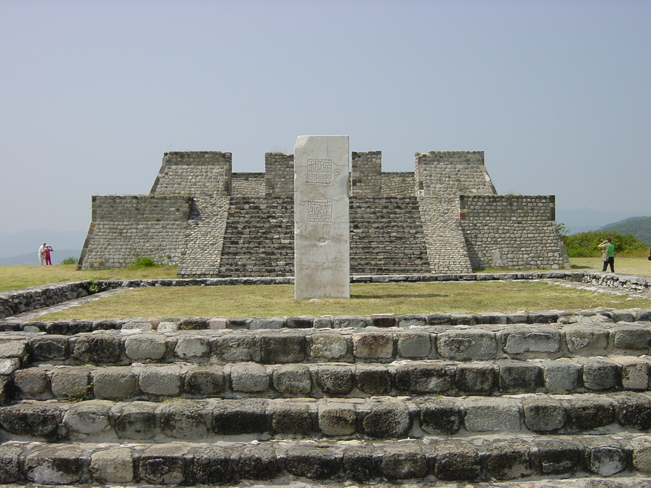
Xochicalco: A Pre-Columbian Political, Religious, and Commercial Center
The Archaeological Monuments Zone of Xochicalco, inscribed as a UNESCO World Heritage Site in 1999, offers a unique glimpse into the complex and dynamic history of Mesoamerica during the Postclassic Period (650–900 AD). Located in Miacatlán, Morelos, approximately 38 kilometers southwest of Cuernavaca and 122 kilometers from Mexico City, this ancient city is a testament to the resilience and ingenuity of its inhabitants following the decline of major Mesoamerican civilizations like Teotihuacan, Monte Albán, Palenque, and Tikal.
More to come…UNESCO Description of the World Heritage Site
Xochicalco is an exceptionally well-preserved example of a fortified political, religious and commercial centre from the troubled period of 650–900 that followed the break-up of the great Mesoamerican states such as Teotihuacan, Monte Albán, Palenque and Tikal.
UNESCO Justification of the World Heritage Site
Criterion (iii): Xochicalco is an exceptionally well preserved and complete example of a fortified settlement from the Epiclassic Period of Mesoamerica.
Criterion (iv): The architecture and art of Xochicalco represent the fusion of cultural elements from different parts of Mesoamerica, at a period when the breakdown of earlier political structures resulted in intensive cultural regrouping.
Encyclopedia Record: Xochicalco
Xochicalco is a pre-Columbian archaeological site in Miacatlán in the western part of the Mexican state of Morelos. The name Xochicalco may be translated from Nahuatl as "in the house of Flowers". The site is located 38 km southwest of Cuernavaca, about 122 km by road from Mexico City. The site is open to visitors all week, from 10 am to 5 pm, although access to the observatory is only allowed after noon. The apogee of Xochicalco came after the fall of Teotihuacan and it has been speculated that Xochicalco may have played a part in the fall of the Teotihuacan empire.Additional Site Details
Area: 707.65 hectares
Number of Components: 1
(iv) — Outstanding example of a type of building or landscape
Coordinates: 18.803972 , -99.29639