World Heritage Identification Number: 476
World Heritage since: 2006
Category: Cultural Heritage
WHE Type: Archaeological Sites
Transboundary Heritage: No
Endangered Heritage: No
Country: 🇲🇼 Malawi
Continent: Africa
UNESCO World Region: Africa
Map
Exploring the Rich Legacy of Chongoni Rock-Art Area: A Unique Cultural Treasure in Central Africa
The Chongoni Rock-Art Area, inscribed as a UNESCO World Heritage Site in 2006, stands out as a remarkable testament to human history and creativity in Central Africa. This unique region, situated amidst a cluster of verdant granite hills on the Malawi plateau, spans an area of approximately 126.4 square kilometers.
More to come…UNESCO Description of the World Heritage Site
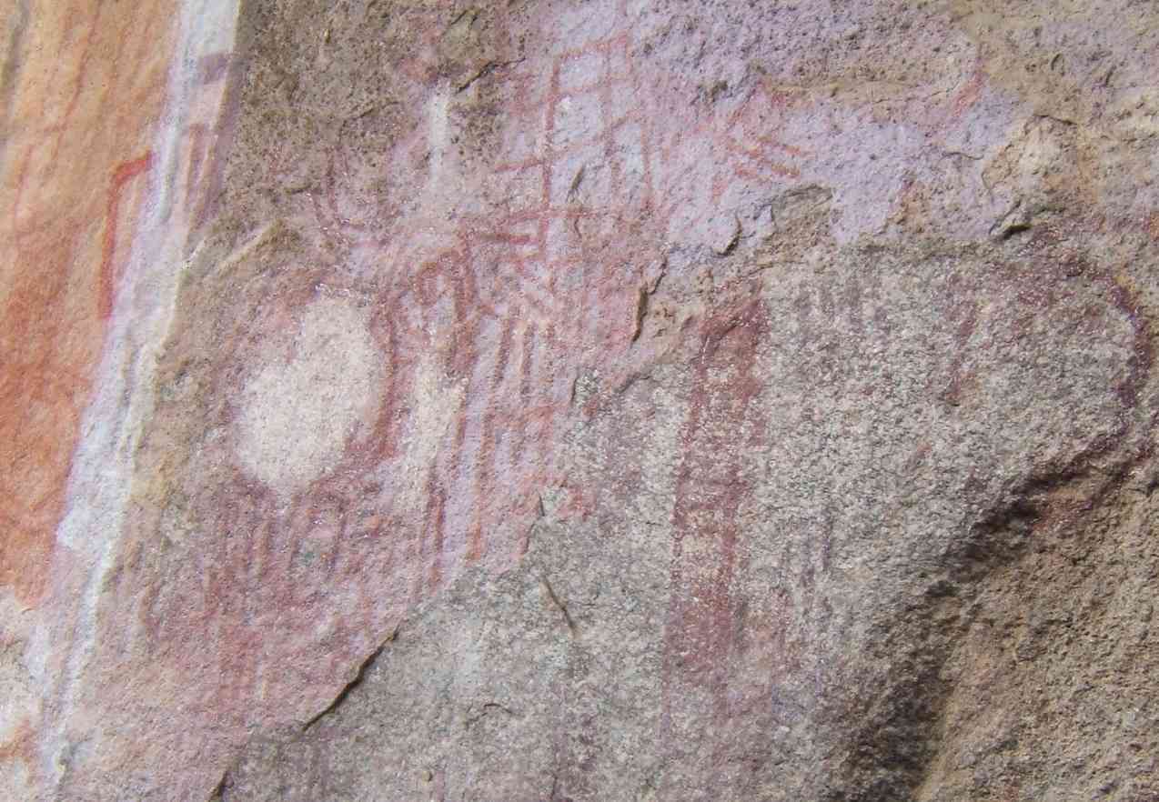
Situated within a cluster of forested granite hills and covering an area of 126.4 km2, high up the plateau of central Malawi, the 127 sites of this area feature the richest concentration of rock art in Central Africa. They reflect the comparatively scarce tradition of farmer rock art, as well as paintings by BaTwa hunter-gatherers who inhabited the area from the late Stone Age. The Chewa agriculturalists, whose ancestors lived there from the late Iron Age, practised rock painting until well into the 20th century. The symbols in the rock art, which are strongly associated with women, still have cultural relevance amongst the Chewa, and the sites are actively associated with ceremonies and rituals.
UNESCO Justification of the World Heritage Site
Criterion (iii): The dense and extensive collection of rock art shelters reflects a remarkable persistence of cultural traditions over many centuries, connected to the role of rock art in women's initiations, in rain making and in funeral rites, particularly in the Chewa agricultural society.
Criterion (vi): The strong association between the rock art images and contemporary traditions of initiation and of the Nyau secret society, and the extensive evidence for those traditions within the painted images over many centuries, together make the Chongoni landscape a powerful force in Chewa society and a significant place for the whole of southern Africa.
Encyclopedia Record: Chongoni Rock Art Area
The Chongoni Rock Art Area is a region containing 127 rock art and painting sites depicting the farmer community of the Late Stone Age and Iron Age, located in the forested hills of the Malawi plateau in the Central Region of Malawi.Additional Site Details
Area: 12,640 hectares
Number of Components: 1
(vi) — Directly associated with events or living traditions
Coordinates: -14.2185207713 , 34.2070738323
Image
「Malawi」, Public domain
