World Heritage Identification Number: 420
World Heritage since: 1987
Category: Cultural Heritage
WHE Type: Historic Cities & Urban Areas
Transboundary Heritage: No
Endangered Heritage: Yes
Country: 🇧🇴 Bolivia (Plurinational State of)
Continent: Americas
UNESCO World Region: Latin America and the Caribbean
Map
The City of Potosí: A UNESCO World Heritage Site and Silver Mining Hub
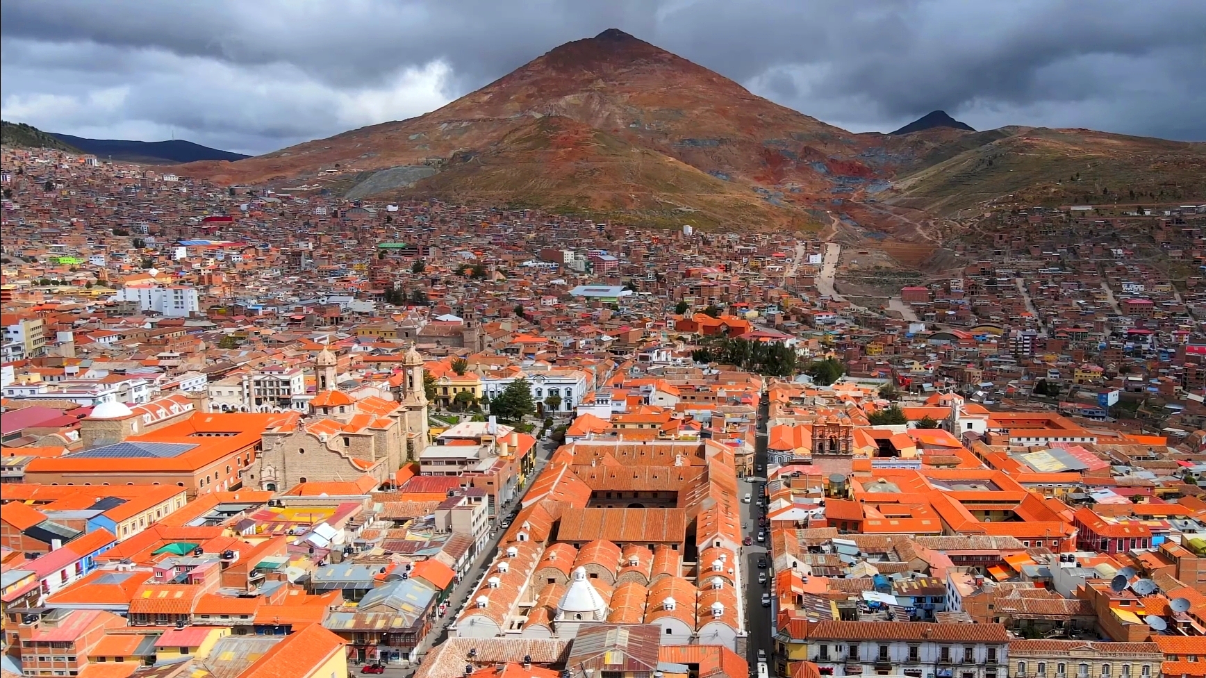
The City of Potosí, located in the highlands of Bolivia, stands as a testament to human ingenuity and the relentless pursuit of wealth during the colonial era. Established in the 16th century, it was once considered the world's largest industrial complex, earning its designation as a UNESCO World Heritage Site in 1987.
More to come…UNESCO Description of the World Heritage Site
In the 16th century, this area was regarded as the world’s largest industrial complex. The extraction of silver ore relied on a series of hydraulic mills. The site consists of the industrial monuments of the Cerro Rico, where water is provided by an intricate system of aqueducts and artificial lakes; the colonial town with the Casa de la Moneda; the Church of San Lorenzo; several patrician houses; and the barrios mitayos, the areas where the workers lived.
Encyclopedia Record: Potosí
Potosí, known as Villa Imperial de Potosí in the colonial period, is the capital city and a municipality of the Department of Potosí in Bolivia. It is one of the highest cities in the world at a nominal 4,067 m (13,343 ft).Additional Site Details
Area: 2,211 hectares
(iv) — Outstanding example of a type of building or landscape
(vi) — Directly associated with events or living traditions
Coordinates: -19.599112 , -65.749813
Image
© Parallelepiped09, CC BY-SA 4.0 Resized from original. (This derivative is under the same CC BY-SA license.)
