World Heritage Identification Number: 614
World Heritage since: 1994
Category: Cultural Heritage
WHE Type: Historic Cities & Urban Areas
Transboundary Heritage: No
Endangered Heritage: No
Country: 🇹🇷 Türkiye
Continent: Asia
UNESCO World Region: Europe and North America
Map
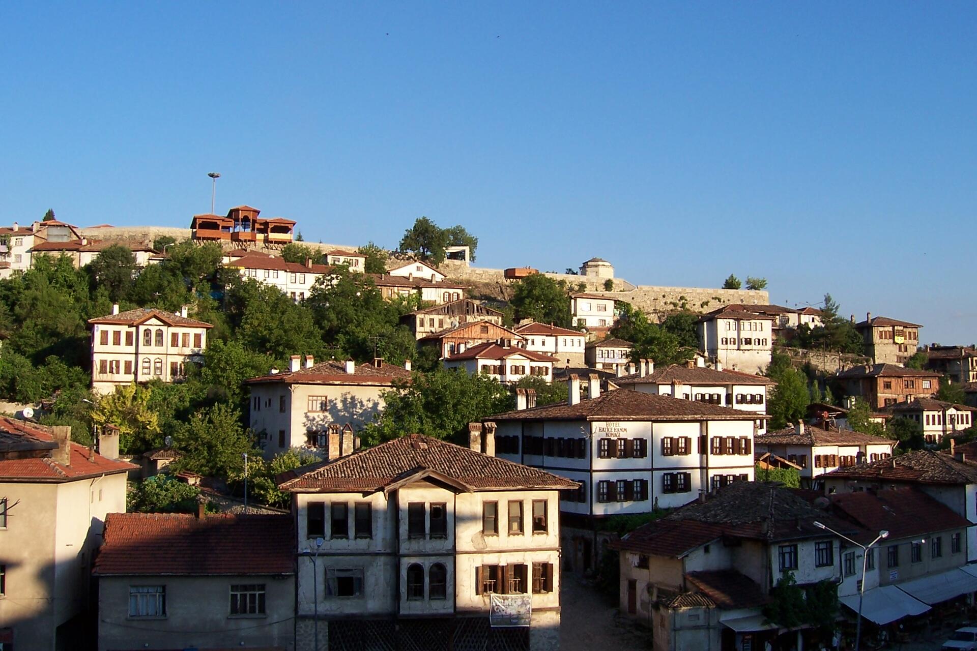
Historical Significance and Architectural Wonders of the City of Safranbolu
The City of Safranbolu, nestled in the Black Sea region of Turkey, offers a unique blend of history, culture, and architectural splendor that has earned it a place on the prestigious list of UNESCO World Heritage Sites since 1994. Situated approximately 9 kilometers north of the city of Karabük, this ancient town boasts a rich heritage dating back to the 13th century.
More to come…UNESCO Description of the World Heritage Site
From the 13th century to the advent of the railway in the early 20th century, Safranbolu was an important caravan station on the main East–West trade route. The Old Mosque, Old Bath and Süleyman Pasha Medrese were built in 1322. During its apogee in the 17th century, Safranbolu's architecture influenced urban development throughout much of the Ottoman Empire.
UNESCO Justification of the World Heritage Site
Criterion (ii): By virtue of its key role in the caravan trade over many centuries, Safranbolu enjoyed great prosperity. As a result, it set a standard in public and domestic architecture that exercised a great influence on urban development over a large area of the Ottoman Empire.
Criterion (iv): For centuries, the caravan trade was the main commercial link between the Orient and Europe. As a result, characteristic towns developed along its route. With the emergence of railways in the 19th century, these towns abruptly lost their raison d’être, and most of them were adapted to other economic purposes. After the collapse of the caravan trade, Safranbolu’s proximity to the Karabük steel works gave it a new socio-economic role, although it preserved its original form and buildings to a remarkable extent.
Criterion (v): Safranbolu is a typical Ottoman city that displays an interesting interaction between its topography and historic settlement.
Encyclopedia Record: Safranbolu
Safranbolu is a town in Karabük Province in the Black Sea region of Turkey. It is the seat of Safranbolu District. Its population is 52,999 (2022). It is about 9 km north of the city of Karabük, 200 kilometres (120 mi) north of Ankara and about 100 km south of the Black Sea coast. The town's historic names in Greek were Theodoroupolis and later Saphrampolis (Σαφράμπολις). Its former names in Turkish were Zalifre and Taraklıborlu. It was part of Kastamonu Province until 1923 and Zonguldak Province between 1923 and 1995. The town lies at an elevation of 508 m (1,667 ft).Additional Site Details
Area: 193 hectares
Number of Components: 3
(iv) — Outstanding example of a type of building or landscape
(v) — Outstanding example of traditional human settlement
Coordinates: 41.26 , 32.68972
Image
© Uğur Başak, CC BY-SA 3.0 Resized from original. (This derivative is under the same CC BY-SA license.)
