World Heritage Identification Number: 1121
World Heritage since: 2011
Category: Cultural Heritage
WHE Type: Agriculture Landscapes, Parks & Gardens
Transboundary Heritage: No
Endangered Heritage: No
Country: 🇨🇴 Colombia
Continent: Americas
UNESCO World Region: Latin America and the Caribbean
Map
The Coffee Cultural Landscape of Colombia: A Unique and Sustainable Tradition
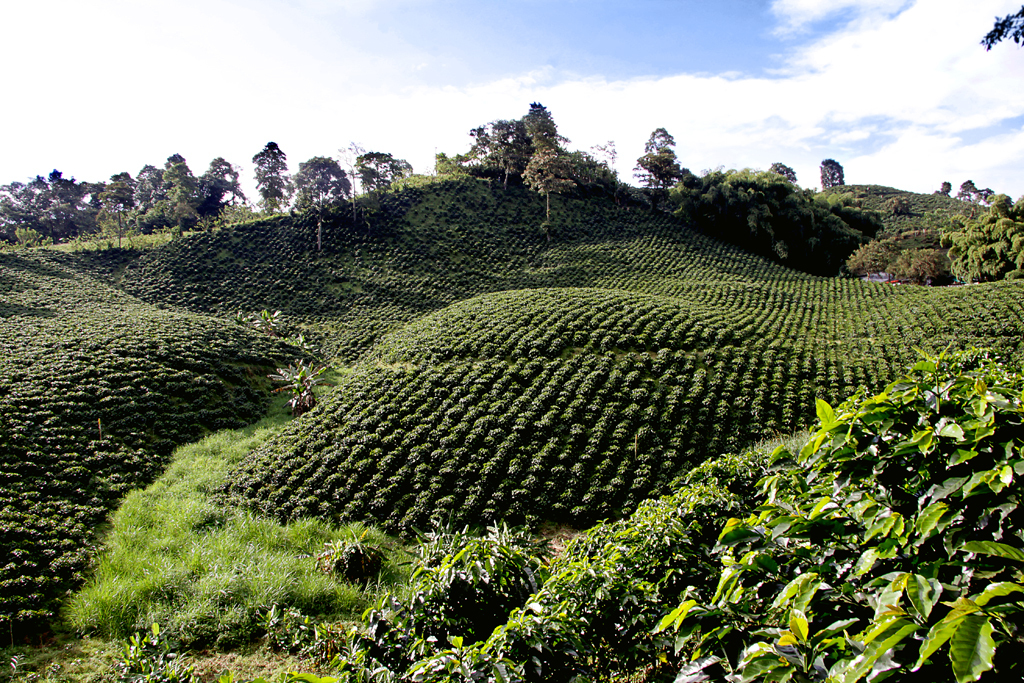
The Coffee Cultural Landscape of Colombia, inscribed as a UNESCO World Heritage Site in 2011, presents an exceptional example of a sustainable and productive cultural landscape. This unique and representative tradition spans across six farming landscapes, which encompass 18 urban centers nestled on the foothills of the western and central ranges of the Cordillera de los Andes in the west of the country.
More to come…UNESCO Description of the World Heritage Site
An exceptional example of a sustainable and productive cultural landscape that is unique and representative of a tradition that is a strong symbol for coffee growing areas worldwide - encompasses six farming landscapes, which include 18 urban centres on the foothills of the western and central ranges of the Cordillera de los Andes in the west of the country. It reflects a centennial tradition of coffee growing in small plots in the high forest and the way farmers have adapted cultivation to difficult mountain conditions. The urban areas, mainly situated on the relatively flat tops of hills above sloping coffee fields, are characterized by the architecture of the Antioquian colonization with Spanish influence. Building materials were, and remain in some areas, cob and pleated cane for the walls with clay tiles for the roofs.
UNESCO Justification of the World Heritage Site
Criterion (v): The CCLC is an outstanding example of continuing land-use, in which the collective effort of several generations of campesino families generated innovative management practices of natural resources in extraordinarily challenging geographical conditions. The strong community focus on coffee production in all aspects of life produced an unparalleled cultural identity, which finds its physical expression in the cultural patterns and materials used for coffee farming as well as the urban settlements.
Criterion (vi): The coffee tradition is the most representative symbol of national culture in Colombia, for which Colombia has gained worldwide recognition. In the CCLC this coffee culture has led to rich tangible and intangible manifestations in the territory, with a unique legacy, included in, but not limited to, the harmonious integration of the productive process in the social organization and housing typology, and communicated though associated local traditions and costumes, such as the sombrero aguadeño – a traditional type of hat – and the raw hide shoulder bag, still used by the coffee producers.
Encyclopedia Record: Colombian coffee growing axis
The Coffee Axis is a geographic, cultural, economic and ecological region of Colombia, located in the departments of Caldas, Risaralda and Quindío, as well as the regions of northwestern Tolima, northern and eastern Valle del Cauca and southwestern Antioquia, including the capital cities of the first four departments mentioned.Additional Site Details
Area: 141,120 hectares
Number of Components: 6
(vi) — Directly associated with events or living traditions
Coordinates: 4.889476 , -75.773082