World Heritage Identification Number: 1423
World Heritage since: 2015
Category: Cultural Heritage
WHE Type: Cultural Landscapes
Transboundary Heritage: No
Endangered Heritage: No
Country: 🇮🇷 Iran (Islamic Republic of)
Continent: Asia
UNESCO World Region: Asia and the Pacific
Map
The Cultural Landscape of Maymand: A Unique Blend of Human Settlement and Natural Environment
The Cultural Landscape of Maymand, inscribed as a UNESCO World Heritage Site in 2015, offers a unique blend of human settlement and natural environment. Located at the southern extremity of Iran's central mountains, this self-contained, semi-arid area forms the end of a valley that presents a remarkable testament to the resilience and adaptability of human societies.
More to come…UNESCO Description of the World Heritage Site
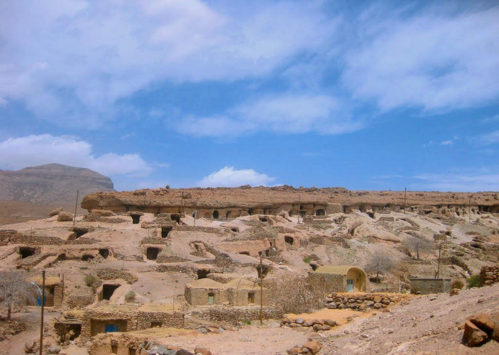
Maymand is a self-contained, semi-arid area at the end of a valley at the southern extremity of Iran’s central mountains. The villagers are semi-nomadic agro-pastoralists. They raise their animals on mountain pastures, living in temporary settlements in spring and autumn. During the winter months they live lower down the valley in cave dwellings carved out of the soft rock (kamar), an unusual form of housing in a dry, desert environment. This cultural landscape is an example of a system that appears to have been more widespread in the past and involves the movement of people rather than animals.
UNESCO Justification of the World Heritage Site
Criterion (v): The Cultural Landscape of Maymand, a small mainly self-sufficient community within one large valley, reflects a traditional three phase transhumance system with unusual troglodytic winter housing in a dry desert environment. It is a good example of a system that appears to have been once more widespread, and involves the movement of people rather than animals to three defined settlement areas, one of which is cave dwellings.
Encyclopedia Record: Meymand, Kerman
Meymand is a village in, and the capital of, Meymand Rural District of the Central District of Shahr-e Babak County, Kerman province, Iran.Additional Site Details
Area: 4,953.85 hectares
Number of Components: 1
Coordinates: 30.1680555556 , 55.3755555556