World Heritage Identification Number: 430
World Heritage since: 1987
Category: Cultural Heritage
WHE Type: Archaeological Sites
Transboundary Heritage: Yes
Endangered Heritage: No
Country: Germany, United Kingdom of Great Britain and Northern Ireland
Continent: Europe
UNESCO World Region: Europe and North America
Map
Frontiers of the Roman Empire: A Testament to Ancient Military Architecture and Strategy
The Frontiers of the Roman Empire, inscribed as a UNESCO World Heritage Site in 1987, offers a unique glimpse into the strategic prowess and architectural ingenuity of the Roman Empire at its zenith during the second century AD. Spanning over 5,000 kilometers, this extensive network of fortifications, military roads, and civilian settlements served as the imperial boundary that demarcated the Roman world from the lands beyond.
More to come…UNESCO Description of the World Heritage Site
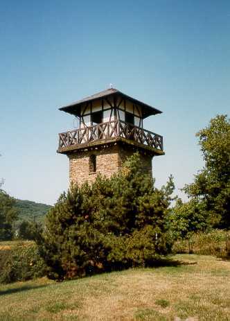
The ‘Roman Limes’ represents the border line of the Roman Empire at its greatest extent in the 2nd century AD. It stretched over 5,000 km from the Atlantic coast of northern Britain, through Europe to the Black Sea, and from there to the Red Sea and across North Africa to the Atlantic coast. The remains of the Limes today consist of vestiges of built walls, ditches, forts, fortresses, watchtowers and civilian settlements. Certain elements of the line have been excavated, some reconstructed and a few destroyed. The two sections of the Limes in Germany cover a length of 550 km from the north-west of the country to the Danube in the south-east. The 118-km-long Hadrian’s Wall (UK) was built on the orders of the Emperor Hadrian c. AD 122 at the northernmost limits of the Roman province of Britannia. It is a striking example of the organization of a military zone and illustrates the defensive techniques and geopolitical strategies of ancient Rome. The Antonine Wall, a 60-km long fortification in Scotland was started by Emperor Antonius Pius in 142 AD as a defense against the “barbarians” of the north. It constitutes the northwestern-most portion of the Roman Limes.
UNESCO Justification of the World Heritage Site
Criterion (ii): The extant remains of the fortified German Limes, Hadrian’s Wall and Antonine Wall constitute significant elements of the Roman Frontiers present in Europe. With their forts, fortlets, walls, ditches, linked infrastructure and civilian architecture they exhibit an important interchange of human and cultural values at the apogee of the Roman Empire, through the development of Roman military architecture, extending the technical knowledge of construction and management to the very edges of the Empire. They reflect the imposition of a complex frontier system on the existing societies of the northwestern part of the Roman Empire, introducing for the first time military installations and related civilian settlements, linked through an extensive supporting network. The frontiers did not constitute an impregnable barrier, but controlled and allowed the movement of peoples: not only the military units, but also civilians and merchants. Hence, they triggered the exchange of cultural values through movement of soldiers and civilians from different nations. This entailed profound changes and developments in the respective regions in terms of settlement patterns, architecture and landscape design and spatial organization. The frontiers still today form a conspicuous part of the landscape.
Criterion (iii): As parts of the Roman Empire’s general system of defense the German Limes, Hadrian’s Wall and the Antonine Wall have an extraordinarily high cultural value. They bear an exceptional testimony to the maximum extension of the power of the Roman Empire through the consolidation of its northwestern frontiers and thus constitute a physical manifestation of Roman imperial policy. They illustrate the Roman Empire’s ambition to dominate the world in order to establish its law and way of life there in a long-term perspective. They witness Roman colonization in the respective territories, the spread of Roman culture and its different traditions – military, engineering, architecture, religion management and politics – and the large number of human settlements associated with the defenses which contribute to an understanding of how soldiers and their families lived in this part of the Roman Empire.
Criterion (iv): The fortified German Limes, Hadrian’s Wall and the Antonine Wall are outstanding examples of Roman military architecture and building techniques and of their technological development, perfected by engineers over the course of several generations. They demonstrate the variety and sophistication of the Romans’ responses to the specific topography and climate as well as to the political, military and social circumstances in the northwestern part of the Empire which spread all around Europe and thereby shaped much of the subsequent development in this part of the world.
Encyclopedia Record: Borders of the Roman Empire
The borders of the Roman Empire, which fluctuated throughout the empire's history, were realised as a combination of military roads and linked forts, natural frontiers and man-made fortifications which separated the lands of the empire from the countries beyond.Additional Site Details
Area: 526.9 hectares
Number of Components: 420
(iii) — Unique or exceptional testimony to a cultural tradition
(iv) — Outstanding example of a type of building or landscape
Coordinates: 54.9926111111 , -2.601
Image
© Unknown, CC BY-SA 3.0 Resized from original. (This derivative is under the same CC BY-SA license.)