World Heritage Identification Number: 380
World Heritage since: 1986
Category: Natural Heritage
WHE Type: Protected Areas & National Parks
Transboundary Heritage: No
Endangered Heritage: No
Country: 🇪🇸 Spain
Continent: Europe
UNESCO World Region: Europe and North America
Map
Garajonay National Park: A Unique Biosphere Reserve in the Canary Islands
Garajonay National Park, located in the heart of the island of La Gomera in the Canary Islands archipelago, is a unique biosphere reserve that boasts a rich and diverse ecosystem. Established in 1981 as a national park and inscribed as a UNESCO World Heritage Site in 1986, this protected area spans over 40 square kilometers, encompassing each of the six municipalities on the island.
More to come…UNESCO Description of the World Heritage Site
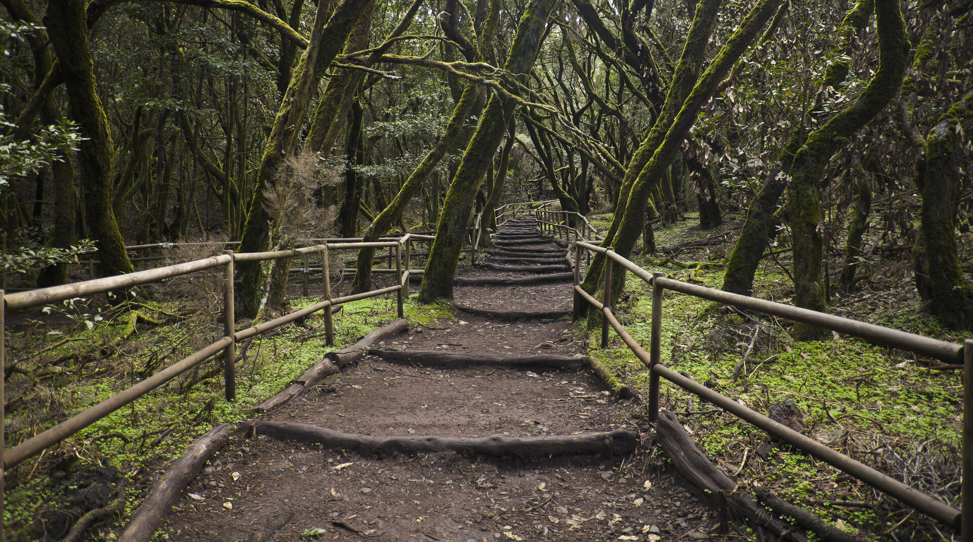
Laurel forest covers some 70% of this park, situated in the middle of the island of La Gomera in the Canary Islands archipelago. The presence of springs and numerous streams assures a lush vegetation resembling that of the Tertiary, which, due to climatic changes, has largely disappeared from southern Europe.
UNESCO Justification of the World Heritage Site
Criterion (vii): Garajonay National Park contains an outstanding and well-preserved example of laurisilva (Laurel forest), an exceptional ecosystem typified by luxuriant evergreen trees with laurel-like leaves, which today is only found in the Macaronesian Islands. This relict ecosystem, a living remnant of the old rainforests and warm temperate forests that occupied much of Europe and North Africa during the Tertiary, is characterised by lush vegetation, fed by numerous springs and streams, and contains a rich and endemic flora and fauna. It is extraordinary that such a forest still exists at this latitude and proximity to the coasts of the Sahara.
Criterion (ix): The Canary Islands are renowned for their relict and endemic species of plants and animals, and present outstanding examples of island evolution. Garajonay National Park contains the best-preserved examples of this evolution in the region, with a recorded flora of 450 vascular plant species, of which 34 are endemic to the island and eight found only in the national park. Two relict and endemic species of pigeons are found almost exclusively in the Laurel forest, and an estimated 40-60% of the invertebrate fauna is endemic.
Encyclopedia Record: Garajonay National Park
Garajonay National Park is located in the center and north of the island of La Gomera, one of the Canary Islands (Spain). It was declared a national park in 1981 and a World Heritage Site by UNESCO in 1986. It occupies 40 km2 and it extends into each of the six municipalities on the island.Additional Site Details
Area: 3,984 hectares
Number of Components: 1
(ix) — Outstanding example representing ecological and biological processes
Coordinates: 28.12625 , -17.23722222
IUCN World Heritage Outlook
The 2025 Conservation Outlook on Garajonay National Park reports the following assessment:
Source: International Union for Conservation of Nature (IUCN) · View assessment
Image
© Diego Delso, CC BY-SA 3.0 Resized from original. (This derivative is under the same CC BY-SA license.)
