World Heritage Identification Number: 1189
World Heritage since: 2006
Category: Cultural Heritage
WHE Type: Historic Cities & Urban Areas
Transboundary Heritage: No
Endangered Heritage: No
Country: 🇪🇹 Ethiopia
Continent: Africa
UNESCO World Region: Africa
Map
Harar Jugol, the Fortified Historic Town: A Unique Blend of African and Islamic Architecture
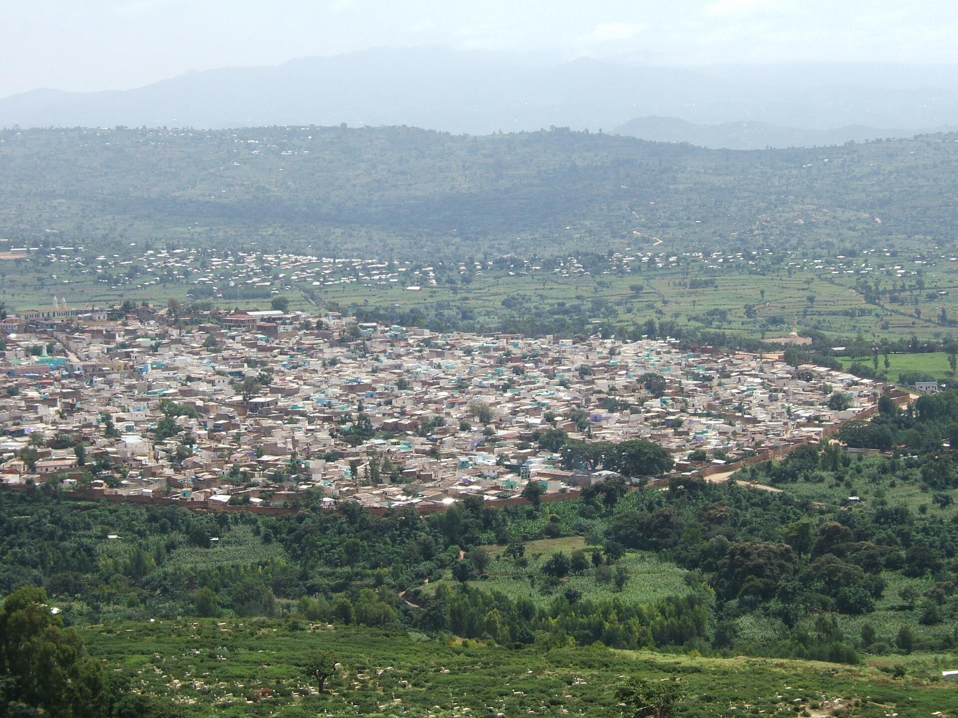
Harar Jugol, officially recognized as a UNESCO World Heritage Site since 2006, is a remarkable example of a fortified historic town that showcases the harmonious fusion of African and Islamic architectural styles. Situated in the eastern part of Ethiopia, this sacred Muslim city stands on a plateau surrounded by deep gorges, deserts, and savannah.
More to come…UNESCO Description of the World Heritage Site
The fortified historic town of Harar is located in the eastern part of the country on a plateau with deep gorges surrounded by deserts and savannah. The walls surrounding this sacred Muslim city were built between the 13th and 16th centuries. Harar Jugol, said to be the fourth holiest city of Islam, numbers 82 mosques, three of which date from the 10th century, and 102 shrines, but the townhouses with their exceptional interior design constitute the most spectacular part of Harar's cultural heritage. The impact of African and Islamic traditions on the development of the town's building types and urban layout make for its particular character and uniqueness.
UNESCO Justification of the World Heritage Site
Criterion (ii): The historic town of Harar Jugol exhibits an important interchange of values of original Islamic culture, expressed in the social and cultural development of the city enclosed within the otherwise Christian region. Such influences have been merged with traditions that relate to the inland of Africa and particularly to southern Ethiopia, giving a particular characteristic form to its architecture and urban plan.
Criterion (iii): Harar Jugol bears exceptional testimony to cultural traditions related to Islamic and African roots. It is considered “the fourth holy city” of Islam, having been developed by a holy missionary from the Arabic Peninsula. Though a trading place and thus a melting pot of various influences, Harar has been in relative isolation in its region, contributing to a cultural specificity, expressed in its characteristic community structure and traditions, which are still alive.
Criterion (iv): Harar Jugol is an outstanding example of a type of architectural and urban ensemble which illustrates the impact of African and Islamic traditions on the development of specific building types. The building types and the entire urban layout reflect these traditions, which give a particular character and even uniqueness to Harar Jugol.
Criterion (v): Harar Jugol with its surrounding landscape is an outstanding example of a traditional human settlement, representative of cultural interaction with the environment. The social and spatial structure (afocha) and the language of the people all reflect a particular and even unique relationship that there developed with the environment. The cultural and physical relationships with the territory have survived till today, but they are also vulnerable to irreversible change under the impact of the modern globalizing world.
Encyclopedia Record: Harar
Harar, known historically by the indigenous as Harar-Gey or simply Gey, is a walled city in eastern Ethiopia. It is also known in Arabic as the City of Saints.Additional Site Details
Area: 48 hectares
Number of Components: 1
(iii) — Unique or exceptional testimony to a cultural tradition
(iv) — Outstanding example of a type of building or landscape
(v) — Outstanding example of traditional human settlement
Coordinates: 9.3088888888 , 42.1377777777