World Heritage Identification Number: 637
World Heritage since: 1992
Category: Natural Heritage
WHE Type: Protected Areas & National Parks
Transboundary Heritage: No
Endangered Heritage: No
Country: 🇨🇳 China
Continent: Asia
UNESCO World Region: Asia and the Pacific
Map
Exploring the Enchanting Landscapes of Jiuzhaigou Valley Scenic and Historic Interest Area
The Jiuzhaigou Valley Scenic and Historic Interest Area, nestled within the northern region of Sichuan Province in southwestern China, presents a captivating tapestry of natural beauty that transcends the ordinary. This expansive landscape, spanning approximately 72,000 hectares, offers visitors a unique opportunity to immerse themselves in a world characterized by its diverse forest ecosystems and breathtaking geological formations.
More to come…UNESCO Description of the World Heritage Site
Stretching over 72,000 ha in the northern part of Sichuan Province, the jagged Jiuzhaigou valley reaches a height of more than 4,800 m, thus comprising a series of diverse forest ecosystems. Its superb landscapes are particularly interesting for their series of narrow conic karst land forms and spectacular waterfalls. Some 140 bird species also inhabit the valley, as well as a number of endangered plant and animal species, including the giant panda and the Sichuan takin.
UNESCO Justification of the World Heritage Site
Criterion (vii): Jiuzhaigou is renowned for its scenic and aesthetic majesty. Its fairyland landscape of numerous lakes, waterfalls, and limestone terraces, with their attractive, clear, mineral-rich waters, set in the spectacular alpine mountains with a highly diverse forest ecosystem, demonstrates remarkable natural beauty.
Encyclopedia Record: Jiuzhaigou
Jiuzhaigou is a nature reserve and national park located in the north of Sichuan Province in southwestern China. A long valley running north to south, Jiuzhaigou was inscribed by UNESCO as a World Heritage Site in 1992 and a World Biosphere Reserve in 1997. It belongs to the category V in the IUCN system of protected area categorization.Additional Site Details
Area: 72,000 hectares
Number of Components: 1
Coordinates: 33.08333 , 103.91667
IUCN World Heritage Outlook
The 2025 Conservation Outlook on Jiuzhaigou Valley Scenic and Historic Interest Area reports the following assessment:
Source: International Union for Conservation of Nature (IUCN) · View assessment
Image
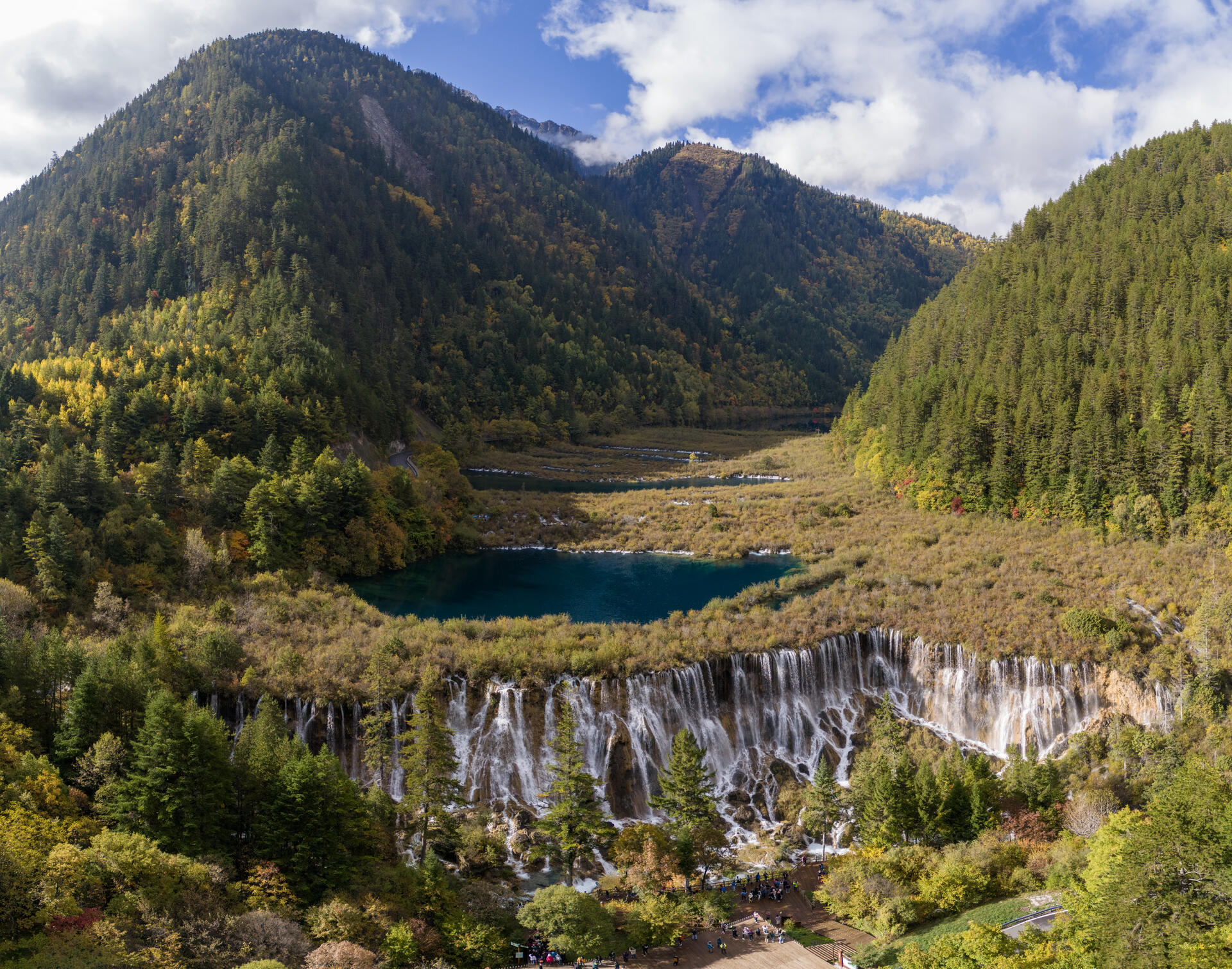
© Chensiyuan, CC BY-SA 4.0 Resized from original. (This derivative is under the same CC BY-SA license.)
World Heritage Research
Discover scientific research and academic studies that deepen our understanding of Jiuzhaigou Valley Scenic and Historic Interest Area from its history and significance to its conservation, management, and contemporary challenges.
-
Quantitative risk assessment and eco-engineering mitigation strategies for debris flows utilizing dynamic process simulation in Shuzheng gully, Jiuzhaigou valley scenic and historic interest area
A novel pine pile–gabion composite dam (PPGD) system, integrated with dynamic process simulation and adaptive eco-engineering strategies, effectively mitigates debris flow risks while preserving ecological integrity. Using high-resolution modeling, researchers simulated debris flows under 20- and 50-year rainfall return periods in Shuzheng gully, Jiuzhaigou Valley, revealing peak velocities of 6.49 m/s and discharges of 38.33 m³/s for the latter. The PPGD system reduced total inundation extent by 45.78% and decreased peak flow velocities downstream by up to 45.34%, demonstrating its potential for sustainable risk management in ecologically sensitive UNESCO World Heritage sites. This approach balances risk reduction with environmental conservation, offering a scalable solution for mountain areas vulnerable to debris flows.
Yang, D., Zong, X., Wu, B., Wang, Y., Liang, B., Wan, F., Liu, J., & Peng, J. (2025). Quantitative risk assessment and eco-engineering mitigation strategies for debris flows utilizing dynamic process simulation in Shuzheng gully, Jiuzhaigou valley scenic and historic interest area. Frontiers in Earth Science, 13. https://doi.org/10.3389/feart.2025.1649068
View Publication Record | Read Publication -
Automated Mapping of Ms 7.0 Jiuzhaigou Earthquake (China) Post-Disaster Landslides Based on High-Resolution UAV Imagery
A novel method combining high-resolution UAV imagery and machine learning achieved near-perfect accuracy (99.89%) in mapping landslides triggered by the 2017 Ms 7.0 Jiuzhaigou earthquake in China, surpassing traditional manual interpretation. The approach used a support vector machine (SVM) classification model integrated with pre-seismic road and village data to automatically identify landslide distribution with high precision (Kappa coefficient > 0.9). This advancement significantly improves post-disaster response capabilities by enabling rapid and accurate landslide mapping, critical for emergency rescue operations. The study also revealed spatial patterns of earthquake-triggered landslides, influenced by factors such as altitude, slope gradient, aspect, and proximity to faults, providing valuable insights for future risk assessment and susceptibility prediction in UNESCO World Heritage Sites.
Liang, R., Dai, K., Shi, X., Guo, B., Dong, X., Liang, F., Tomás, R., Wen, N., & Fan, X. (2021). Automated Mapping of Ms 7.0 Jiuzhaigou Earthquake (China) Post-Disaster Landslides Based on High-Resolution UAV Imagery. Remote Sensing, 13(7), 1330. https://doi.org/10.3390/rs13071330
View Publication Record | Read Publication