World Heritage Identification Number: 675
World Heritage since: 1993
Category: Cultural Heritage
WHE Type: Archaeological Sites
Transboundary Heritage: No
Endangered Heritage: No
Country: 🇸🇻 El Salvador
Continent: Americas
UNESCO World Region: Latin America and the Caribbean
Map
The Pre-Hispanic Farming Community of Joya de Cerén: A Time Capsule from Ancient America
The Pre-Hispanic Farming Community of Joya de Cerén: A Time Capsule from Ancient America
More to come…UNESCO Description of the World Heritage Site
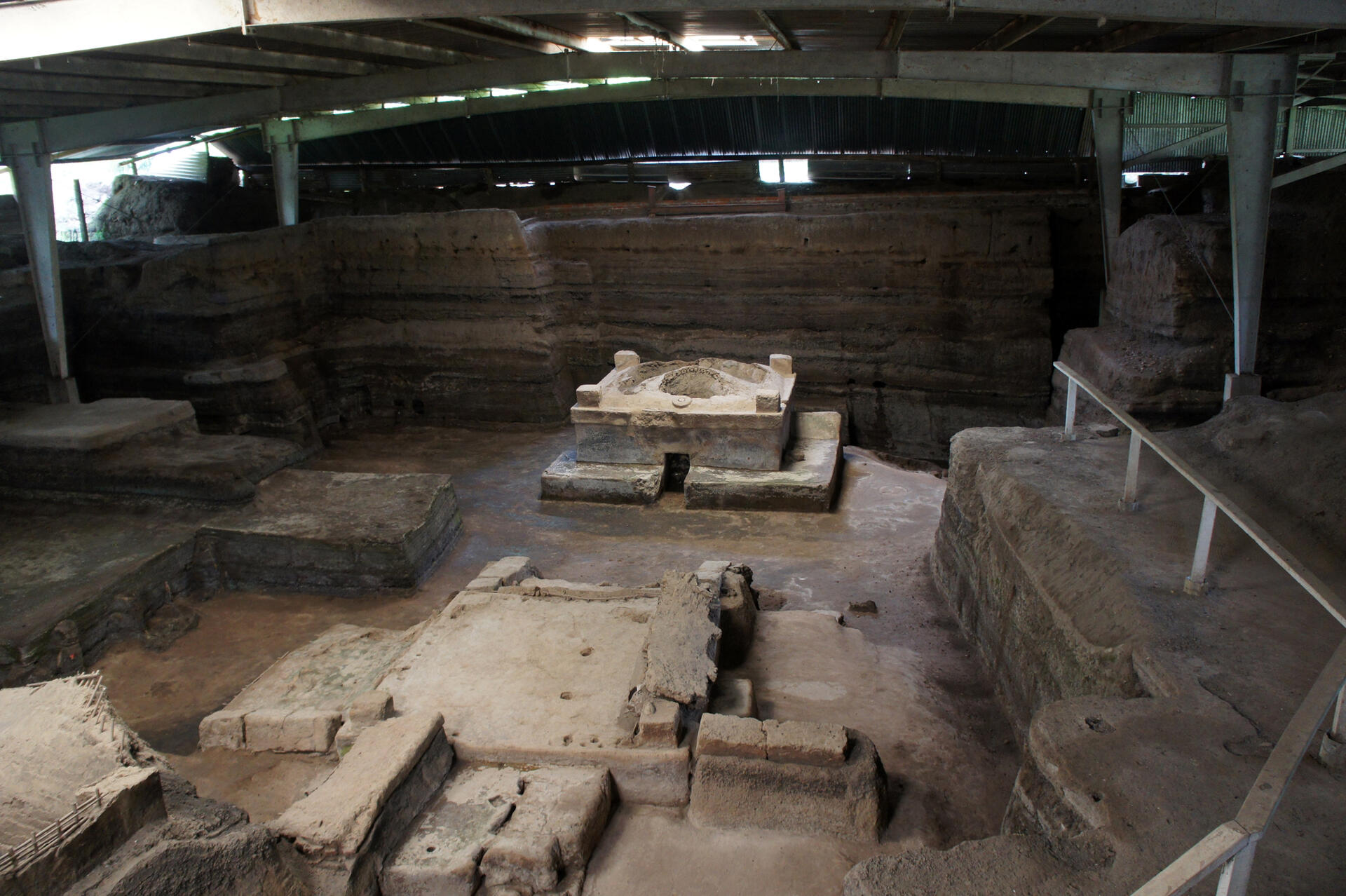
Joya de Cerén was a pre-Hispanic farming community that, like Pompeii and Herculaneum in Italy, was buried under an eruption of the Laguna Caldera volcano c. AD 600. Because of the exceptional condition of the remains, they provide an insight into the daily lives of the Central American populations who worked the land at that time.
UNESCO Justification of the World Heritage Site
Criterion (iii): Joya de Cerén archaeological site is a unique testimony of the daily lives of ordinary people. This site is a remarkable by virtue of the completeness of the evidence that it provides of everyday life in Mesoamerican farming community of the seventh century A.D, which is without parallel in this cultural region.
Criterion (iv): The rapid ash fall from Loma Caldera volcano, and the sudden abandonment of the village, created exceptional circumstances that preserved architecture, organic materials and different artefacts. The archaeological site is a unique window into the past that allows for the interpretation of the interactions between the ancient settlers and their environment. The preserved earthen architecture remains, along with the rest of the material culture, forms a unique context that illustrates daily life of a prehispanic communities during the Late Classic period.
Encyclopedia Record: Joya de Cerén
Joya de Cerén is an archaeological site in La Libertad Department, El Salvador, featuring a pre-Columbian Maya farming village. The ancient Maya site of Joya de Cerén is located in the Zapotitán Valley, 36 kilometers northwest of San Salvador, El Salvador. It is often referred to as the "Pompeii of the Americas", in comparison to the famed Ancient Roman ruins.Additional Site Details
Area: 3,200 hectares
Number of Components: 1
(iv) — Outstanding example of a type of building or landscape
Coordinates: 13.8275 , -89.36916667
Image
© Mariordo (Mario Roberto Duran Ortiz), CC BY-SA 3.0 Resized from original. (This derivative is under the same CC BY-SA license.)
