World Heritage Identification Number: 1382
World Heritage since: 2011
Category: Cultural Heritage
WHE Type: Archaeological Sites
Transboundary Heritage: No
Endangered Heritage: No
Country: 🇲🇳 Mongolia
Continent: Asia
UNESCO World Region: Asia and the Pacific
Map
Exploring the Petroglyphic Complexes of the Mongolian Altai: A Journey Through Time
The Petroglyphic Complexes of the Mongolian Altai, inscribed as a UNESCO World Heritage Site in 2011, offer a unique glimpse into the rich cultural history of Mongolia that spans over 12,000 years. These complexes, located within the vast and majestic Altai Mountains, consist of numerous rock carvings and funerary monuments that provide valuable insights into the evolution of human societies in northern Asia.
More to come…UNESCO Description of the World Heritage Site
The numerous rock carvings and funerary monuments found in these three sites illustrate the development of culture in Mongolia over a period of 12,000 years. The earliest images reflect a time (11,000 - 6,000 BC) when the area was partly forested and the valley provided a habitat for hunters of large game. Later images show the transition to herding as the dominant way of life. The most recent images show the transition to a horse-dependent nomadic lifestyle during the early 1st millennium BC, the Scythian period and the later Turkic period (7th and 8th centuries AD). The carvings contribute valuably to our understanding of pre-historic communities in northern Asia.
UNESCO Justification of the World Heritage Site
Criterion (iii): The Petroglyphic Complexes of the Mongolian Altai Mountain provide an exceptional documentation of the pre-historic and early historic communities in the northwestern Altai Mountains, at the intersection of Central and North Asia. The petroglyphic imagery includes animals such as mammoths, rhinoceros, and ostriches, executed in static profile contours. These animals inhabited North Asia when the region was significantly colder, drier and covered by rough grasses and forbs rather than forests. By the end of the Late Pleistocene (ca. 11,000 BP), the dry steppe was gradually being replaced by the forested environment of the Early Holocene (ca. 11,000 – 6,000 BP). This period is reflected in majestic images of elk, aurochs, and ibex, executed in profile silhouettes. There are very few sites in North Asia that include pre-Bronze Age petroglyphs in such number, variety, and quality.
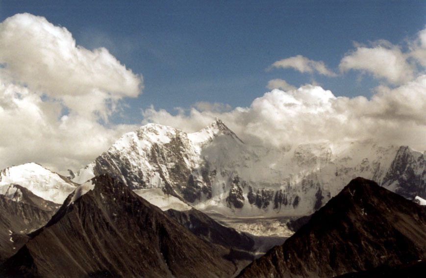
Encyclopedia Record: Altai Mountains
The Altai Mountains are a mountain range in Central Asia, where Russia, China, Mongolia, and Kazakhstan converge, and where the rivers Irtysh and Ob have their headwaters. The highest summit of the range is Belukha, whose summit reaches 4,506 m above sea level. The massif merges with the Sayan Mountains in the northeast, and gradually becomes lower in the southeast, where it merges into the high plateau of the Gobi Desert. In the southwest, it is separated from the higher Tian Shan range by the Junggar Basin. It spans from about 45° to 52° N and from about 84° to 99° E.Additional Site Details
Area: 11,300 hectares
Number of Components: 3
Coordinates: 49.3338888889 , 88.3952777778
Image
© Stefan Kühn, CC BY-SA 3.0 Resized from original. (This derivative is under the same CC BY-SA license.)
