World Heritage Identification Number: 769
World Heritage since: 2003
Category: Natural Heritage
WHE Type: Natural Landscapes & Geographic Features
Transboundary Heritage: Yes
Endangered Heritage: No
Country: Mongolia, Russian Federation
Continent: Asia, Europe
UNESCO World Region: Asia and the Pacific,Europe and North America
Map
Uvs Nuur Basin: A Biodiverse Oasis in Central Asia
The Uvs Nuur Basin, inscribed as a UNESCO World Heritage Site in 2003, is a vast, biologically diverse region spanning over 1,068,853 hectares. This expansive basin, straddling the borders of Mongolia and Tuva, a republic within the Russian Federation, is a unique microcosm of the Central Asian landscape. Named after the Uvs Nuur Lake, a significant body of water within the basin, this region holds immense ecological, cultural, and historical value.
More to come…UNESCO Description of the World Heritage Site
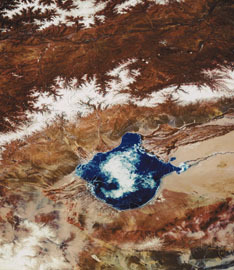
The Uvs Nuur Basin (1,068,853 ha), is the northernmost of the enclosed basins of Central Asia. It takes its name from Uvs Nuur Lake, a large, shallow and very saline lake, important for migrating birds, waterfowl and seabirds. The site is made up of twelve protected areas representing the major biomes of eastern Eurasia. The steppe ecosystem supports a rich diversity of birds and the desert is home to a number of rare gerbil, jerboas and the marbled polecat. The mountains are an important refuge for the globally endangered snow leopard, mountain sheep (argali) and the Asiatic ibex.
UNESCO Justification of the World Heritage Site
Criterion (ix): The remote and enclosed salt lake system of Uvs Nuur with its high degree of naturalness is of international scientific importance due to its large-scale undisturbed climatic, hydrological and ecological processes and phenomena. Because of the relatively stable past and contemporary pastoral use of the grasslands and the absence of conversion or major human impacts over thousands of years, it constitutes a unique field site for a great variety of subjects, including research into the ongoing development of Uvs Nuur and other smaller lakes within the basin, and the still intact processes of long term lake salinisation and eutrophication. In addition to important past and current research efforts on both sides of the border and in recognition of its unique geophysical and biological characteristics, the Uvs Nuur Basin has also been selected as a field site for the International Geosphere-Biosphere Programme (IGPB), a global effort to monitor and understand global change.
Criterion (x): The serial property conserves the most valuable areas representing the much larger Uvs Nuur Basin, across an enormous range of ecosystems and habitats, including along a major altitudinal gradient. The diversity represents the major biomes of Central Asia with a corresponding floral and faunal diversity. There are important areas of different forest types and highly specialized vegetation in high altitudes, tundra systems and dry land ecosystems, including species and communities adapted to saline conditions. The more than 550 higher plants include relict species and a number of plants endemic to Mongolia and the Tuva Republic, with five species endemic to the lake basin. The various ecosystems support a rich faunal diversity, such as the argali sheep, Siberian ibex, Pallas's cat and the elusive and globally endangered snow leopard. The numerous rodents are of major ecological importance and include two vulnerable jerboa species and gerbil. The many ecological niches are occupied by an impressive density of breeding raptors. The property is also of major importance for waterfowl, as well as a stepping stone in the bird migration between Siberia and wintering ranges in China and South Asia.
Encyclopedia Record: Uvs Lake Basin
Uvs Lake Basin is an endorheic basin located on the territorial border of Mongolia and Tuva, a republic of the Russian Federation. The basin is part of the Central Asian Internal Drainage Basin and is named after Uvs Lake, a large saline lake situated in the western part of its drainage basin, and is one of the last remnants of the mammoth steppes. Uvs Lake is a shallow lake with an area of 3,350 km2 (1,290 sq mi). Its entire basin, which includes several smaller lakes, is 70,000 km2 (27,000 sq mi).Additional Site Details
Area: 898,063.5 hectares
Number of Components: 12
(x) — Contains most important habitats for biodiversity
Coordinates: 50.275 , 92.71972222
IUCN World Heritage Outlook
The 2025 Conservation Outlook on Uvs Nuur Basin reports the following assessment:
Source: International Union for Conservation of Nature (IUCN) · View assessment
Image
Unknown, Public domain