World Heritage Identification Number: 1459
World Heritage since: 2014
Category: Cultural Heritage
WHE Type: Infrastructure & Industry
Transboundary Heritage: Yes
Endangered Heritage: No
Country: Argentina, Bolivia (Plurinational State of), Chile, Colombia, Ecuador, Peru
Continent: Americas
UNESCO World Region: Latin America and the Caribbean
Map
The Qhapaq Ñan, Andean Road System: A Remarkable Incan Legacy
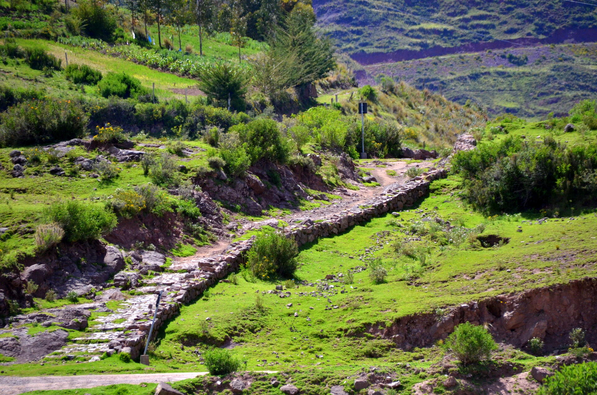
The Qhapaq Ñan, also known as the Andean Road System, is an impressive testament to the ingenuity and ambition of the Inca civilization. Designated as a UNESCO World Heritage Site in 2014, this extensive network of roads spans over 30,000 kilometers, making it one of the most extensive and advanced transportation systems in pre-Columbian South America.
More to come…UNESCO Description of the World Heritage Site
This site is an extensive Inca communication, trade and defence network of roads covering 30,000 km. Constructed by the Incas over several centuries and partly based on pre-Inca infrastructure, this extraordinary network through one of the world’s most extreme geographical terrains linked the snow-capped peaks of the Andes – at an altitude of more than 6,000 m – to the coast, running through hot rainforests, fertile valleys and absolute deserts. It reached its maximum expansion in the 15th century, when it spread across the length and breadth of the Andes. The Qhapac Ñan, Andean Road System includes 273 component sites spread over more than 6,000 km that were selected to highlight the social, political, architectural and engineering achievements of the network, along with its associated infrastructure for trade, accommodation and storage, as well as sites of religious significance.
UNESCO Justification of the World Heritage Site
Criterion (ii): The Qhapaq Ñan exhibits important processes of interchange of goods, communication and cultural traditions within a cultural area of the world which created a vast empire of up to 4,200km in extension at its height in the 15th century. It is based on the integration of prior Andean ancestral knowledge and the specifics of Andean communities and cultures forming a state organizational system that enabled the exchange of social, political and economic values for imperial policy. Several roadside structures provide lasting evidence of valuable resources and goods traded along the network, such as precious metals, muyu (spondylus shell), foodstuffs, military supplies, feathers, wood, coca and textiles transported from the areas where they were collected, produced or manufactured, to Inca centres of various types and to the capital itself. Several communities, who remain custodians of components of this vast Inca communication network, are living reminders of the exchange of cultural values and language.
Criterion (iii): The Qhapaq Ñan is an exceptional and unique testimony to the Inca civilization based on the values and principles of reciprocity, redistribution and duality constructed in a singular system of organization called Tawantinsuyu. The road network was the life giving support to the Inca Empire integrated into the Andean landscape. As a testimony to the Inca Empire, it illustrates thousands of years of cultural evolution and was an omnipresent symbol of the Empire’s strength and extension throughout the Andes. This testimony influences the communities along the Qhapaq Ñan until today, in particular with relation to the social fabric of local communities and the cultural philosophies that give meaning to relationships among people and between people and the land. Most importantly, life is still defined by links among close kin and an ethic of mutual support.
Criterion (iv): The Qhapaq Ñan, Andean Road System is an outstanding example of a type of technological ensemble which despite the most difficult geographical conditions created a continuous and functioning communication and trade system with exceptional technological and engineering skills in rural and remote settings. Several elements illustrate characteristic typologies in terms of walls, roads, steps, roadside ditches, sewage pipes, drains, etc., with construction methods unique to the Qhapaq Ñan while varying according to location and regional context. Many of these elements were standardized by the Inca State, which allowed for the control of equal conditions along the road network.
Criterion (vi): The Qhapaq Ñan played an essential role in the organization of space and society in a wide geographical area along the Andes, where the roads were used as a means to share cultural values with outstanding intangible significance. The Qhapaq Ñan continues today to provide communities with a sense of identity and to enable their cultural practices, cultural expressions and traditional skills to continue to be transmitted from generation to generation. Members of these communities base their own existence on an Andean cosmovision, which is unique in the World. This cosmovision applies to all aspects of everyday life. Today, Qhapaq Ñan is directly associated with the intangible values shared by the communities in the Andean World, such as traditional trade, ritual practices, and the use of ancient technology, among others, which are living traditions and beliefs essential to the cultural identity of the communities concerned. The Andean Road System continues to serve its original functions of integration, communication, exchange and flow of goods and knowledge, and - despite the current modern trade and social changes - keeps its pertinence and importance throughout the centuries and its role as a cultural reference which contributes to reinforcing the identity within the Andean world.
Encyclopedia Record: Inca road system
The Inca road system was the most extensive and advanced transportation system in pre-Columbian South America. It was about 40,000 kilometres (25,000 mi) long in total. The construction of the roads required a large expenditure of time and effort.Additional Site Details
Area: 3,642.807 hectares
Number of Components: 137
(iii) — Unique or exceptional testimony to a cultural tradition
(iv) — Outstanding example of a type of building or landscape
(vi) — Directly associated with events or living traditions
Coordinates: -18.25 , -69.5916666667
Image
© Aga Khan (IT), CC BY-SA 4.0 Resized from original. (This derivative is under the same CC BY-SA license.)