World Heritage Identification Number: 722
World Heritage since: 1995
Category: Cultural Heritage
WHE Type: Agriculture Landscapes, Parks & Gardens
Transboundary Heritage: No
Endangered Heritage: No
Country: 🇵🇭 Philippines
Continent: Asia
UNESCO World Region: Asia and the Pacific
Map
The Rice Terraces of the Philippine Cordilleras: A Testament to Ancient Knowledge and Cultural Harmony
The Rice Terraces of the Philippine Cordilleras, inscribed as a UNESCO World Heritage Site in 1995, stand as a testament to the ancient wisdom, cultural traditions, and harmonious relationship between humans and their environment among the indigenous Ifugao people of the Philippines. These remarkable terraces, located in the mountainous region of the Cordillera Central on the island of Luzon, represent the longest continuous human settlement in Southeast Asia, dating back approximately 2,000 years.
More to come…UNESCO Description of the World Heritage Site
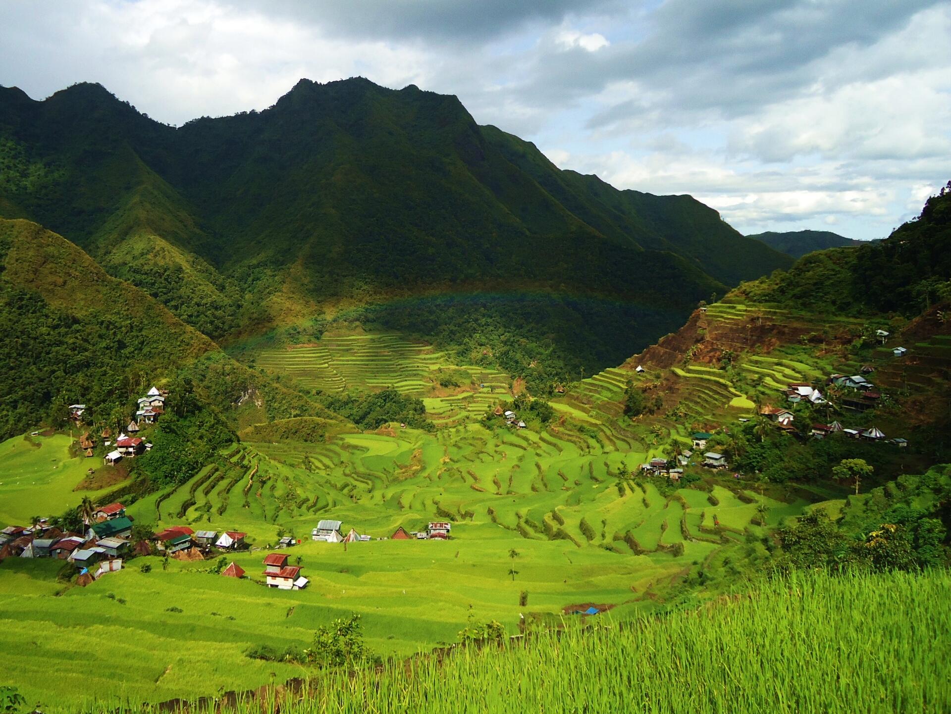
For 2,000 years, the high rice fields of the Ifugao have followed the contours of the mountains. The fruit of knowledge handed down from one generation to the next, and the expression of sacred traditions and a delicate social balance, they have helped to create a landscape of great beauty that expresses the harmony between humankind and the environment.
UNESCO Justification of the World Heritage Site
Criterion (iii): The rice terraces are a dramatic testimony to a community's sustainable and primarily communal system of rice production, based on harvesting water from the forest clad mountain tops and creating stone terraces and ponds, a system that has survived for two millennia.
Criterion (iv): The rice terraces are a memorial to the history and labour of more than a thousand generations of small-scale farmers who, working together as a community, have created a landscape based on a delicate and sustainable use of natural resources.
Criterion (v): The rice terraces are an outstanding example of land-use that resulted from a harmonious interaction between people and its environment which has produced a steep terraced landscape of great aesthetic beauty, now vulnerable to social and economic changes.
Encyclopedia Record: Rice Terraces of the Philippine Cordilleras
The Rice Terraces of the Philippine Cordilleras are a World Heritage Site consisting of a complex of rice terraces on the island of Luzon in the Philippines. They were inscribed on the UNESCO World Heritage List in 1995, the first-ever property to be included in the cultural landscape category of the World Heritage List. This inscription has five sites: the Batad Rice Terraces and Bangaan Rice Terraces, Mayoyao Rice Terraces, Hungduan Rice Terraces and Nagacadan Rice Terraces, all in Ifugao Province. The Ifugao Rice Terraces reach a higher altitude and were built on steeper slopes than many other terraces. The Ifugao complex of stone or mud walls and the careful carving of the natural contours of hills and mountains combine to make terraced pond fields, coupled with the development of intricate irrigation systems, harvesting water from the forests of the mountain tops, and an elaborate farming system.Additional Site Details
Area: Not available
Number of Components: 5
(iv) — Outstanding example of a type of building or landscape
(v) — Outstanding example of traditional human settlement
Coordinates: 16.93389 , 121.13667
Image
© Cid Jacobo, CC BY-SA 3.0 Resized from original. (This derivative is under the same CC BY-SA license.)
