World Heritage Identification Number: 352
World Heritage since: 1985
Category: Cultural Heritage
WHE Type: Archaeological Sites
Transboundary Heritage: No
Endangered Heritage: No
Country: 🇳🇴 Norway
Continent: Europe
UNESCO World Region: Europe and North America
Map
The Rock Art of Alta: A Prehistoric Treasure Trove in Northern Norway
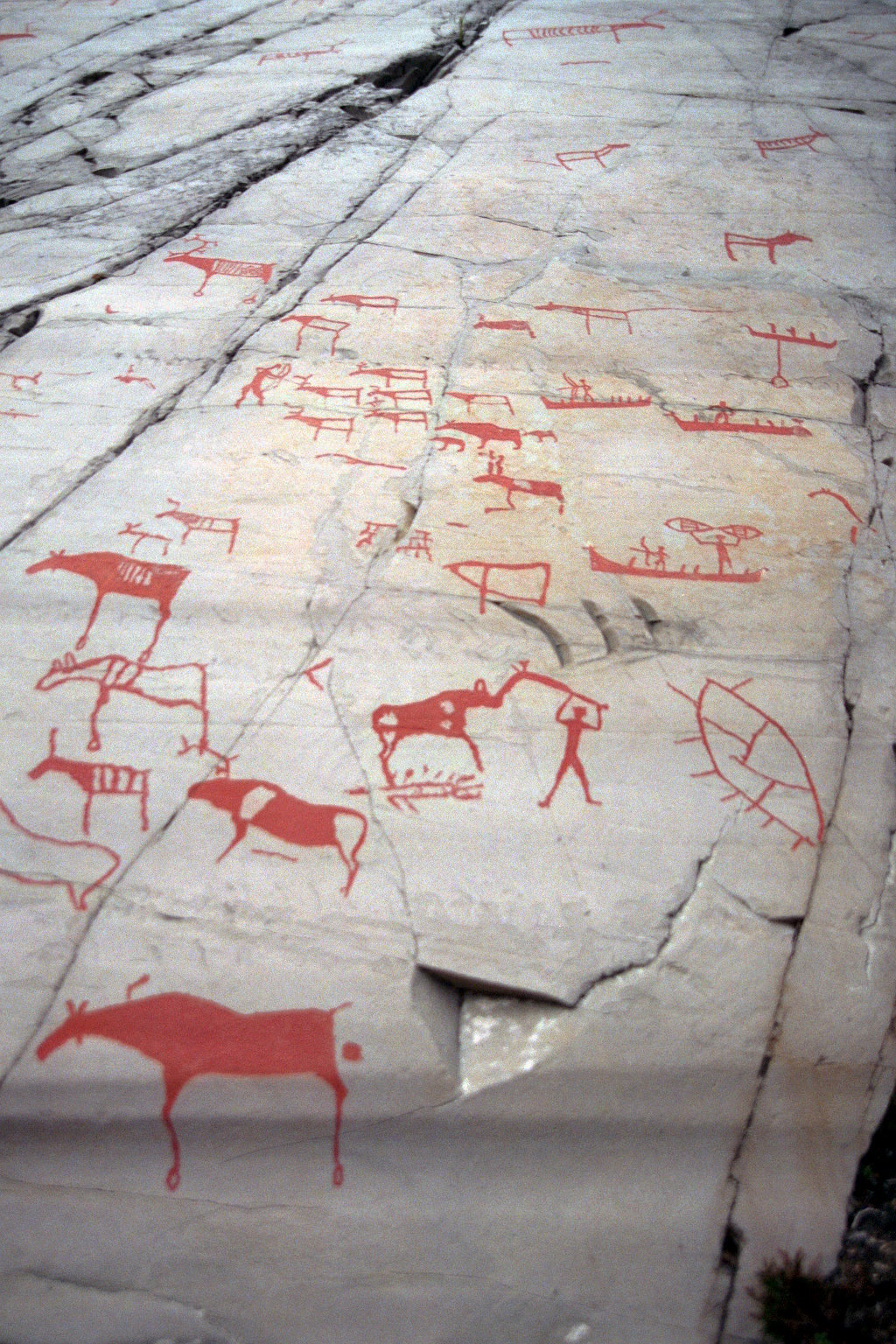
The Rock Art of Alta, located in the Alta Fjord region of Finnmark County, Norway, stands as a testament to the rich cultural history of prehistoric societies that once inhabited the far north. Inscribed as a UNESCO World Heritage Site in 1985, this collection of over 6,000 petroglyphs offers a unique glimpse into the lives, beliefs, and interactions of these ancient communities.
More to come…UNESCO Description of the World Heritage Site
This group of petroglyphs in the Alta Fjord, near the Arctic Circle, bears the traces of a settlement dating from c. 4200 to 500 B.C. The thousands of paintings and engravings add to our understanding of the environment and human activities on the fringes of the Far North in prehistoric times.
UNESCO Justification of the World Heritage Site
Criterion (iii): The Rock Art of Alta, with its thousands of paintings and engravings, is an exceptional testimony of the aspects of life, the environment and the activities of hunter-gatherer societies in the Arctic in prehistoric times. The wide range of motifs and scenes of high artistic quality reflect a long tradition of hunter-gatherer societies and their interaction with landscape, as well as the evolution of their symbols and rituals from approximately 5000 B.C. to about the year 0.
Encyclopedia Record: Rock carvings at Alta
The Rock art of Alta are located in and around Alta Municipality in Finnmark county in northern Norway. Since the first carvings were discovered in 1973, more than 6,000 carvings have been found on several sites around Alta. The largest locality, at Jiepmaluokta about five kilometers (3.1 mi) from Alta, contains thousands of individual carvings and has been turned into an open-air museum. The site, along with the sites Storsteines, Kåfjord, Amtmannsnes, and Transfarelv, was placed on the UNESCO list of World Heritage Sites on 3 December 1985. It is Norway's only prehistoric World Heritage Site.Additional Site Details
Area: 53.59 hectares
Number of Components: 5
Coordinates: 69.95 , 23.18333
Image
© Karl Brodowsky, CC BY-SA 3.0 Resized from original. (This derivative is under the same CC BY-SA license.)
