World Heritage Identification Number: 55
World Heritage since: 1980
Category: Cultural Heritage
WHE Type: Infrastructure & Industry
Transboundary Heritage: No
Endangered Heritage: No
Country: 🇳🇴 Norway
Continent: Europe
UNESCO World Region: Europe and North America
Map
Røros Mining Town and the Circumference: A Unique Cultural Landscape in Norway
The Røros Mining Town and the Circumference, inscribed as a UNESCO World Heritage Site in 1980, offers a fascinating glimpse into Norway's rich history of copper mining. Situated in the remote region of Trøndelag county, this site showcases the enduring culture that developed around the extraction of copper over three centuries.
More to come…UNESCO Description of the World Heritage Site
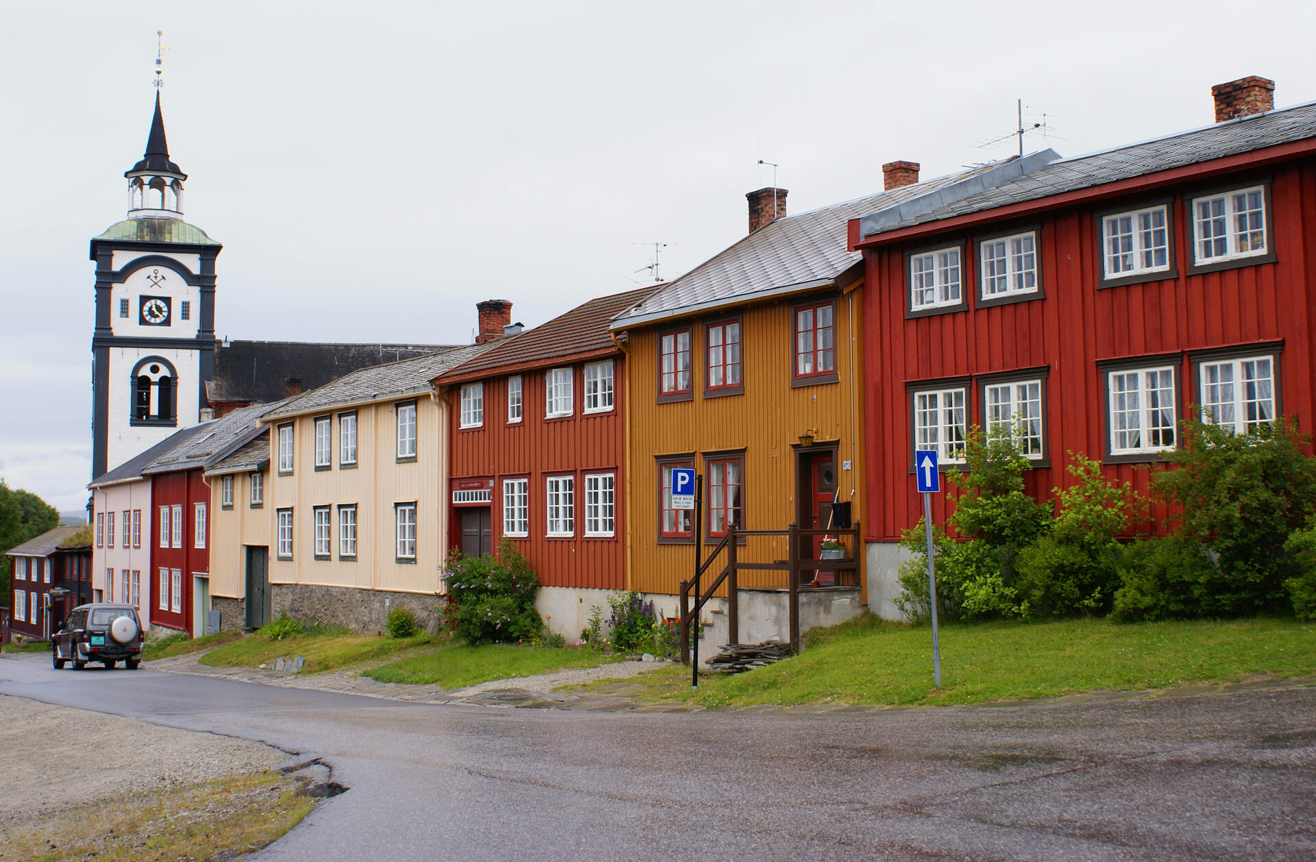
Røros Mining Town and the Circumference is linked to the copper mines, established in the 17th century and exploited for 333 years until 1977. The site comprises the Town and its industrial-rural cultural landscapes; Femundshytta, a smelter with its associated area; and the Winter Transport Route. Completely rebuilt after its destruction by Swedish troops in 1679, Røros contains about 2000 wooden one- and two-storey houses and a smelting house. Many of these buildings have preserved their blackened wooden façades, giving the town a medieval appearance. Surrounded by a buffer zone, coincident with the area of privileges (the Circumference) granted to the mining enterprise by the Danish-Norwegian Crown (1646), the property illustrates the establishment and flourishing of a lasting culture based on copper mining in a remote region with a harsh climate.
UNESCO Justification of the World Heritage Site
Criterion (iii): From the time copper ore was found in the mountains at Røros in 1644 until the copper works went bankrupt in 1977, with German mining technology as a starting point, employing German, Danish, Swedish immigrants, and Norwegian nationals,, a unique culture developed to extract the valuable copper in a remote and sparsely inhabited area. Today there is no mining in the area, but Røros Mining Town and the traces of mining, smelters, transport, and water management systems bear unique witness to the adaptation of technology to the requirements of the natural environment and the remoteness of the situation.
Criterion (iv): Røros townscape and its related industrial and rural landscapes, with their interlinked industrial activity and domestic and agricultural accommodation within an urban environment, illustrate in an outstanding manner how people adapted to the extreme circumstances in which they had to live and how they used the available indigenous resources to provide shelter, produce food for their sustenance, and contribute to the national wealth of the country. Technologically, their buildings and installations evolved through the use of available indigenous materials to functionally satisfy the combined approach of mining and agrarian practices whilst at the same time accommodating the consequences of dealing with extreme climatic conditions.
Criterion (v): Røros Mining Town and the Circumference constitute a totality that is an outstanding example of traditional settlement and land-use. The various activities that have been carried out in the area constitute a coherent and interdependent unit. These activities have shaped a cultural landscape that provides a unique picture of how the mines and the mining town functioned as a complex and at times vulnerable system that verged on the limits of what was possible in an inhospitable environment with a harsh climate.
Encyclopedia Record: Røros (town)
(Norwegian) or Plaassja (Southern Sami) is the administrative centre of Røros Municipality in Trøndelag county, Norway. The town is located along the river Hyttelva and along the Rørosbanen railway line, about 10 kilometres (6.2 mi) south of the village of Glåmos and about the same distance north of the village of Os i Østerdalen in neighboring Innlandet county.Additional Site Details
Area: 16,510 hectares
Number of Components: 2
(iv) — Outstanding example of a type of building or landscape
(v) — Outstanding example of traditional human settlement
Coordinates: 62.5738888889 , 11.3855555556
Image
© Randi Hausken from Bærum, Norway, CC BY-SA 2.0 Resized from original. (This derivative is under the same CC BY-SA license.)
