World Heritage Identification Number: 120
World Heritage since: 1979
Category: Natural Heritage
WHE Type: Protected Areas & National Parks
Transboundary Heritage: No
Endangered Heritage: No
Country: 🇳🇵 Nepal
Continent: Asia
UNESCO World Region: Asia and the Pacific
Map
Sagarmatha National Park: A Unique Blend of Natural Beauty and Cultural Richness
Sagarmatha National Park, located in the Himalayas of eastern Nepal, is a testament to the harmonious coexistence of breathtaking natural beauty and rich cultural heritage. Established in 1976 and inscribed as a UNESCO World Heritage Site in 1979, this protected area spans over an expanse of 1,148 square kilometers in the Solukhumbu District.
More to come…UNESCO Description of the World Heritage Site
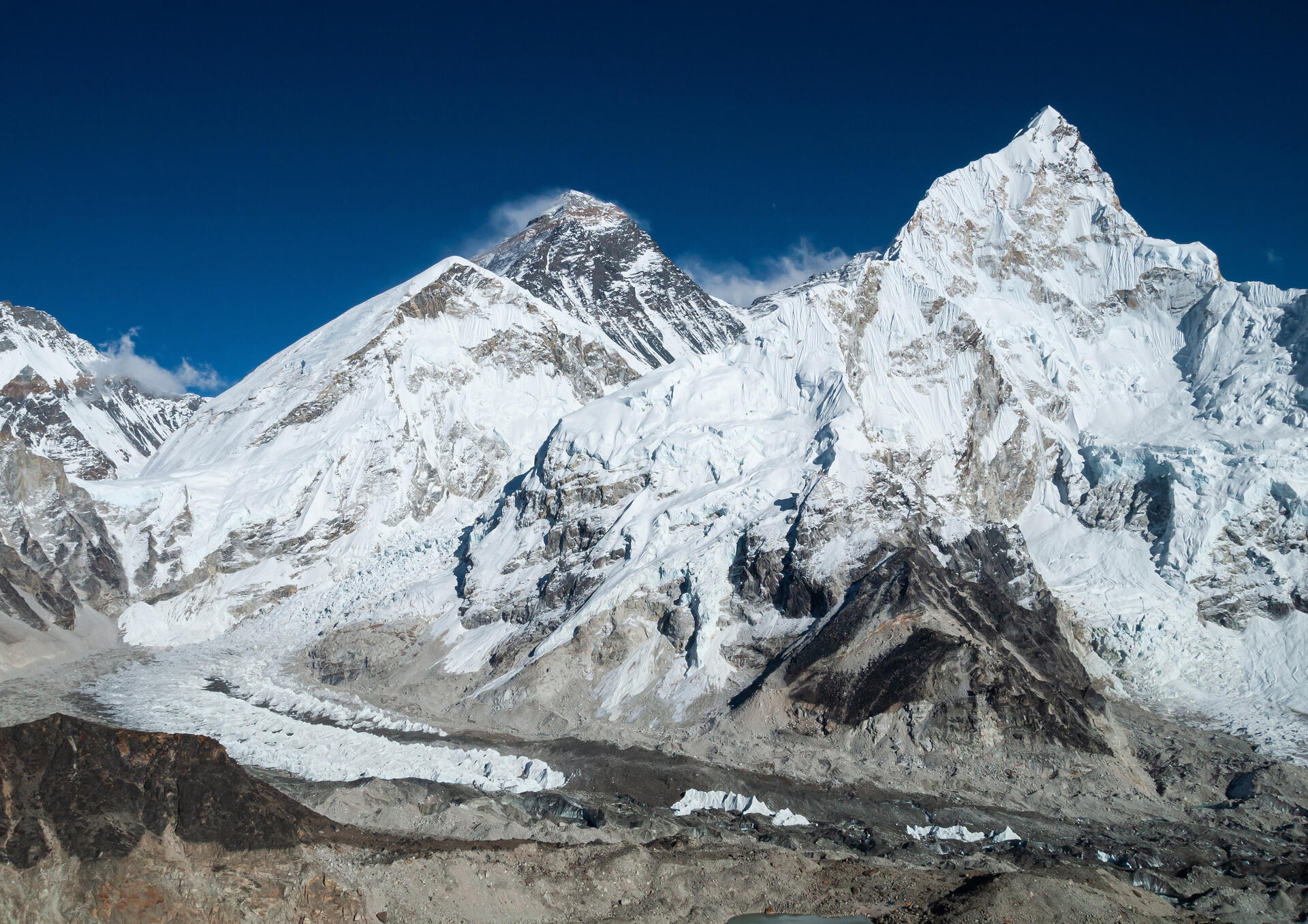
Sagarmatha is an exceptional area with dramatic mountains, glaciers and deep valleys, dominated by Mount Everest, the highest peak in the world (8,848 m). Several rare species, such as the snow leopard and the lesser panda, are found in the park. The presence of the Sherpas, with their unique culture, adds further interest to this site.
UNESCO Justification of the World Heritage Site
Criteria (vii): Sagarmatha National Parks’ superlative and exceptional natural beauty is embedded in the dramatic mountains, glaciers, deep valleys and majestic peaks including the Worlds’ highest, Mount Sagarmatha (Everest) (8,848 m.). The area is home to several rare species such as the snow leopard and the red panda. The area represents a major stage of the Earth’s evolutionary history and is one of the most geologically interesting regions in the world with high, geologically young mountains and glaciers creating awe inspiring landscapes and scenery dominated by the high peaks and corresponding deeply-incised valleys. This park contains the world’s highest ecologically characteristic flora and fauna, intricately blended with the rich Sherpa culture. The intricate linkages of the Sherpa culture with the ecosystem are a major highlight of the park and they form the basis for the sustainable protection and management of the park for the benefit of the local communities.
Encyclopedia Record: Sagarmatha National Park
Sagarmāthā National Park is a national park in the Himalayas of eastern Nepal that was established in 1976 and encompasses an area of 1,148 km2 (443 sq mi) in the Solukhumbu District. It ranges in elevation from 2,845 to 8,848 m and includes Mount Everest. In the north, it shares the international border with Qomolangma National Nature Preserve in Tibet Autonomous Region. In the east, it is adjacent to Makalu Barun National Park, and in the south it extends to Dudh Kosi river. It is part of the Sacred Himalayan Landscape.Additional Site Details
Area: 124,400 hectares
Number of Components: 1
Coordinates: 27.96528 , 86.91306
IUCN World Heritage Outlook
The 2025 Conservation Outlook on Sagarmatha National Park reports the following assessment:
Source: International Union for Conservation of Nature (IUCN) · View assessment