World Heritage Identification Number: 1749
World Heritage since: 2024
Category: Cultural Heritage
WHE Type: Religious Sites & Sacred Architecture
Transboundary Heritage: No
Endangered Heritage: Yes
Country: 🇵🇸 State of Palestine
Continent: Asia
UNESCO World Region: Arab States
Map
Exploring the Ancient Saint Hilarion Monastery/Tell Umm Amer: A Significant Monastic Site in the Middle East
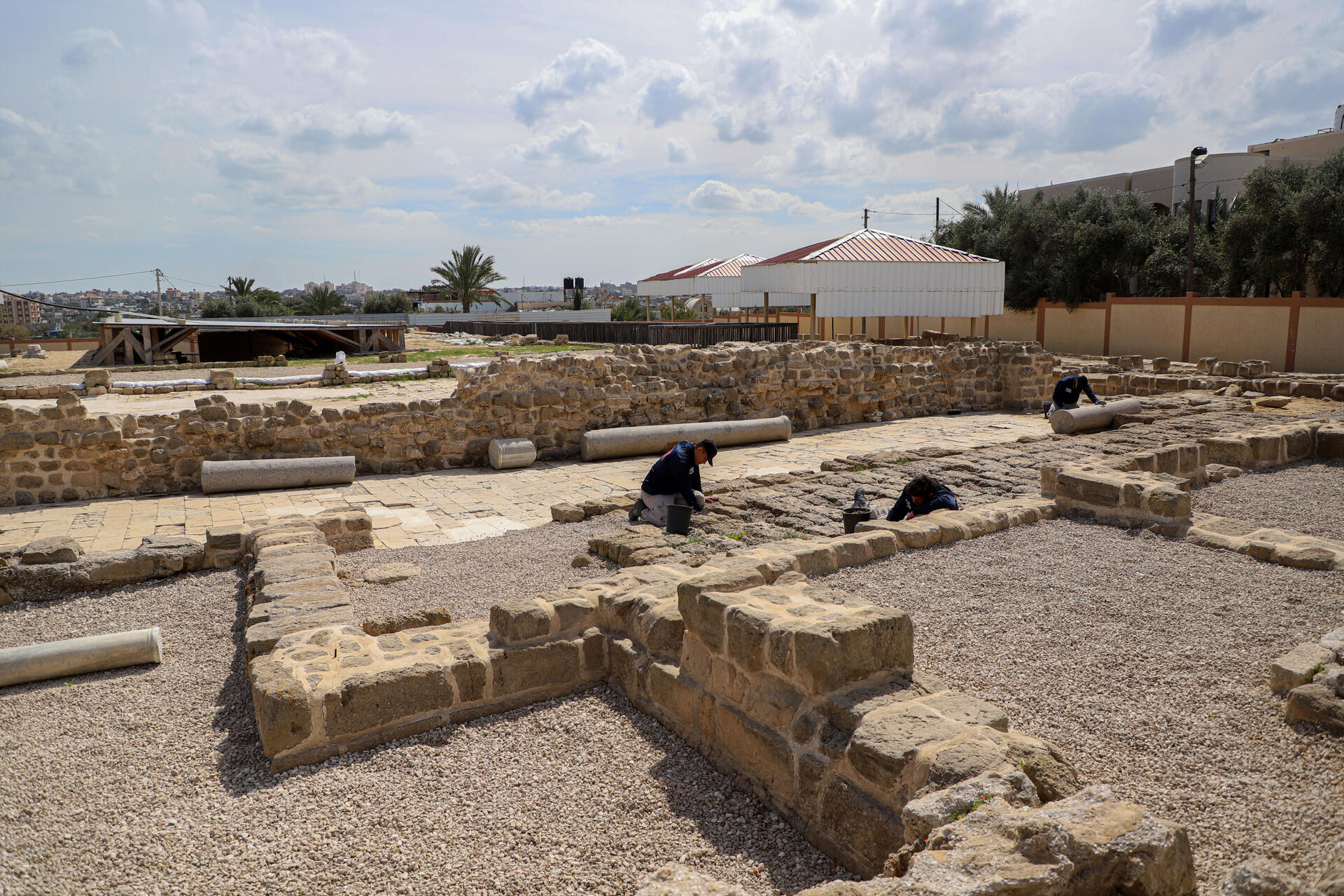
The Saint Hilarion Monastery, also known as Tell Umm Amer, is a remarkable archaeological site located in the Nuseirat Municipality, within the borders of the Gaza Strip, Palestine. Inscribed as a UNESCO World Heritage Site in 2024, this ancient monastery represents one of the earliest monastic settlements in the Middle East, dating back to the 4th century.
More to come…UNESCO Description of the World Heritage Site
Situated on the coastal dunes in Nuseirat Municipality, the ruins of Saint Hilarion Monastery/ Tell Umm Amer represent one of the earliest monastic sites in the Middle East, dating back to the 4th century. Founded by Saint Hilarion, the monastery began with solitary hermits and evolved into a coenobitic community. It was the first monastic community in the Holy Land, laying the groundwork for the spread of monastic practices in the region. The monastery occupied a strategic position at the crossroads of major trade and communication routes between Asia and Africa. This prime location facilitated its role as a hub of religious, cultural, and economic interchange, exemplifying the flourishing of monastic desert centres during the Byzantine period.
Encyclopedia Record: Saint Hilarion Monastery
Saint Hilarion Monastery, at the archaeological site of Tell Umm el-'Amr, was an ancient Christian monastery. Its excavated ruins lay close to Deir al-Balah in the Gaza Strip, Palestine.Additional Site Details
Area: 1.3293 hectares
Number of Components: 1
(iii) — Unique or exceptional testimony to a cultural tradition
(vi) — Directly associated with events or living traditions
Coordinates: 31.4473055556 , 34.3663611111
Image
© RIZEK ABDELJAWAD, CC BY-SA 4.0 Resized from original. (This derivative is under the same CC BY-SA license.)
