World Heritage Identification Number: 1187
World Heritage since: 2005
Category: Cultural Heritage
WHE Type: Infrastructure & Industry
Transboundary Heritage: Yes
Endangered Heritage: No
Country: Belarus, Estonia, Finland, Latvia, Lithuania, Norway, Republic of Moldova, Russian Federation, Sweden, Ukraine
Continent: Europe
UNESCO World Region: Europe and North America
Map
The Struve Geodetic Arc: A Pioneering Feat in Earth Sciences
The Struve Geodetic Arc, inscribed as a UNESCO World Heritage Site in 2005, stands as a testament to human ingenuity and international cooperation in the field of earth sciences. This remarkable chain of survey triangulations spans an impressive distance of approximately 2,820 kilometers, traversing ten countries from Hammerfest in Norway to the Black Sea.
The Arc's origins trace back to the early 19th century when the astronomer Friedrich Georg Wilhelm Struve embarked upon a groundbreaking project. His objective was to measure a significant portion of a meridian accurately, thereby contributing to the understanding of the Earth's size and shape. While meridian measurements had been attempted earlier on shorter scales, the Struve Geodetic Arc represented the first accurate triangulated measurement of such an extensive meridian arc, marking a major advance in geodesy and cartography.
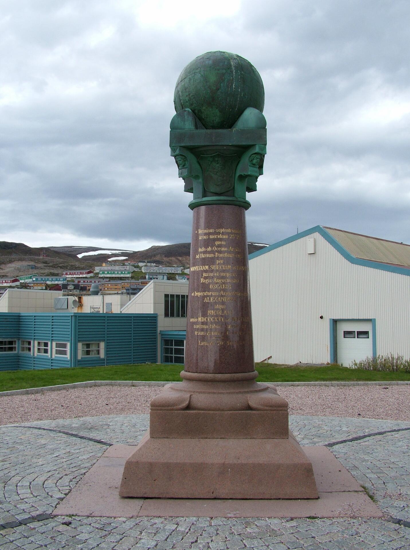
The Arc consists of 258 main triangles, each containing one or more station points. Initially, there were 265 main station points; however, the current listed site encompasses only 34 of these points, each marked uniquely depending on the terrain—ranging from drilled holes in rocks, iron crosses, cairns, to built obelisks.
The construction of the Struve Arc was no small undertaking, requiring meticulous planning and execution. Over four decades, from 1816 to 1855, surveyors worked tirelessly to ensure the accuracy of their measurements. Their efforts resulted in a precise determination of the Earth's ellipsoidal shape and the length of its meridians.
One of the most striking aspects of the Struve Arc is the level of international collaboration it fostered. Scientists from various nations collaborated on this project, sharing knowledge and resources to achieve a common goal. Furthermore, the project was supported by multiple monarchs, further underscoring the spirit of global cooperation that characterized this endeavor.
Beyond its historical importance, the Struve Geodetic Arc retains substantial scientific and educational value. Although modern geodesy now relies on satellite-based technologies, the Arc remains a foundational achievement in the history of Earth measurement and a benchmark in the development of geodetic science. Moreover, the Arc serves as a powerful symbol of human curiosity, perseverance, and the ability to transcend borders for the pursuit of knowledge.
Today, the Struve Geodetic Arc stands as a UNESCO World Heritage Site, preserving a vital piece of our shared history while continuing to inspire future generations of scientists and explorers. As we look towards the future, the Arc serves as a reminder of what can be achieved when individuals and nations come together in pursuit of a common goal—the expansion of human knowledge.
UNESCO Description of the World Heritage Site
The Struve Arc is a chain of survey triangulations stretching from Hammerfest in Norway to the Black Sea, through 10 countries and over 2,820 km. These are points of a survey, carried out between 1816 and 1855 by the astronomer Friedrich Georg Wilhelm Struve, which represented the first accurate measuring of a long segment of a meridian. This helped to establish the exact size and shape of the planet and marked an important step in the development of earth sciences and topographic mapping. It is an extraordinary example of scientific collaboration among scientists from different countries, and of collaboration between monarchs for a scientific cause. The original arc consisted of 258 main triangles with 265 main station points. The listed site includes 34 of the original station points, with different markings, i.e. a drilled hole in rock, iron cross, cairns, or built obelisks.
UNESCO Justification of the World Heritage Site
Criterion (ii): The first accurate measuring of a long segment of a meridian, helping in the establishment of the exact size and shape of the world exhibits an important step in the development of earth sciences. It is also an extraordinary example for interchange of human values in the form of scientific collaboration among scientists from different countries. It is at the same time an example for collaboration between monarchs of different powers, for a scientific cause.
Criterion (iv): The Struve Geodetic Arc is undoubtedly an outstanding example of a technological ensemble - presenting the triangulation points of the measuring of the meridian, being the non-movable and non-tangible part of the measuring technology.
Criterion (vi): The measuring of the arc and its results are directly associated with humans wondering about their world, its shape and size. It is linked with Sir Isaac Newton’s theory that the world is not an exact sphere.
Encyclopedia Record: Struve Geodetic Arc
The Struve Geodetic Arc is a chain of survey triangulations stretching from Hammerfest in Norway to the Black Sea, through ten countries and over 2,820 kilometres (1,750 mi), which yielded the first accurate measurement of a meridian arc.Additional Site Details
Area: Not available
Number of Components: 34
(iv) — Outstanding example of a type of building or landscape
(vi) — Directly associated with events or living traditions
Coordinates: 59.0577777778 , 26.3377777777
Image
© Clemensfranz, CC BY-SA 3.0 Resized from original. (This derivative is under the same CC BY-SA license.)