World Heritage Identification Number: 205
World Heritage since: 1983
Category: Natural Heritage
WHE Type: Protected Areas & National Parks
Transboundary Heritage: Yes
Endangered Heritage: No
Country: Costa Rica, Panama
Continent: Americas
UNESCO World Region: Latin America and the Caribbean
Map
The Talamanca Range-La Amistad Reserves / La Amistad National Park: A Unique Biodiversity Hotspot Straddling Two Countries
The Talamanca Range-La Amistad Reserves / La Amistad National Park (hereafter referred to as La Amistad) is a remarkable conservation area that spans across the southeastern region of Costa Rica and the far western part of Panama. This unique site was inscribed as a UNESCO World Heritage Site in 1983, recognizing its exceptional natural and cultural values.
More to come…UNESCO Description of the World Heritage Site
The location of this unique site in Central America, where Quaternary glaciers have left their mark, has allowed the fauna and flora of North and South America to interbreed. Tropical rainforests cover most of the area. Four different Indian tribes inhabit this property, which benefits from close co-operation between Costa Rica and Panama.
UNESCO Justification of the World Heritage Site
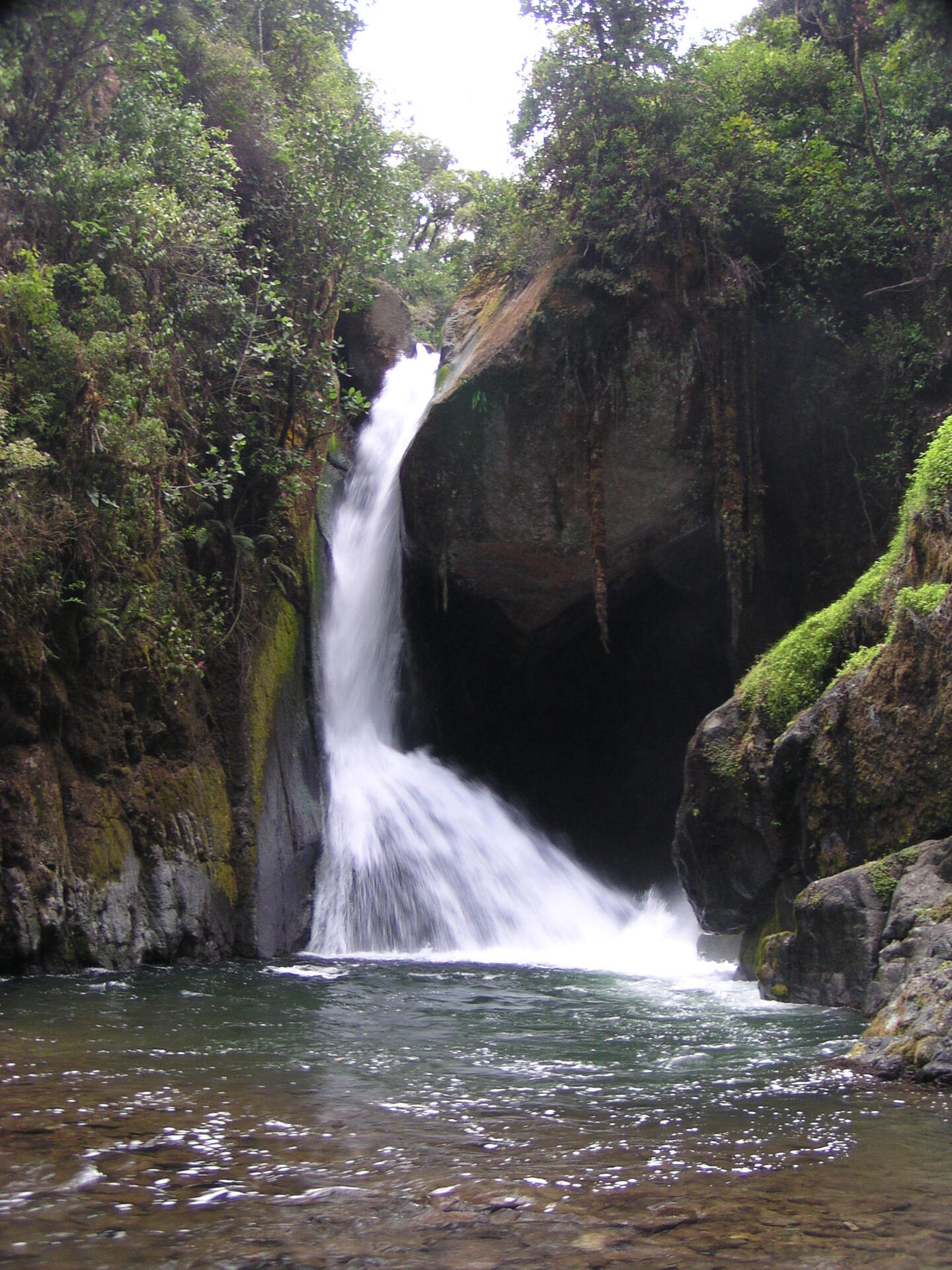
Criterion (vii): The property harbours exceptionally beautiful mountain landscapes. Much of the rugged terrain is covered by vast forests. Within the region, the unusual high altitude grasslands are restricted to the property, allowing extraordinary panoramic views. The remarkable vestiges of Quaternary glaciation add to the particularity of the landscape through the cirques, shapes of valleys and glacial lakes. The Talamanca Range hosts countless rivers and creeks, some of them forming spectacular waterfalls. In addition to scenic values the Talamanca Mountains also have major spiritual value for local communities.
Criterion (viii): The Talamanca Range is a very particular sample of the recent geological history of the Central American Isthmus, the relatively narrow strip of land connecting North and South America and separating the Pacific and Atlantic Oceans. The property shows impressive marks of Quaternary glacial activity, which has shaped glacial cirques, glacial lakes and deep, “U”-shaped valleys, which cannot be found anywhere else in Central America.
Criterion (ix): As a large and mostly intact part of a geologically young land bridge, what is today the property is a meeting point of flora and fauna coming from North and South America. Many of the original species of the previously disconnected sub-continents reach their distribution boundaries in the Talamanca Mountains. Jointly with the climatic variation, the complex relief and huge altitudinal range and heterogeneity of many other environmental conditions this biogeographic location has resulted in a complex mosaic of ecosystems and habitats of global importance for conservation and science. The mosaic includes oak forests, different types of tropical rainforest, cloud forest and the rare high altitude bogs and grasslands. The latter, referred to as “Isthmus Paramo”, is regionally restricted to the property and extremely rich in endemic species. Evolutionary processes triggered a speciation with extraordinary levels of endemism across numerous taxonomic groups. Many endemic species are restricted to single peaks of the mountain range. Ecologically, these peaks can be compared to islands of an archipelago.
Criterion (x): The property boasts an exuberant biological diversity of both flora and fauna with an elevated degree of endemism across numerous taxonomic groups, often exceeding one third of the species within a taxonomic group. The Talamanca Mountains host some 10,000 flowering plants and over 4,000 non-vascular plants. There are approximately 1,000 fern species and about 900 species of lichen. Many of the region's large mammals have important populations within the property; overall 215 species of mammals have been recorded. The property hosts viable populations of many rare, vulnerable and endangered species, which include all cat species of Central America, the endangered species Ornate Spider Monkey and Central American Tapir, as well as the vulnerable Black-crowned Central American Squirrel Monkey. Some 600 bird species include the resplendent Quetzal and several species of rare raptors. Other vertebrates include some 250 species of reptiles and amphibians and remarkable 115 species of freshwater fish. Of the amphibians, six species are restricted to the Cordillera, such as the endangered Splendid Poison Frog.
Encyclopedia Record: Cordillera de Talamanca
The Cordillera de Talamanca is a mountain range that lies in the southeast half of Costa Rica and the far west of Panama. Much of the range and the area around it is included in La Amistad International Park, which also is shared between the two countries.Additional Site Details
Area: 570,045 hectares
Number of Components: 1
(viii) — Outstanding example representing major earth stages
(ix) — Outstanding example representing ecological and biological processes
(x) — Contains most important habitats for biodiversity
Coordinates: 9.407083333 , -82.93880556
IUCN World Heritage Outlook
The 2025 Conservation Outlook on Talamanca Range-La Amistad Reserves / La Amistad National Park reports the following assessment:
Source: International Union for Conservation of Nature (IUCN) · View assessment