World Heritage Identification Number: 1255
World Heritage since: 2007
Category: Cultural Heritage
WHE Type: Archaeological Sites
Transboundary Heritage: No
Endangered Heritage: No
Country: 🇳🇦 Namibia
Continent: Africa
UNESCO World Region: Africa
Map
Twyfelfontein or /Ui-//aes: A Rich Archaeological Site in Namibia
Twyfelfontein or /Ui-//aes, located in the Kunene Region of north-western Namibia, is a significant archaeological site renowned for its abundant collection of petroglyphs, making it one of the largest concentrations of rock engravings in Africa. This UNESCO World Heritage Site offers valuable insights into the cultural practices and beliefs of prehistoric hunter-gatherer communities in southern Africa.
More to come…UNESCO Description of the World Heritage Site
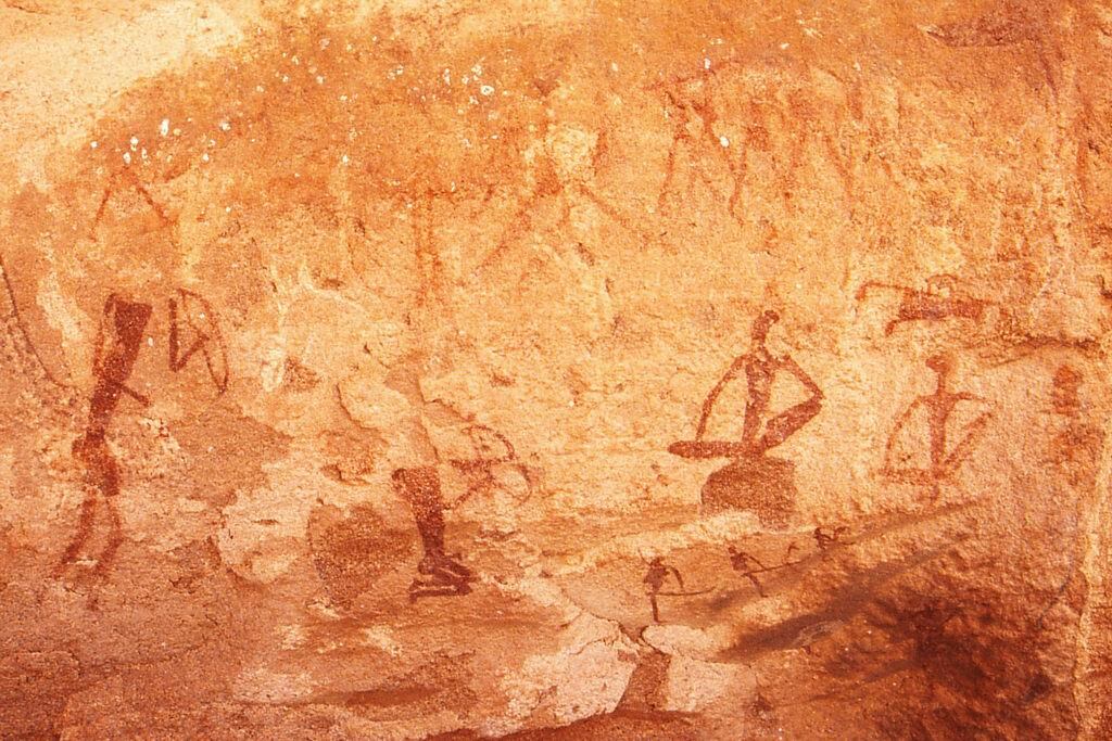
Twyfelfontein or /Ui-//aes has one of the largest concentrations of [...] petroglyphs, i.e. rock engravings in Africa. Most of these well-preserved engravings represent rhinoceros, . The site also includes six painteelephant, ostrich and giraffe, as well as drawings of human and animal footprintsd rock shelters with motifs of human figures in red ochre. The objects excavated from two sections, date from the Late Stone Age. The site forms a coherent, extensive and high-quality record of ritual practices relating to hunter-gatherer communities in this part of southern Africa over at least 2,000 years, and eloquently illustrates the links between the ritual and economic practices of hunter-gatherers.
UNESCO Justification of the World Heritage Site
Criterion (iii): The rock art engravings and paintings in Twyfelfontein form a coherent, extensive and high quality record of ritual practices relating to hunter-gather communities in this part of southern Africa over at least two millennia.
Criterion (v): The rock art reflects links between ritual and economic practices in the apparent sacred association of the land adjacent to an aquifer as a reflection of its role in nurturing hunter-gather communities over many millennia.
Encyclopedia Record: Twyfelfontein
Twyfelfontein, officially known as ǀUi-ǁAis, is a site of ancient rock engravings in the Kunene Region of north-western Namibia. It consists of a spring in a valley flanked by the slopes of a sandstone table mountain that receives very little rainfall and has a wide range of diurnal temperatures.Additional Site Details
Area: 57.4269 hectares
Number of Components: 1
(v) — Outstanding example of traditional human settlement
Coordinates: -20.597 , 14.376
Image
© Thomas Schoch, CC BY-SA 3.0 Resized from original. (This derivative is under the same CC BY-SA license.)
