World Heritage Identification Number: 1721
World Heritage since: 2024
Category: Cultural Heritage
WHE Type: Archaeological Sites
Transboundary Heritage: No
Endangered Heritage: No
Country: 🇯🇴 Jordan
Continent: Asia
UNESCO World Region: Arab States
Map
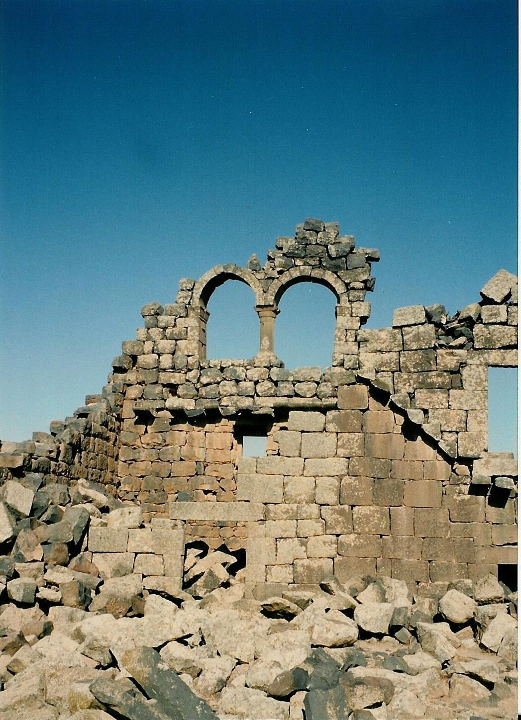
Umm Al-Jimāl: An Ancient Rural Settlement in Northern Jordan
Umm Al-Jimāl, a rural settlement in northern Jordan, offers a unique glimpse into the past, providing valuable insights into the history, culture, and architectural styles of the Hauran region. Inscribed as a UNESCO World Heritage Site in 2024, this remarkable archaeological site has been meticulously preserved, offering visitors a chance to walk through time and experience the life of its ancient inhabitants.
More to come…UNESCO Description of the World Heritage Site
The property is a rural settlement in northern Jordan that developed organically on the site of an earlier Roman settlement around the 5th century CE and functioned until the end of the 8th century CE. It preserves basaltic structures from the Byzantine and Early Islamic periods that represent the local architecture style of the Hauran region, with some earlier Roman military buildings re-purposed by later inhabitants. The settlement formed part of a broader agricultural landscape that included a complex water catchment system, which sustained agriculture and animal herding. The earliest structures uncovered at Umm Al-Jimāl date back to the 1st century CE, when the area formed part of the Nabataean Kingdom. A rich epigraphic corpus in Greek, Nabataean, Safaitic, Latin and Arabic uncovered on the site and spanning many centuries provides insights into its history, and sheds light on the changes in its inhabitants’ religious beliefs.
UNESCO Justification of the World Heritage Site
Criterion (iii): As a typical rural Hauranian settlement that developed around agricultural and animal herding activities on the Hauran basaltic plateau, Umm Al-Jimāl is one of the most representative examples of the rural lifestyle of the Hauranian people, reflecting the key aspects of their cultural traditions and social values embodied in the well-preserved distinctive basalt architecture. By preserving the local architectural character and cultural traditions over centuries despite political or religious change, the property testifies to the resilience of the Hauranian culture.
Encyclopedia Record: Umm el-Jimal
Umm el-Jimal, also rendered as Umm ej Jemāl, Umm al-Jimal or Umm idj-Djimal, is a village in northern Jordan approximately 17 kilometers east of Mafraq. It is primarily notable for the substantial ruins of a Byzantine and early Islamic town which are clearly visible above the ground, as well as an older Roman village located to the southwest of the Byzantine ruins.Additional Site Details
Area: 42.584 hectares
Number of Components: 1
Coordinates: 32.3269444444 , 36.37