World Heritage Identification Number: 1342
World Heritage since: 2012
Category: Natural Heritage
WHE Type: Natural Landscapes & Geographic Features
Transboundary Heritage: No
Endangered Heritage: No
Country: 🇮🇳 India
Continent: Asia
UNESCO World Region: Asia and the Pacific
Map
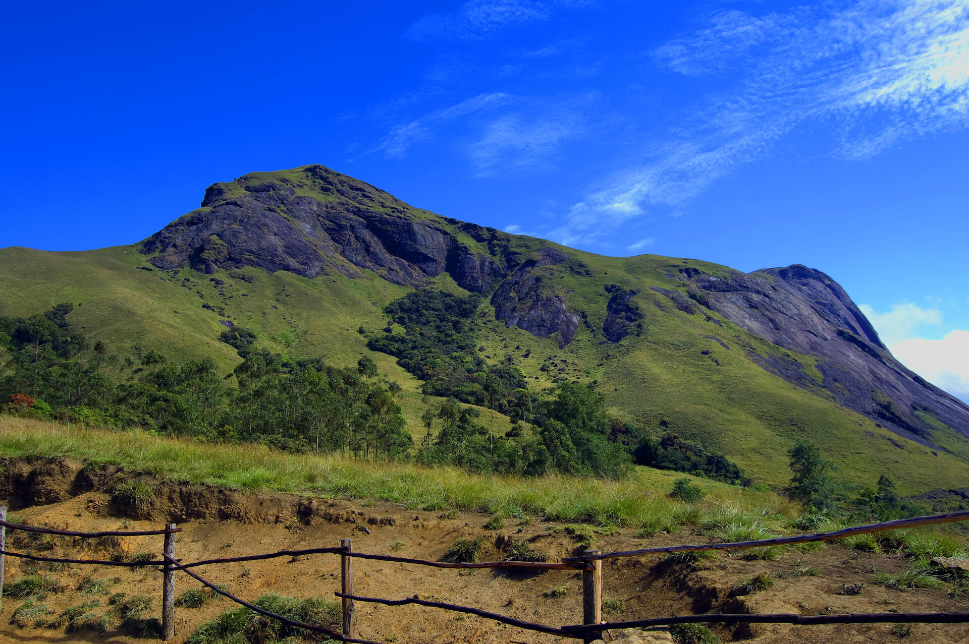
The Western Ghats: A Biodiversity Hotspot and Climate Regulator
The Western Ghats, also known as the Sahyadri, is a significant mountain range that spans approximately 1,600 kilometers along the western coast of India. This ancient range, older than the Himalayas, covers an area of around 160,000 square kilometers and traverses six Indian states: Gujarat, Maharashtra, Goa, Karnataka, Kerala, and Tamil Nadu. The Western Ghats forms an almost continuous chain of mountains along the western edge of the Deccan Plateau, from the Tapti River to Swamithoppe in Kanyakumari district at the southern tip of the Indian peninsula.
More to come…UNESCO Description of the World Heritage Site
Older than the Himalaya mountains, the mountain chain of the Western Ghats represents geomorphic features of immense importance with unique biophysical and ecological processes. The site’s high montane forest ecosystems influence the Indian monsoon weather pattern. Moderating the tropical climate of the region, the site presents one of the best examples of the monsoon system on the planet. It also has an exceptionally high level of biological diversity and endemism and is recognized as one of the world’s eight ‘hottest hotspots’ of biological diversity. The forests of the site include some of the best representatives of non-equatorial tropical evergreen forests anywhere and are home to at least 325 globally threatened flora, fauna, bird, amphibian, reptile and fish species.
UNESCO Justification of the World Heritage Site
Criterion (ix): The Western Ghats region demonstrates speciation related to the breakup of the ancient landmass of Gondwanaland in the early Jurassic period; secondly to the formation of India into an isolated landmass and the thirdly to the Indian landmass being pushed together with Eurasia. Together with favourable weather patterns and a high gradient being present in the Ghats, high speciation has resulted. The Western Ghats is an “Evolutionary Ecotone” illustrating “Out of Africa” and “Out of Asia” hypotheses on species dispersal and vicariance.tb1
Criterion (x): The Western Ghats contain exceptional levels of plant and animal diversity and endemicity for a continental area. In particular, the level of endemicity for some of the 4-5,000 plant species recorded in the Ghats is very high: of the nearly 650 tree species found in the Western Ghats, 352 (54%) are endemic. Animal diversity is also exceptional, with amphibians (up to 179 species, 65% endemic), reptiles (157 species, 62% endemic), and fishes (219 species, 53% endemic). Invertebrate biodiversity, once better known, is likely also to be very high (with some 80% of tiger beetles endemic). A number of flagship mammals occur in the property, including parts of the single largest population of globally threatened ‘landscape’ species such as the Asian Elephant, Gaur and Tiger. Endangered species such as the lion-tailed Macaque, Nilgiri Tahr and Nilgiri Langur are unique to the area. The property is also key to the conservation of a number of threatened habitats, such as unique seasonally mass-flowering wildflower meadows, Shola forests and Myristica swamps.
Encyclopedia Record: Western Ghats
The Western Ghats, also known as the Sahyadri, is a mountain range that stretches 1,600 km (990 mi) along the western coast of the Indian peninsula. Covering an area of 160,000 km2 (62,000 sq mi), it traverses the Indian states of Gujarat, Maharashtra, Goa, Karnataka, Kerala, and Tamil Nadu. The range forms an almost continuous chain of mountains along the western edge of the Deccan Plateau, from the Tapti River to Swamithoppe in Kanyakumari district at the southern tip of the Indian peninsula. The Western Ghats meet with the Eastern Ghats at Nilgiris before continuing south.Additional Site Details
Area: 795,315 hectares
Number of Components: 39
(x) — Contains most important habitats for biodiversity
Coordinates: 8.5297222222 , 77.2497222222
IUCN World Heritage Outlook
The 2025 Conservation Outlook on Western Ghats reports the following assessment:
Source: International Union for Conservation of Nature (IUCN) · View assessment
Image
© Arunguy2002, CC BY-SA 3.0 Resized from original. (This derivative is under the same CC BY-SA license.)
