World Heritage Identification Number: 1537
World Heritage since: 2018
Category: Cultural Heritage
WHE Type: Historic Cities & Urban Areas
Transboundary Heritage: No
Endangered Heritage: No
Country: 🇴🇲 Oman
Continent: Asia
UNESCO World Region: Arab States
Map
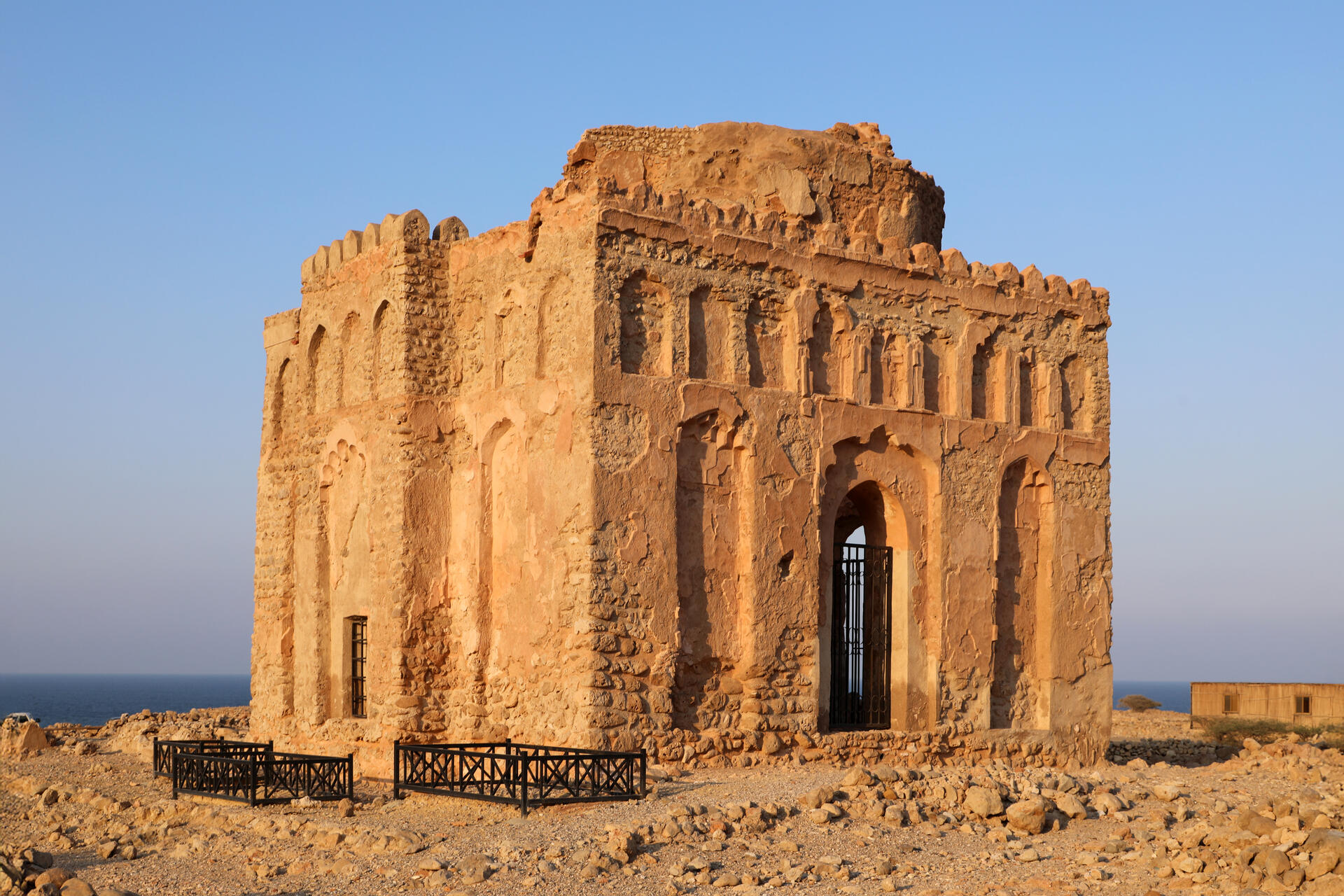
The Ancient City of Qalhat: A Testimony to Trade Links Across Continents
The Ancient City of Qalhat, situated on the eastern coast of Oman, offers a captivating glimpse into the rich history of trade connections that spanned continents during the 11th to 15th centuries CE. Inscribed as a UNESCO World Heritage Site in 2018, this ancient city played a pivotal role as a major port on the east coast of Arabia, fostering economic ties with regions such as East Africa, India, China, and Southeast Asia.
More to come…UNESCO Description of the World Heritage Site
The property, which is located on the east coast of the Sultanate of Oman, includes the ancient city of Qalhat, surrounded by inner and outer walls, as well as areas beyond the ramparts where necropolises are located. The city developed as a major port on the east coast of Arabia between the 11th and 15th centuries CE, during the reign of the Hormuz princes. The Ancient City bears unique archaeological testimony to the trade links between the east coast of Arabia, East Africa, India, China and South-East Asia.
UNESCO Justification of the World Heritage Site
Criterion (ii): Qalhat exhibits the cultural and commercial interchange of values within the trading range of the Kingdom of Hormuz, which extended to India and as far as China and South East Asia. The archaeological site of Qalhat provides physical evidence of these interchanges, documenting the architectural features which indicate its own produce, dates, Arabian horses as well as spices and pearls but also integrating the multi-cultural features of a medieval cosmopolitan city, with houses influenced by the needs of their various owners and inhabitants of foreign cultural origin. The ancient city also includes a number of highly representative buildings which were references in narratives authored by historic travellers.
Criterion (iii): The Ancient City of Qalhat presents a unique testimony to the Kingdom of Hormuz, as it prospered from the 11th to 16th century CE. Ancient Qalhat presents exceptional evidence of a major trade hub, which came under the rule of the Princes of Hormuz and profited from its geo-political position in the region. It was a seasonal residence and refuge to the Princes of Hormuz, which has given it the title of a secondary capital of the larger kingdom. The urban plan and the excavated buildings of Qalhat show features and characteristics specific to the Kingdom of Hormuz and the archaeological remains are its most complete representation and provide further potential for a more detailed understanding of its ways of life and trade.
Encyclopedia Record: Qalhat
Qalhāt is a village in Oman, over 20 km north of Sur. The residential area is to the northwest of Wādī Ḥilm, and the ruins of the ancient city are located to the southeast. The ancient city is referred to as Calatu by Marco Polo and as Calha in the map of Abraham Ortelius.Additional Site Details
Area: 75.82 hectares
Number of Components: 1
(iii) — Unique or exceptional testimony to a cultural tradition
Coordinates: 22.6952222222 , 59.3781111111
Image
© Francesco Bini, CC BY-SA 4.0 Resized from original. (This derivative is under the same CC BY-SA license.)
