World Heritage Identification Number: 434
World Heritage since: 1988
Category: Cultural Heritage
WHE Type: Archaeological Sites
Transboundary Heritage: No
Endangered Heritage: No
Country: 🇴🇲 Oman
Continent: Asia
UNESCO World Region: Arab States
Map
Archaeological Sites of Bat, Al-Khutm, and Al-Ayn: A Journey into Ancient Oman
The Archaeological Sites of Bat, Al-Khutm, and Al-Ayn, situated in the heart of Oman, offer a unique glimpse into the rich cultural history of this Middle Eastern nation. Inscribed as a UNESCO World Heritage Site in 1988, these archaeological sites represent one of the most extensive collections of settlements and necropolises dating back to the 3rd millennium B.C., making them a significant historical treasure trove.
More to come…UNESCO Description of the World Heritage Site
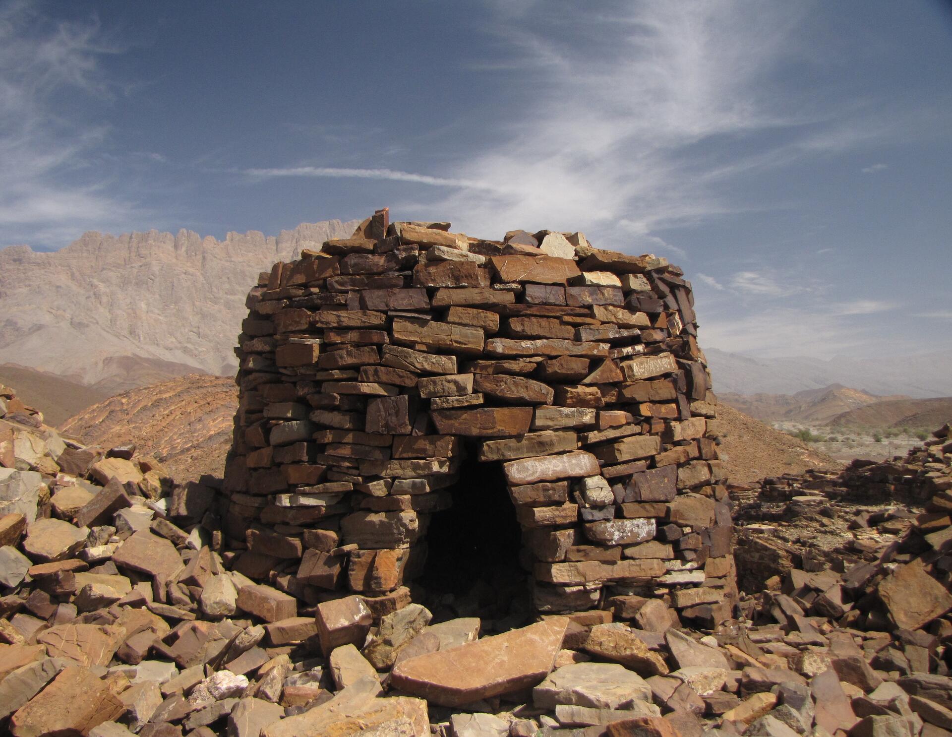
The protohistoric site of Bat lies near a palm grove in the interior of the Sultanate of Oman. Together with the neighbouring sites, it forms the most complete collection of settlements and necropolises from the 3rd millennium B.C. in the world.
UNESCO Justification of the World Heritage Site
Criterion (iii): The area encompassing the settlements, the necropolises and the workshop areas of Bat, al-Khutm and al-Ayn is the most complete and best known archaeological complex in Eastern Arabia for the 3rd millennium BCE. Cuneiform texts of ancient Mesopotamia (Iraq), dating to the end of the 3rd millennium BCE, tell us that the country of Magan (Oman) was at the time the principal extraction centre of copper, which was exported overseas to Mesopotamia to the northwest, and possibly to the Indus Valley in the east. Archaeological evidence for the appearance of a more hierarchical and structured social organization is attested at Bat in both the settlements, where circular monumental structures contrast with rectangular houses, and the necropolises, where the arrangement of funerary space increased in complexity and the grave goods testify to higher living standards and social changes mainly due to the introduction of a long-distance trade economy.
Criterion (v): In a restricted, coherent space, the necropolis of Bat bears characteristic and unique witness to the evolution of funeral practices during the Early Bronze Age in the peninsula of Oman.
Encyclopedia Record: Archaeological Sites of Bat, Al-Khutm and Al-Ayn
The Archaeological Sites of Bat, Al-Khutm and Al-Ayn are a group of beehive tombs or necropolis from the Hafit period in the 3rd Millennium BC, located near a palm grove in Oman. They were declared World Heritage by UNESCO in 1988, becoming only the second such Omani site after the Bahla Fort was designated world heritage in 1987.Additional Site Details
Area: Not available
Number of Components: 1
(iv) — Outstanding example of a type of building or landscape
Coordinates: 23.26986 , 56.745