World Heritage Identification Number: 1735
World Heritage since: 2025
Category: Cultural Heritage
WHE Type: Archaeological Sites
Transboundary Heritage: No
Endangered Heritage: No
Country: 🇦🇪 United Arab Emirates
Continent: Asia
UNESCO World Region: Arab States
Map
The Faya Palaeolandscape: A Window into Human Resilience in Hyper-Arid Environments
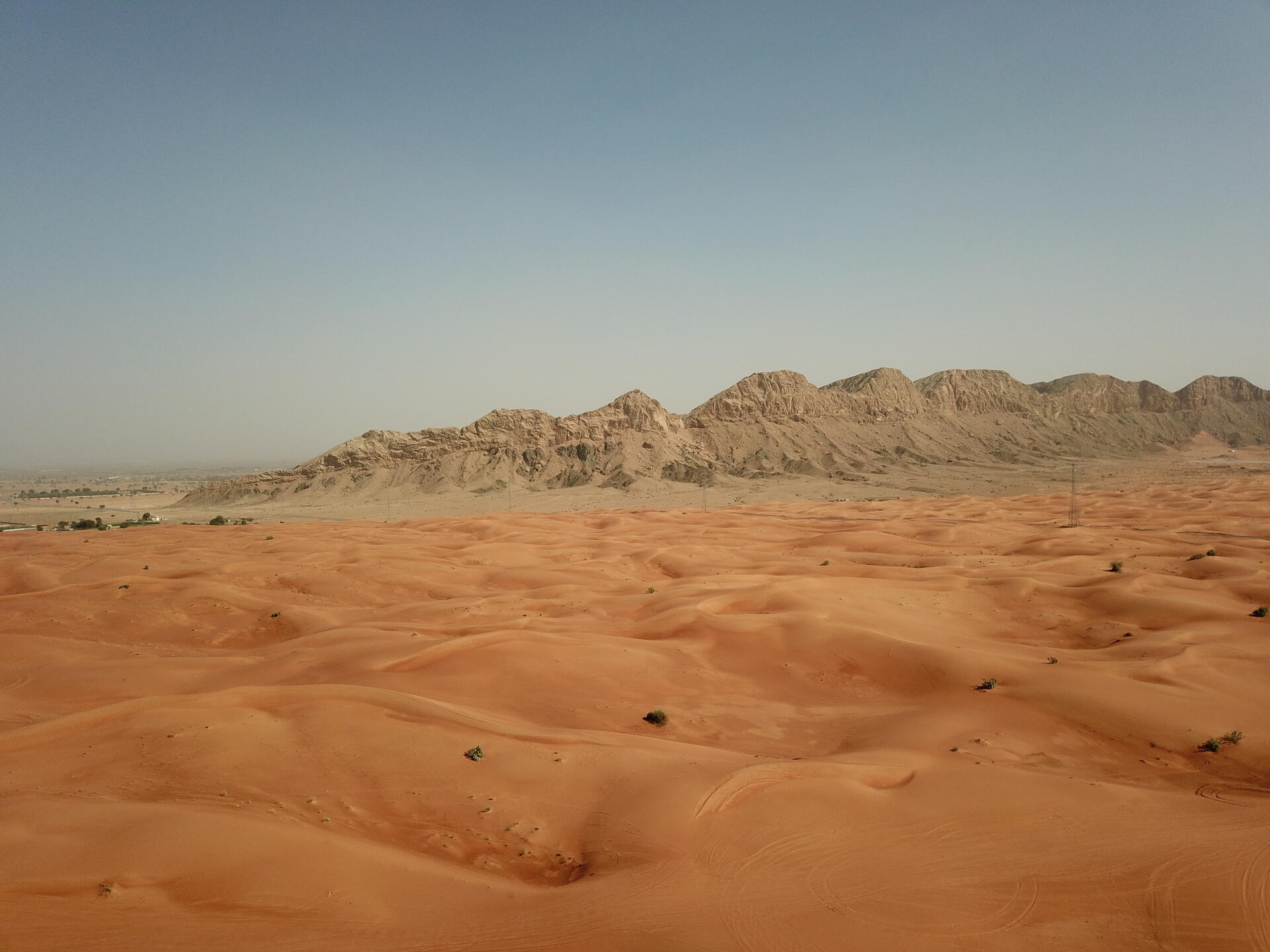
The Faya Palaeolandscape, inscribed as a UNESCO World Heritage Site in 2025, offers a unique glimpse into the lives of our ancestors who inhabited this region over 210,000 years ago. Situated between the Persian Gulf and Arabian Sea, the property encompasses the Jebel Faya archaeological site and its surrounding landscapes, providing valuable insights into human adaptation and resilience in hyper-arid environments.
More to come…UNESCO Description of the World Heritage Site
Located between the Persian Gulf and Arabian Sea, the property preserves evidence of human occupation from the Middle Palaeolithic and Neolithic periods (210,000–6,000 years ago). Archaeological layers reveal how hunter-gatherers and pastoralists adapted to extreme climates, alternating between arid and rainy periods every 20,000 years. Beyond subsistence activities, early human groups utilized the site's geomorphological features for resource extraction. With diverse water sources and raw materials, Faya provides valuable insights into human resilience in hyper-arid environments.
Encyclopedia Record: Jebel Faya
Jebel Faya is an archaeological site and limestone hill or escarpment in near Mleiha, Al Faya in the Emirate of Sharjah, UAE.Additional Site Details
Area: 29.085 hectares
Number of Components: 1
(iv) — Outstanding example of a type of building or landscape
Coordinates: 25.0828055556 , 55.8065833333
Image
© Alexandermcnabb, CC BY-SA 4.0 Resized from original. (This derivative is under the same CC BY-SA license.)
