World Heritage Identification Number: 1411
World Heritage since: 2013
Category: Cultural Heritage
WHE Type: Archaeological Sites
Transboundary Heritage: No
Endangered Heritage: No
Country: 🇺🇦 Ukraine
Continent: Europe
UNESCO World Region: Europe and North America
Map
The Ancient City of Tauric Chersonese and Its Chora: A Unique Blend of History and Agriculture
The Ancient City of Tauric Chersonese and its Chora, inscribed as a UNESCO World Heritage Site in 2013, offers a captivating glimpse into the rich history and unique agricultural practices of ancient Greece. Situated on the northern shores of the Black Sea, this site serves as a testament to the democratic land organization that underpinned the city's social structure.
More to come…UNESCO Description of the World Heritage Site
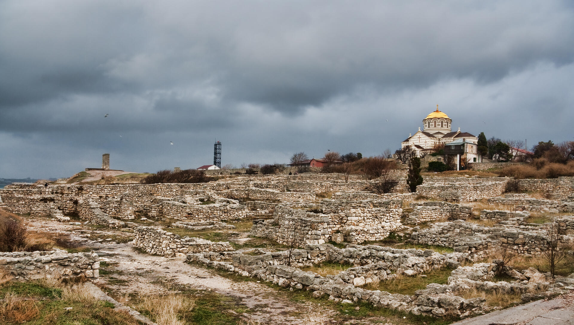
The site features the remains of a city founded by Dorian Greeks in the 5th century BC on the northern shores of the Black Sea. It encompasses six component sites with urban remains and agricultural lands divided into several hundreds of chora, rectangular plots of equal size. The plots supported vineyards whose production was exported by the city which thrived until the 15th century. The site features several public building complexes and residential neighbourhoods, as well as early Christian monuments alongside remains from Stone and Bronze Age settlements; Roman and medieval tower fortifications and water supply systems; and exceptionally well-preserved examples of vineyard planting and dividing walls. In the 3rd century AD, the site was known as the most productive wine centre of the Black Sea and remained a hub of exchange between the Greek, Roman and Byzantine Empires and populations north of the Black Sea. It is an outstanding example of democratic land organization linked to an ancient polis, reflecting the city’s social organization.
UNESCO Justification of the World Heritage Site
Criterion (ii): Tauric Chersonese provides an outstanding physical testimony to the exchange that took place between the Greek, Roman and Byzantine Empires and the populations north of the Black Sea. The polis and its chora stand out for having retained this role as a centre of exchange of influences and cross-fertilization between these cultures for a very long time and with continuity over millennia.
Criterion (v): Tauric Chersonese and its Chora represents a relict agricultural landscape of a vast and, at locations, well-preserved land allotment system, of formerly over 400 equal allotments connected to a preserved polis. The remains of the division walls, fortifications, farmsteads and the characteristic grid layout embodied the lifestyles of the city’s inhabitants and illustrate the agricultural use and continuity of the landscape despite later changes in production.
Encyclopedia Record: Chersonesus
Chersonesus, contracted in medieval Greek to Cherson (Χερσών), was an ancient Greek colony founded approximately 2,500 years ago in the southwestern part of the Crimean Peninsula. Settlers from Heraclea Pontica in Bithynia established the colony in the 6th century BC.Additional Site Details
Area: 259.3752 hectares
Number of Components: 8
(v) — Outstanding example of traditional human settlement
Coordinates: 44.6108333333 , 33.4913888889
Image
© Dmitry A. Mottl, CC BY-SA 3.0 Resized from original. (This derivative is under the same CC BY-SA license.)
