World Heritage Identification Number: 1622
World Heritage since: 2021
Category: Cultural Heritage
WHE Type: Archaeological Sites
Transboundary Heritage: No
Endangered Heritage: No
Country: 🇹🇷 Türkiye
Continent: Asia
UNESCO World Region: Europe and North America
Map
Arslantepe Mound: An Ancient City on the Tohma River
The Arslantepe Mound, officially recognized as a UNESCO World Heritage Site in 2021, is a significant archaeological tell situated in the Malatya plain, approximately 15 kilometers south-west of the Euphrates River. This ancient city, historically known as Melid, is now identified with the modern archaeological site of Arslantepe near Malatya, Turkey.
More to come…UNESCO Description of the World Heritage Site
Arslantepe Mound is a 30-metre-tall archaeological tell located in the Malatya plain, 15 km south-west of the Euphrates River. Archaeological evidence from the site testifies to its occupation from at least the 6th millennium BCE up until the Medieval period. The earliest layers belong to the Late Chalcolithic 1-2 periods, contemporary to Early Uruk in Southern Mesopotamia (4300-3900 BCE) and are characterized by adobe houses. The most prominent and flourishing period of the site was in the Late Chalcolithic 5 period, during which the so-called palace complex was constructed. Considerable evidence also testifies to the Early Bronze Age period, most prominently identified by the Royal Tomb complex. The archaeological stratigraphy then extends to the Middle and Late Bronze Ages and Hittite periods, including Neo-Hittite levels. The site illustrates the processes which led to the emergence of a State society in the Near East and a sophisticated bureaucratic system that predates writing. Exceptional metal objects and weapons have been excavated at the site, among them the earliest swords so far known in the world, which suggests the beginning of forms of organized combat as the prerogative of an elite, who -at Arslantepe- exhibited them as instruments of their new political power.
UNESCO Justification of the World Heritage Site
Criterion (iii): Arslantepe presents an exceptional testimony to the life of early administrative elites in the Late Chalcolithic period and their relationship with the wider public. The archaeological evidence is exceptional in terms of its state of conservation and the level of detail preserved in architectural and archaeological evidence found at Arslantepe is highly unusual. As the result of a catastrophic and perhaps even violent event that led to the sudden destruction of the palace complex and other structures and thereby caused a sealing of evidence in the debris and rubble under collapsed walls, the property provides a complete and vivid picture of society and daily life of these early administrate elites.
Encyclopedia Record: Arslantepe
Arslantepe, also known as Melid, was an ancient city on the Tohma River, a tributary of the upper Euphrates rising in the Taurus Mountains. It has been identified with the modern archaeological site of Arslantepe near Malatya, Turkey.Additional Site Details
Area: 4.85 hectares
Number of Components: 1
Coordinates: 38.3822 , 38.3610916667
Image
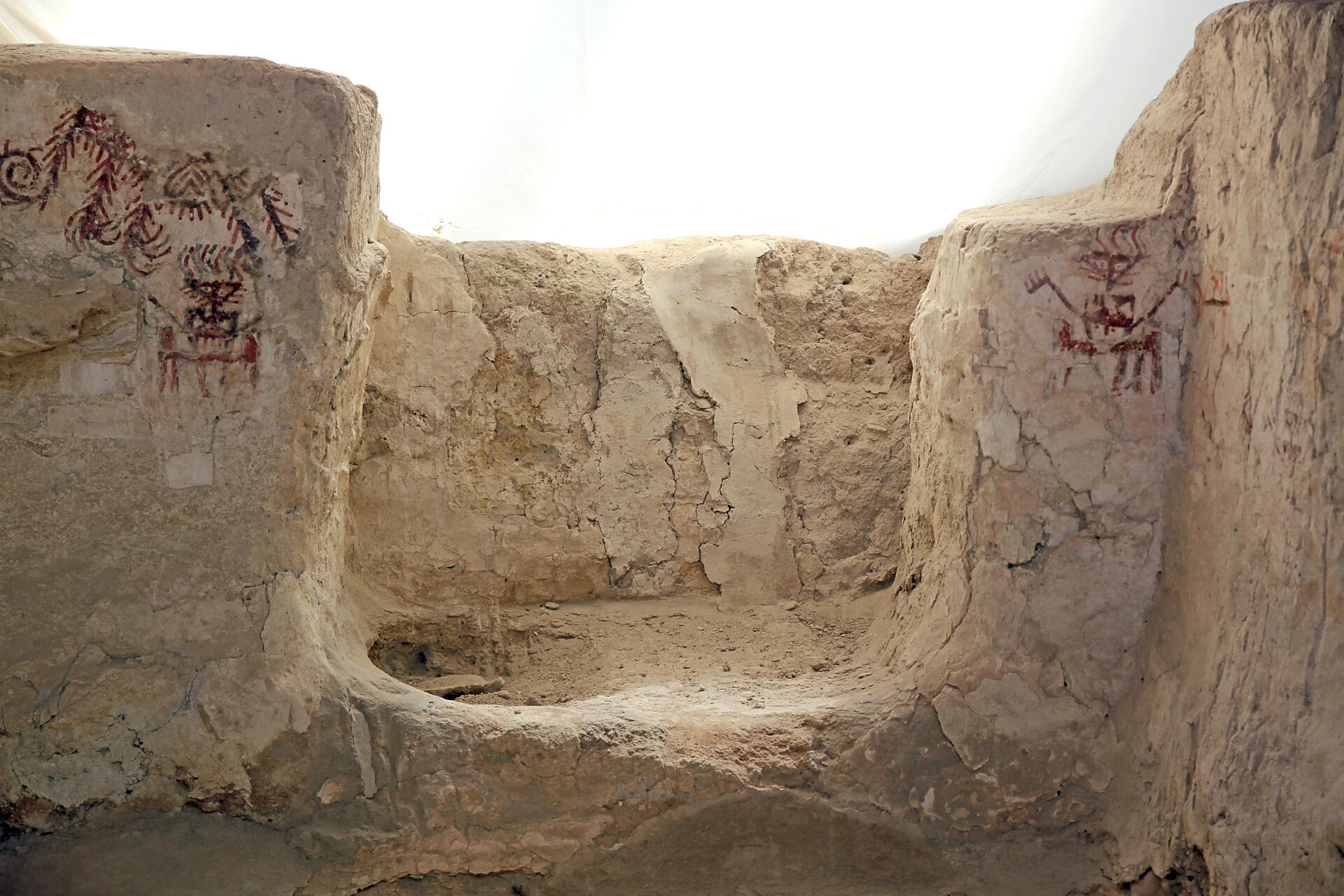
© Klaus-Peter Simon, CC BY-SA 3.0 Resized from original. (This derivative is under the same CC BY-SA license.)
World Heritage Research
Discover scientific research and academic studies that deepen our understanding of Arslantepe Mound from its history and significance to its conservation, management, and contemporary challenges.
-
Arslantepe in the foreground: The economic and social role of the large blades at the end of the 4th millennium BC
Large chert blades from Arslantepe Mound (3500–3200 BCE) reveal significant insights into the economic and social dynamics of late prehistoric societies. These tools, analyzed through raw material characterization, technological studies, use-wear analysis, and experimental archaeology, demonstrate their potential as proxies for reconstructing technical systems and routine activities. The study highlights how large blades played a pivotal role in reinforcing social inequality during this period, coinciding with the emergence of centralized administration and symbols of power at the site.
Moscone, D., D’Errico, D., Pellegrini, D., Pellegrini, A., Nobile, E., & Lemorini, C. (2024). Arslantepe in the foreground: The economic and social role of the large blades at the end of the 4th millennium BC. Journal of Archaeological Science: Reports, 56, 104544. https://doi.org/10.1016/j.jasrep.2024.104544
View Publication Record | Read Publication -
Drifting Southward? Tracing Aspects of Cultural Continuity and Change in the Late 2nd Millennium BC Syro-Anatolian Region
Arslantepe Mound, a significant archaeological site in southeastern Turkey, showcases complex cultural dynamics during the Late Bronze Age. The study reveals that while the site maintained continuity with Hittite traditions following the fall of the Hittite Empire, it also exhibited emerging influences from the western Euphrates valley and inner Syrian regions. This dual pattern of local identity preservation and extra-regional contact suggests a nuanced relationship between Arslantepe and its neighboring areas, shaped by cross-cultural interactions. The research employs a diachronic perspective to integrate Late Bronze Age material into a broader historical context, providing insights into the transformations in cultural relationships over time.
Manuelli, F. (2018). Drifting Southward? Tracing Aspects of Cultural Continuity and Change in the Late 2nd Millennium BC Syro-Anatolian Region. Studia Eblaitica, 4(1), 139–186. https://doi.org/10.13173/stebla/2018/1/139
View Publication Record | Read Publication -
Drifting Southward? Tracing Aspects of Cultural Continuity and Change in the Late 2nd Millennium BC Syro-Anatolian Region
Arslantepe Mound, a site with over a thousand years of occupation in southeastern Turkey, exhibits complex patterns of cultural continuity and change during the Late Bronze Age. Research reveals that while Hittite influence was prominent in material culture, local traditions persisted even after the fall of the Hittite Empire. The study identifies new trends emerging from the Euphrates valley and northern Levant, suggesting dynamic cross-cultural relationships. By comparing Early Iron Age artifacts at Arslantepe with those from neighboring regions, the research highlights both local identity and broader extra-regional contacts, offering insights into the transformations in regional interactions during this period.
Manuelli, F. (2018). Drifting Southward? Tracing Aspects of Cultural Continuity and Change in the Late 2nd Millennium BC Syro-Anatolian Region. Freie Universität Berlin. https://doi.org/10.17169/REFUBIUM-31421
View Publication Record | Read Publication -
Using laser scanner technology to analyse mud-brick architecture in the ancient Near East: the Palatial Complex of Arslantepe (Malatya, Turkey)
Laser scanning technology has proven highly effective in analyzing the complex, ever-changing structures of mud-brick architecture at Arslantepe Mound, a UNESCO World Heritage Site candidate in eastern Turkey. This study demonstrates that laser scanning can provide extremely accurate measurements and structural monitoring over time, addressing the challenges posed by the irregular designs typical of such ancient buildings. The research, conducted on the Palatial Complex dating back to the 4th millennium BCE, offers valuable insights into the architectural evolution and condition assessment of these monumental structures, aiding in their preservation and interpretation.
Liberotti, G., & Alvaro, C. (2017). Using laser scanner technology to analyse mud-brick architecture in the ancient Near East. The Palatial Complex of Arslantepe (Malatya, Turkey) [JB]. Archeologia e Calcolatori, 28(2), 447–455. https://doi.org/10.19282/ac.28.2.2017.36
View Publication Record | Read Publication