World Heritage Identification Number: 1407
World Heritage since: 2012
Category: Cultural Heritage
WHE Type: Cultural Landscapes
Transboundary Heritage: No
Endangered Heritage: No
Country: 🇸🇳 Senegal
Continent: Africa
UNESCO World Region: Africa
Map
Bassari Country: A Multicultural Landscape of Symbiosis between Humans and Nature
The Bassari Country: Bassari, Fula, and Bedik Cultural Landscapes, inscribed as a UNESCO World Heritage Site in 2012, is a unique testament to the harmonious coexistence of diverse cultures and the natural environment in southeastern Senegal. This site encompasses three distinct geographical regions: the Bassari–Salémata area, the Bedik–Bandafassi area, and the Fula–Dindéfello area, each with its distinctive topographical features.
More to come…UNESCO Description of the World Heritage Site
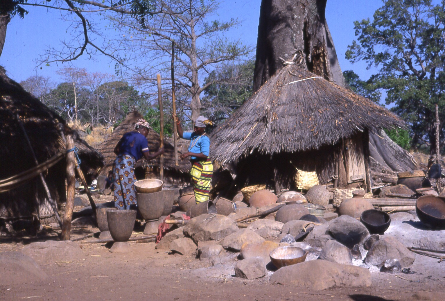
The site, located in south-east Senegal, includes three geographical areas: the Bassari–Salémata area, the Bedik–Bandafassi area and the Fula–Dindéfello area, each with its specific morphological traits. The Bassari, Fula and Bedik peoples settled from the 11th to the 19th centuries and developed specific cultures and habitats symbiotic with their surrounding natural environment. The Bassari landscape is marked by terraces and rice paddies, interspersed with villages, hamlets and archaeological sites. The Bedik villages are formed by dense groups of huts with steep thatched roofs. Their inhabitants’ cultural expressions are characterized by original traits of agro-pastoral, social, ritual and spiritual practices, which represent an original response to environmental constraints and human pressures. The site is a well-preserved multicultural landscape housing original and still vibrant local cultures.
UNESCO Justification of the World Heritage Site
Criterion (iii): The physical layout of the Bassari Cultural landscape bears an exceptional witness to the complex interactions among environmental factors, land-use practices, social rules, beliefs that altogether have concurred to shape a peculiar and remarkably preserved cultural landscape that outstandingly reflects the ability of make a respectful and sustainable use of the resources of the region.
Criterion (v): The Bassari cultural landscape bears witness to peculiar uses of the land, including crop rotation and manuring, communal sowing, weeding and harvesting and commuting practices imposed by traditional agricultural systems and by the relative scarcity of resources, thus representing an outstanding example of human interaction with a vulnerable environment.
Criterion (vi): The Pays Bassari as well as the sacred dimension that Bassari, Fula and Bedik people attach to it bear exceptional, tangible witness to the intertwined complex of practices, social rules, rites and beliefs that have helped the Bassari regulate the interaction between men and their living environment and have produced a cultural landscape shaped by and imbued with cultural traditions and spiritual meanings that persist in a lively dynamic of transmission.
Encyclopedia Record: Bassari Country
The Bassari Country and its Bassari, Fula and Bedik Cultural Landscapes, located in the southeast of Senegal, is a well-preserved multicultural landscape which emerged from the interaction of human activities and the natural environment. It aggregates three geographical areas: the Bassari–Salémata area, the Bedik–Bandafassi area and the Fula–Dindéfello area, each one with its specific morphological characteristics.Additional Site Details
Area: 50,309 hectares
Number of Components: 3
(v) — Outstanding example of traditional human settlement
(vi) — Directly associated with events or living traditions
Coordinates: 12.5933333333 , -12.8458333333
Image
© gbaku, CC BY-SA 2.0 Resized from original. (This derivative is under the same CC BY-SA license.)
