World Heritage Identification Number: 1222
World Heritage since: 2006
Category: Cultural Heritage
WHE Type: Archaeological Sites
Transboundary Heritage: No
Endangered Heritage: No
Country: 🇮🇷 Iran (Islamic Republic of)
Continent: Asia
UNESCO World Region: Asia and the Pacific
Map
The Archaeological Wonders of Bisotun: A Testament to Ancient Persian History
The Archaeological Wonders of Bisotun: A Testament to Ancient Persian History
More to come…UNESCO Description of the World Heritage Site
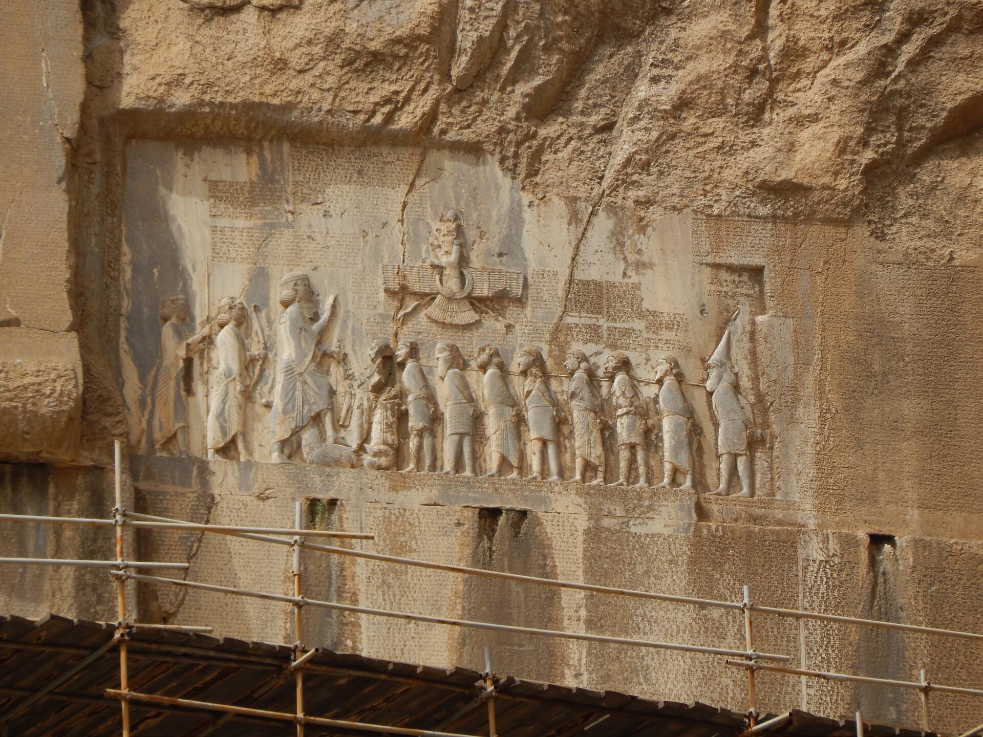
Bisotun is located along the ancient trade route linking the Iranian high plateau with Mesopotamia and features remains from the prehistoric times to the Median, Achaemenid, Sassanian, and Ilkhanid periods. The principal monument of this archaeological site is the bas-relief and cuneiform inscription ordered by Darius I, The Great, when he rose to the throne of the Persian Empire, 521 BC. The bas-relief portrays Darius holding a bow, as a sign of sovereignty, and treading on the chest of a figure who lies on his back before him. According to legend, the figure represents Gaumata, the Median Magus and pretender to the throne whose assassination led to Darius’s rise to power. Below and around the bas-reliefs, there are ca. 1,200 lines of inscriptions telling the story of the battles Darius waged in 521-520 BC against the governors who attempted to take apart the Empire founded by Cyrus. The inscription is written in three languages. The oldest is an Elamite text referring to legends describing the king and the rebellions. This is followed by a Babylonian version of similar legends. The last phase of the inscription is particularly important, as it is here that Darius introduced for the first time the Old Persian version of his res gestae (things done). This is the only known monumental text of the Achaemenids to document the re-establishment of the Empire by Darius I. It also bears witness to the interchange of influences in the development of monumental art and writing in the region of the Persian Empire. There are also remains from the Median period (8th to 7th centuries B.C.) as well as from the Achaemenid (6th to 4th centuries B.C.) and post-Achaemenid periods.
UNESCO Justification of the World Heritage Site
Criterion (ii): The monument created by Darius I the Great in Bisotun in 521 BCE is an outstanding testimony to the important interchange of human values on the development of monumental art and writing. The symbolic representation of the Achaemenid king in relation to his enemy reflects traditions in monumental bas-reliefs that date from ancient Egypt and the Middle East, and which were subsequently further developed during the Achaemenid and later empires.
Criterion (iii): The site of Bisotun is located along one of the main routes linking Persia with Mesopotamia and associated with the sacred Bisotun mountain. There is archaeological evidence of human settlements that date from the prehistoric times, while the most significant period was from the 6th century BCE to the 6th century CE. The Bisotun inscription is unique, being the only known monumental text of the Achaemenids to document a specific historic event, that of the re-establishment of the empire by Darius I the Great. It was the first cuneiform writing to be deciphered in the 19th century.
Encyclopedia Record: Behistun Inscription
The Behistun Inscription is a multilingual Achaemenid royal inscription and large rock relief on a cliff at Mount Behistun in the Kermanshah Province of Iran, near the city of Kermanshah in western Iran, established by Darius the Great. It was important to the decipherment of cuneiform, as it is the longest known trilingual cuneiform inscription, written in Old Persian, Elamite, and Babylonian.Additional Site Details
Area: 187 hectares
Number of Components: 1
(iii) — Unique or exceptional testimony to a cultural tradition
Coordinates: 34.3883333333 , 47.4366666666
Image
© Korosh.091, CC BY-SA 4.0 Resized from original. (This derivative is under the same CC BY-SA license.)
