World Heritage Identification Number: 1625
World Heritage since: 2021
Category: Cultural Heritage
WHE Type: Buildings & Architectural Ensembles
Transboundary Heritage: No
Endangered Heritage: No
Country: 🇫🇷 France
Continent: Europe
UNESCO World Region: Europe and North America
Map
The Maritime Masterpiece: Cordouan Lighthouse
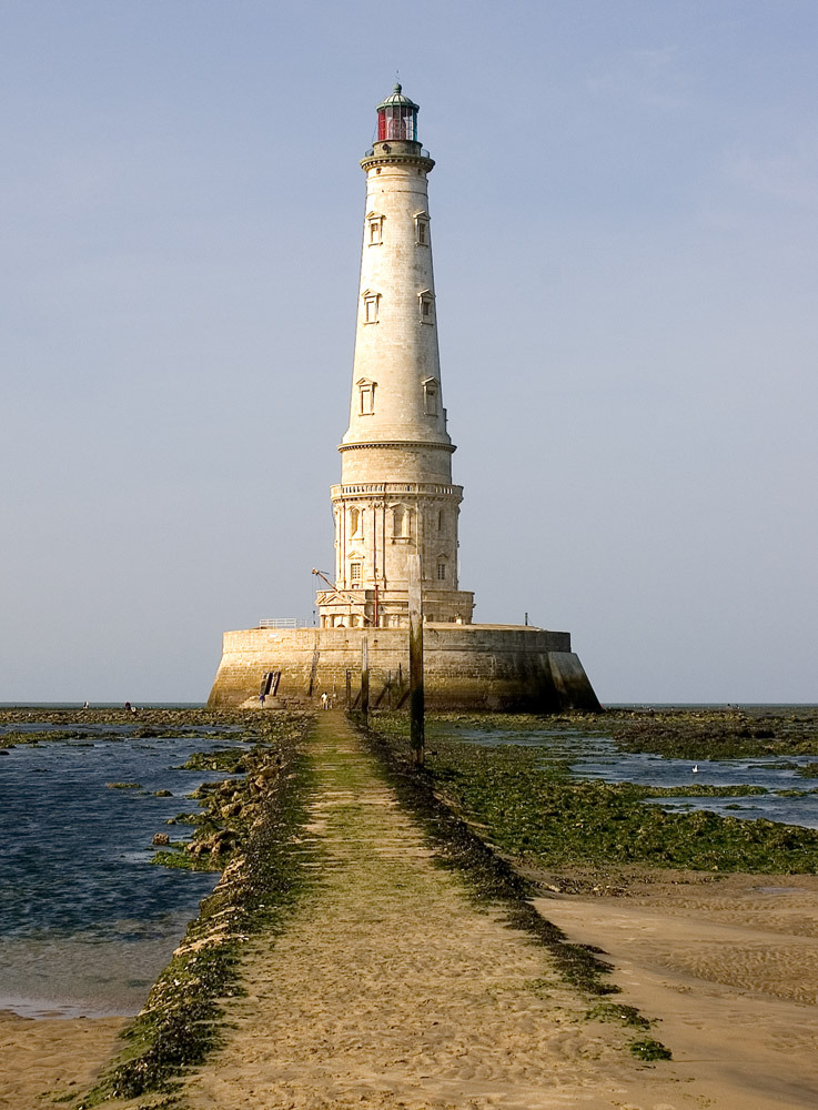
The Cordouan Lighthouse, a testament to human ingenuity and architectural prowess, stands tall amidst the tumultuous waters of the Atlantic Ocean. Inscribed as a UNESCO World Heritage Site in 2021, this architectural marvel has been a beacon of hope for sailors since its construction in the early 17th century.
More to come…UNESCO Description of the World Heritage Site
The Lighthouse of Cordouan rises up on a shallow rocky plateau in the Atlantic Ocean at the mouth of the Gironde estuary in the Nouvelle-Aquitaine region, in a highly exposed and hostile environment. Built in white limestone dressed blocks at the turn of the 16th and 17th centuries, it was designed by engineer Louis de Foix and remodelled by engineer Joseph Teulère in the late 18th century. A masterpiece of maritime signalling, Cordouan’s monumental tower is decorated with pilasters, columns modillions and gargoyles. It embodies the great stages of the architectural and technological history of lighthouses and was built with the ambition of continuing the tradition of famous beacons of antiquity, illustrating the art of building lighthouses in a period of renewed navigation, when beacons played an important role as territorial markers and as instruments of safety. Finally, the increase of its height, in the late 18th century, and the changes to its light chamber, attest to the progress of science and technology of the period. Its architectural forms drew inspiration from ancient models, Renaissance Mannerism and the specific architectural language of France’s engineering school École des Ponts et Chaussées.UNESCO Justification of the World Heritage Site
Criterion (i): The Cordouan Lighthouse is a masterpiece of maritime signalling, which has remained in use from the 17th century until today. Since it was first built, this lighthouse has represented a symbolic endowment to the glory of the King of France of the time. In the 18th century, Joseph Teulère heightened and strengthened the lighthouse. The masterly application of the stereometry and stereotomy has allowed for a superb integration between the existing fabric and the new addition, which confirmed also its symbolic function. The aggressive natural environment it was erected in consolidates the status of this building as an eminent example of artistic, technical and technological human ingenuity.
Criterion (iv): The Cordouan Lighthouse embodies in an outstanding manner the great stages of the history of lighthouses. It was built with the ambition to continue the tradition of famous beacons of antiquity and illustrates the art of building lighthouses in a period of renewed navigation between the 16th and the 17th centuries, when beacons played an important role as territorial markers and as instruments of safety. Finally, the increase of its height, in the late 18th century, and the changes to its light chamber, attest to the progress made by science and technology of the period. Thanks to its fame, the Cordouan Lighthouse witnessed several experiments to improve lighthouses’ capacity to assist navigation.
Encyclopedia Record: Cordouan Lighthouse
Cordouan lighthouse is an active lighthouse located 7 kilometres at sea, near the mouth of the Gironde estuary in France. At a height of 67.5 metres (221 ft), it is the tenth-tallest "traditional lighthouse" in the world.Additional Site Details
Area: 23,582 hectares
Number of Components: 1
(iv) — Outstanding example of a type of building or landscape
Coordinates: 45.5863055556 , -1.1733333333