World Heritage Identification Number: 1627
World Heritage since: 2025
Category: Cultural Heritage
WHE Type: Archaeological Sites
Transboundary Heritage: No
Endangered Heritage: No
Country: 🇹🇯 Tajikistan
Continent: Asia
UNESCO World Region: Asia and the Pacific
Map
Cultural Heritage Sites of Ancient Khuttal: A Medieval Kingdom Along the Silk Roads
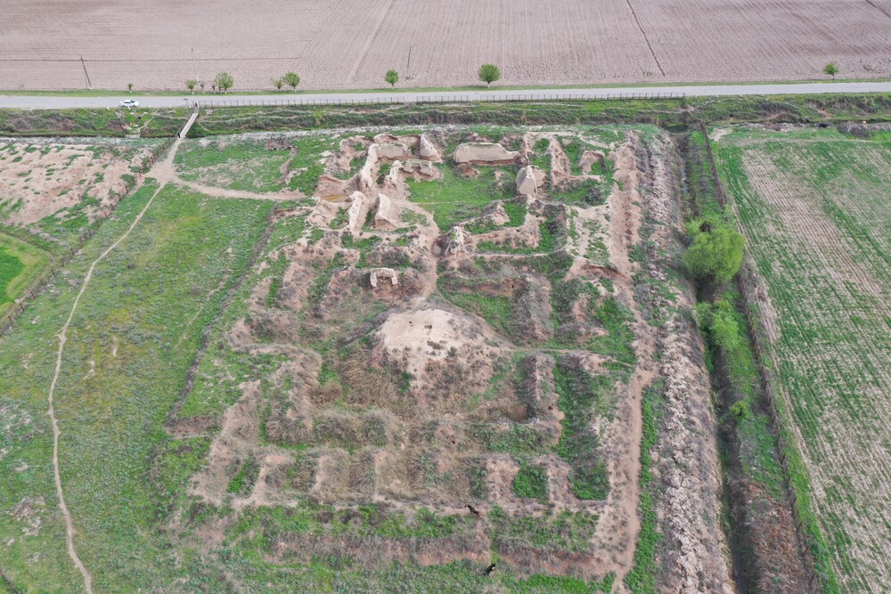
The Cultural Heritage Sites of Ancient Khuttal, inscribed by UNESCO in 2025, offer a captivating glimpse into the rich history and cultural diversity that thrived along the ancient Silk Roads. Situated between the Panj and Vakhsh Rivers and the Pamir piedmonts, this medieval kingdom played a pivotal role from the 7th to 16th centuries as a vital trading hub and cultural crossroads.
More to come…UNESCO Description of the World Heritage Site
Ancient Khuttal was a medieval kingdom located between the Panj and Vakhsh Rivers and the Pamir piedmonts. The property includes ten sites and one monument reflecting its role from the 7th to 16th centuries in Silk Roads trade. Khuttal contributed valuable goods like salt, gold, silver, and horses, and served as a hub for cultural, religious, and technological exchanges. Its diverse archaeological remains—Buddhist temples, palaces, settlements, manufacturing centres, and caravanserais—illustrate its strategic importance and vibrant interactions with neighbouring empires.
Encyclopedia Record: Khuttal
Khuttal, frequently also in the plural form Khuttalan was a medieval region and principality on the north bank of the river Oxus, lying between its tributaries Vakhsh and Panj. It corresponds roughly to the modern Khatlon Province of Tajikistan.Additional Site Details
Area: 152.409 hectares
Number of Components: 11
(iii) — Unique or exceptional testimony to a cultural tradition
Coordinates: 37.7443936111 , 69.2987127778
Image
© IICAS. Used with permission.
