World Heritage Identification Number: 889
World Heritage since: 1999
Category: Natural Heritage
WHE Type: Protected Areas & National Parks
Transboundary Heritage: No
Endangered Heritage: No
Country: 🇨🇺 Cuba
Continent: Americas
UNESCO World Region: Latin America and the Caribbean
Map
Geological Wonders and Historical Significance: An Overview of Desembarco del Granma National Park
Desembarco del Granma National Park, located in south-western Cuba, offers a unique blend of geological wonders and historical significance. Established in 1999, this national park spans across the Niquero and Pilón municipalities within the present-day Granma Province. The park's name is derived from the "Landing of the Granma," a historic event that took place in 1956 when Fidel Castro, Che Guevara, and other revolutionaries disembarked from the yacht "Granma" onto the shores of this very region, marking the beginning of the Cuban Revolution.
More to come…UNESCO Description of the World Heritage Site
Desembarco del Granma National Park, with its uplifted marine terraces and associated ongoing development of karst topography and features, represents a globally significant example of geomorphologic and physiographic features and ongoing geological processes. The area, which is situated in and around Cabo Cruz in south-east Cuba, includes spectacular terraces and cliffs, as well as some of the most pristine and impressive coastal cliffs bordering the western Atlantic.
UNESCO Justification of the World Heritage Site
Criterion (vii): The terraces of Cabo Cruz form a singular coastal landscape in Cuba and are the world’s largest and best preserved coastal limestone terrace system. The imposing and nearly pristine coastal cliffs bordering the Western Atlantic are both a remarkable natural phenomenon and a stunningly beautiful sight. Jointly with the diverse, mostly native vegetation, the cliffs form an extraordinary visual ensemble of forms, contours, color and texture within a spectacular coastal setting.
Criterion (viii): The uplifted marine terraces of DGNP, and the continuing development of karst topography and features, are a globally significant illustration of geomorphologic and physiographic features and ongoing geological processes. DGNP displays a rare relief formed by the combination of tectonic movements in the still active contact zone between two tectonic plates and the effects of past sea level change in response to climate fluctuations. The karst forms include escarpments, cliffs, cave systems, river canyons and large sinkholes known as dolines in most diverse sizes and shapes.
Encyclopedia Record: Desembarco del Granma National Park
Desembarco del Granma National Park is a national park in south-western Cuba, stretching across the Niquero and Pilón municipalities in what is now Granma Province. The name of the park means "Landing of the Granma" and refers to the yacht in which Fidel Castro, Che Guevara, Raúl Castro, and 79 of their supporters sailed from Mexico to Cuba in 1956 and incited the Cuban Revolution. The National park is well known for its karst topography and coastal cliffs.Additional Site Details
Area: 32,576 hectares
Number of Components: 1
(viii) — Outstanding example representing major earth stages
Coordinates: 19.88333 , -77.63333
IUCN World Heritage Outlook
The 2025 Conservation Outlook on Desembarco del Granma National Park reports the following assessment:
Source: International Union for Conservation of Nature (IUCN) · View assessment
Image
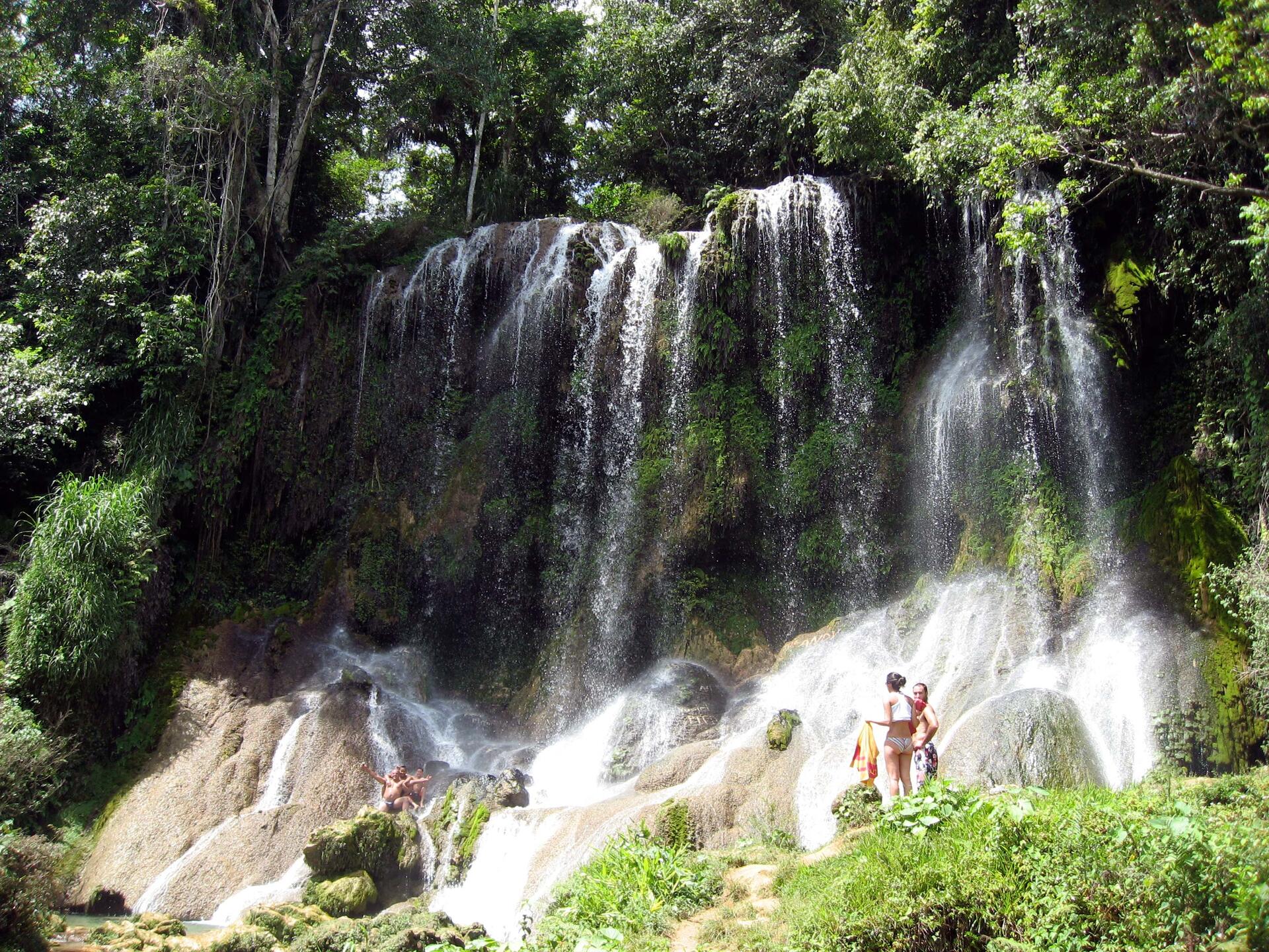
© VIChapayev at Wikitravel, CC BY-SA 1.0 Resized from original. (This derivative is under the same CC BY-SA license.)
World Heritage Research
Discover scientific research and academic studies that deepen our understanding of Desembarco del Granma National Park from its history and significance to its conservation, management, and contemporary challenges.
-
Density and Structure of a Queen ConchStrombus gigas(Mollusca: Strombidae) Population at Desembarco del Granma National Park, Cabo Cruz, Cuba.
A queen conch population at Desembarco del Granma National Park, Cuba, exhibits density-dependent stunting, with high densities (up to 1767 ind.ha-1) leading to smaller-than-expected sizes. The study found that while 73% of conchs had fully formed lips, they measured less than the minimum fishing size (200 mm SL), suggesting a 'dwarf' population. Research across three zones and climatic periods revealed aggregated distributions and seasonal density variations, with the highest densities during the dry season. These findings highlight the need for revised management plans to ensure sustainable use of this protected area's conch resources.
Cala, Y. R., Jesús-Navarrete, A. d., Ocaña, F. A., & Oliva-Rivera, J. J. (2013). Density and Structure of a Queen ConchStrombus gigas(Mollusca: Strombidae) Population at Desembarco del Granma National Park, Cabo Cruz, Cuba. Caribbean Journal of Science, 47(2-3), 242–250. https://doi.org/10.18475/cjos.v47i3.a12
View Publication Record | Read Publication -
Density and reproduction of the Queen Conch Eustrombus gigas (Mesogastropoda: Strombidae) at Cabo Cruz, Desembarco del Granma National Park, Cuba
A study at Cabo Cruz, Desembarco del Granma National Park, Cuba, reveals that the queen conch (Eustrombus gigas) population exhibits seasonal variations in density and reproduction. The highest density (468.5 ind./ha) was observed during cold fronts, while the lowest (268.5 ind./ha) occurred in the dry season. Laguna area showed the highest density (520.4 ind./ha), whereas Farito had the lowest (290.9 ind./ha). Reproductive activity, totaling 158 events, was most frequent during the rainy season (36%), with mating and egg-laying influenced by temperature and photoperiod. The population appears self-sufficient for recruitment year-round, suggesting sustainable exploitation is possible if managed through functional zoning, fishing area rotation, and a closed season. Laguna should be protected as a reproduction zone.
Cala, Y. R., Navarrete, A. D. J., Ocaña, F. A., & Oliva Rivera, J. (2013). Density and reproduction of the Queen Conch Eustrombus gigas (Mesogastropoda: Strombidae) at Cabo Cruz, Desembarco del Granma National Park, Cuba. Revista de Biología Tropical, 61(2). https://doi.org/10.15517/rbt.v61i2.11165
View Publication Record | Read Publication -
Density and reproduction of the Queen Conch Eustrombus gigas (Mesogastropoda: Strombidae) at Cabo Cruz, Desembarco del Granma National Park, Cuba
A significant queen conch (Eustrombus gigas) population exists in the Southeastern region of Cuba, with sustainable exploitation viable through targeted management. The study, conducted at Cabo Cruz, Desembarco del Granma National Park from 2009-2010, found the highest density during cold fronts (468.5 ind./ha), particularly at Laguna (520.4 ind./ha). Reproductive activity occurred year-round, peaking in the rainy season (36%), indicating a self-sufficient population for recruitment. Researchers recommend protecting Laguna as a no-fishing reproduction zone and implementing functional zoning, fishing area rotation, and a closed season to ensure sustainable management.
Yuself R. Cala, Alberto de Jesús‐Navarrete, Frank A. Ocaña, & José Juan Oliva-Rivera. (2013). Density and reproduction of the Queen Conch Eustrombus gigas (Mesogastropoda: Strombidae) at Cabo Cruz, Desembarco del Granma National Park, Cuba. OpenAlex. https://doi.org/10.60692/JZ64Z-1DX92
View Publication Record | Read Publication