World Heritage Identification Number: 34
World Heritage since: 1979
Category: Cultural Heritage
WHE Type: Buildings & Architectural Ensembles
Transboundary Heritage: No
Endangered Heritage: No
Country: 🇬🇭 Ghana
Continent: Africa
UNESCO World Region: Africa
Map
Forts and Castles of Ghana: A Legacy of Colonial Trade and Power
The Forts and Castles of Ghana, inscribed as a UNESCO World Heritage Site in 1979, offer a unique glimpse into the rich history of trade and colonization that shaped West Africa during the 15th through 19th centuries. Stretching across the Volta, Greater Accra, Central, and Western regions, these fortifications serve as tangible reminders of the complex interplay between European powers and local kingdoms.
More to come…UNESCO Description of the World Heritage Site
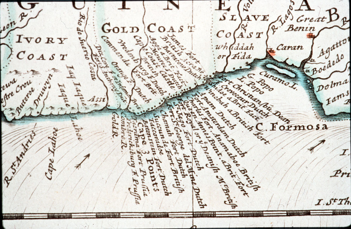
The remains of fortified trading-posts, erected between 1482 and 1786, can still be seen along the coast of Ghana between Keta and Beyin. They were links in the trade routes established by the Portuguese in many areas of the world during their era of great maritime exploration.
UNESCO Justification of the World Heritage Site
Criterion (vi): The Castles and Forts of Ghana shaped not only Ghana’s history but that of the world over four centuries as the focus of first the gold trade and then the slave trade. They are a significant and emotive symbol of European-African encounters and of the starting point of the African Diaspora.
Encyclopedia Record: List of castles in Ghana
During the colonial period in Ghana, at the time known as the Gold Coast, roughly corresponding to the 15th through 19th centuries, European-style coastal forts and castles were built, mostly by the Portuguese, Dutch and British. These forts linked the trading routes established by the Portuguese and acted as important market places for the gold and slave trades.Additional Site Details
Area: Not available
Number of Components: 1
Coordinates: 5.39103 , -0.49361
Image
Unknown, Public domain
