World Heritage Identification Number: 1073
World Heritage since: 2003
Category: Cultural Heritage
WHE Type: Archaeological Sites
Transboundary Heritage: No
Endangered Heritage: No
Country: 🇸🇩 Sudan
Continent: Africa
UNESCO World Region: Arab States
Map
Exploring the Cultural Richness of Gebel Barkal and the Napatan Region
The Napatan Region, situated approximately 400 kilometers north of Khartoum, along the banks of the Nile River, offers a fascinating glimpse into the rich cultural history of ancient Kush. This expansive region, spanning over 60 kilometers, encompasses five significant archaeological sites, collectively recognized as a UNESCO World Heritage Site since 2003. Among these sites, Gebel Barkal stands out as a central hub of religious traditions and folklore.
More to come…UNESCO Description of the World Heritage Site
These five archaeological sites, stretching over more than 60 km in the Nile valley, are testimony to the Napatan (900 to 270 BC) and Meroitic (270 BC to 350 AD) cultures, of the second kingdom of Kush. Tombs, with and without pyramids, temples, living complexes and palaces, are to be found on the site. Since Antiquity, the hill of Gebel Barkal has been strongly associated with religious traditions and folklore. The largest temples are still considered by the local people as sacred places.
UNESCO Justification of the World Heritage Site
Criterion (i): The pyramids, palaces, temples, burial chambers and funerary chapels of Gebel Barkal and the Sites of the Napatan Region and their related relief, writings and painted scenes on walls represent a masterpiece of creative genius demonstrating the artistic, social, political and religious values of a human group for more than 2000 years. The corbel vaults of the tombs of Kurru constitute a new building technique which influenced Mediterranean architecture from the 7th Century BC onwards.
Criterion (ii): In terms of their architecture the sites of the Napatan Region testify to the revival of a once almost universal religion and related language: the Egyptian old script and the worship of the State God Amon.
Criterion (iii): Gebel Barkal and the other sites of the property bear an exceptional witness of the Napato-Meroitic (Kushite) civilization that prevailed in the Nile Valley from the 9th Century BC to the Christianization of the country in the 6th Century. This civilization had strong links to the northern Pharaonic and other African cultures.
Criterion (iv): The typology of the buildings, their details and the layout of the ensemble of the pyramids of Gebel Barkal, Nuri and Kurru with their steep angles and decorated sides, together with the painted rock-cut burial chambers, represent an outstanding example of funerary architecture and distinctive art that prevailed over a long period of time (9th Century BC- 4th Century AD). The mounds of Zuma represent a continuation of some aspects of this burial tradition up to the 6th Century AD.
Criterion (vi): Since antiquity the hill of Gebel Barkal has been strongly associated with religious traditions and local folklore. For this reason, the largest temples (Amon Temple for example) were built at the foot of the hill and are still considered by the local people as sacred places.
Encyclopedia Record: Jebel Barkal
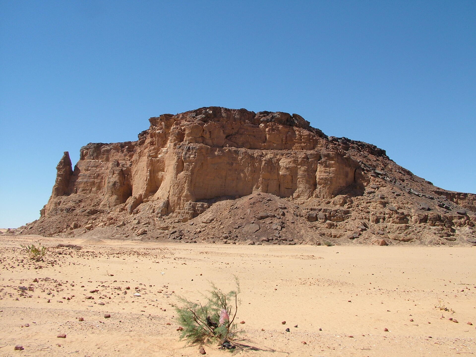
Jebel Barkal or Gebel Barkal is a mesa or large rock outcrop located 400 km north of Khartoum, next to Karima in Northern State in Sudan, on the Nile River, in the region that is sometimes called Nubia. The jebel is 104 m tall, has a flat top, and came to have religious significance for both ancient Kush and ancient Egyptian occupiers. In 2003, the mountain, together with the extensive archaeological site at its base, were named as the center of a World Heritage Site by UNESCO. The Jebel Barkal area houses the Jebel Barkal Museum.Additional Site Details
Area: 182.5 hectares
Number of Components: 5
(ii) — Significant interchange of human values
(iii) — Unique or exceptional testimony to a cultural tradition
(iv) — Outstanding example of a type of building or landscape
(vi) — Directly associated with events or living traditions
Coordinates: 18.537 , 31.8280277778
Image
© LassiHU, CC BY-SA 4.0 Resized from original. (This derivative is under the same CC BY-SA license.)
