World Heritage Identification Number: 1246
World Heritage since: 2007
Category: Cultural Heritage
WHE Type: Infrastructure & Industry
Transboundary Heritage: No
Endangered Heritage: No
Country: 🇯🇵 Japan
Continent: Asia
UNESCO World Region: Asia and the Pacific
Map
The Iwami Ginzan Silver Mine and Its Cultural Landscape: A Historical Perspective on Mining and Trade in Japan
The Iwami Ginzan Silver Mine and its Cultural Landscape, inscribed as a UNESCO World Heritage Site in 2007, offers a unique insight into the historical development of Japan's economy and trade relations with neighboring countries such as Korea and China. Located in the southwestern part of Honshu Island, this extensive mining area spans across mountains, deep river valleys, and coastal towns, providing a rich tapestry of archaeological remains that chronicle over four centuries of mining activities.
More to come…UNESCO Description of the World Heritage Site
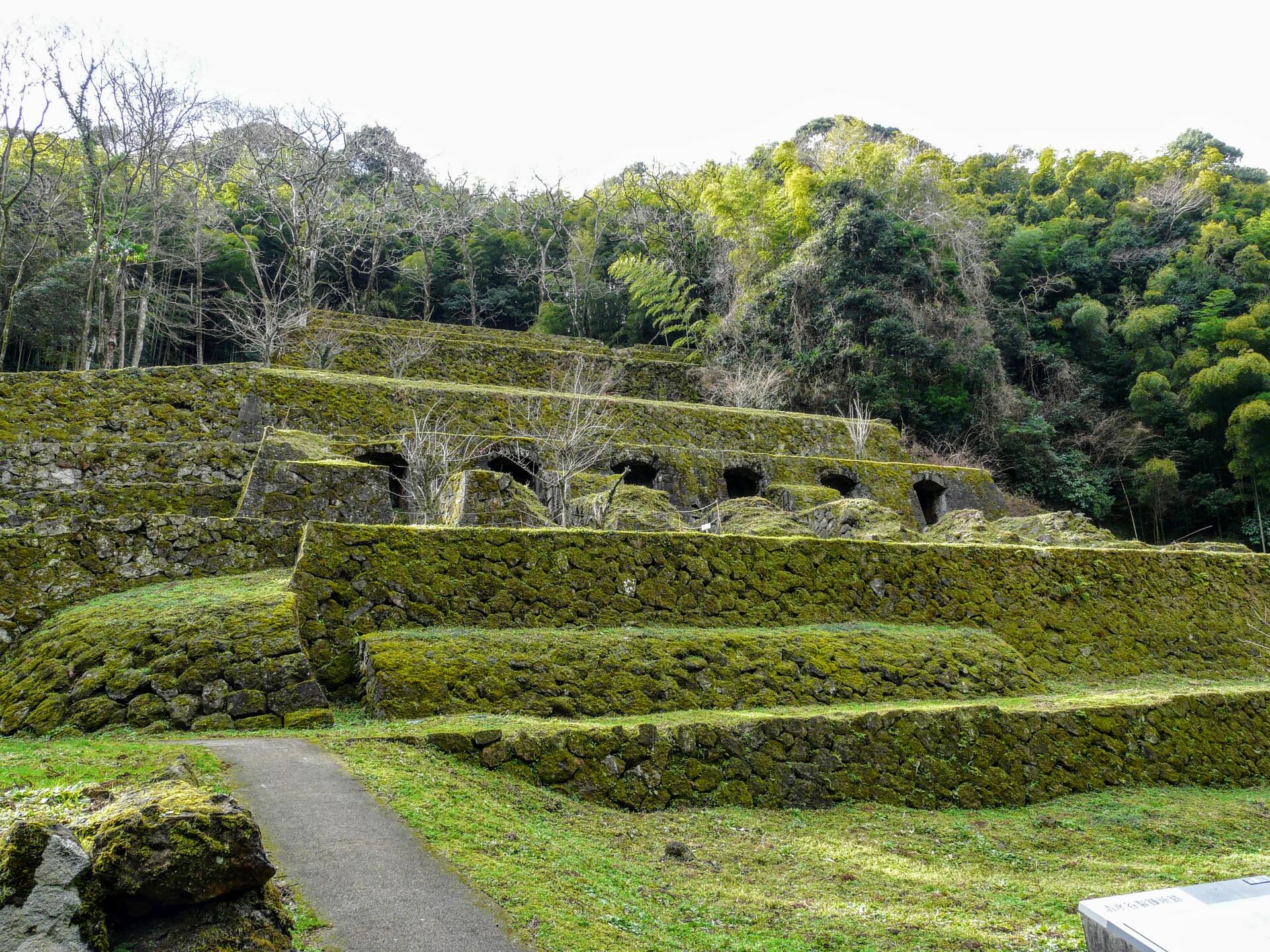
The Iwami Ginzan Silver Mine in the south-west of Honshu Island is a cluster of mountains, rising to 600 m and interspersed by deep river valleys featuring the archaeological remains of large-scale mines, smelting and refining sites and mining settlements worked between the 16th and 20th centuries. The site also features routes used to transport silver ore to the coast, and port towns from where it was shipped to Korea and China. The mines contributed substantially to the overall economic development of Japan and south-east Asia in the 16th and 17th centuries, prompting the mass production of silver and gold in Japan. The mining area is now heavily wooded. Included in the site are fortresses, shrines, parts of Kaidô transport routes to the coast, and three port towns, Tomogaura, Okidomari and Yunotsu, from where the ore was shipped.
UNESCO Justification of the World Heritage Site
Criterion (ii): During the Age of Discovery, in the 16th and early 17th centuries, the large production of silver by the Iwami Ginzan Silver Mine resulted in significant commercial and cultural exchanges between Japan and the trading countries of East Asia and Europe.
Criterion (iii): Technological developments in metal mining and production in Japan resulted in the evolution of a successful system based on small-scale, labor-intensive units covering the entire range of skills from digging to refining. The political and economic isolation of Japan during the Edo Period (1603 to 1868) impeded the introduction of technologies developed in Europe during the Industrial Revolution and this, coupled with the exhaustion of commercially viable silver-ore deposits, resulted in the cessation of mining activities by traditional technologies in the area in the second half of the 19th century, leaving the site with well-preserved archaeological traces of those activities.
Criterion (v): The abundant traces of silver production, such as mines, smelting and refining sites, transportation routes, and port facilities, that have survived virtually intact in the Iwami Ginzan Silver Mine Site, are now concealed to a large extent by the mountain forests that have reclaimed the landscape. The resulting relict landscape, which includes the surviving settlements of the people related to the silver production, bears dramatic witness to historic land-uses of outstanding universal value.
Encyclopedia Record: Iwami Ginzan Silver Mine
The Iwami Ginzan (石見銀山) was an underground silver mine in the city of Ōda, in Shimane Prefecture on the main island of Honshu, Japan. It was the largest silver mine in Japanese history. It was active for almost four hundred years, from its discovery in 1526 to its closing in 1923.Additional Site Details
Area: 529.17 hectares
Number of Components: 14
(iii) — Unique or exceptional testimony to a cultural tradition
(v) — Outstanding example of traditional human settlement
Coordinates: 35.1127777777 , 132.435
Image
© Naokijp, CC BY-SA 4.0 Resized from original. (This derivative is under the same CC BY-SA license.)
