World Heritage Identification Number: 1587
World Heritage since: 2019
Category: Cultural Heritage
WHE Type: Archaeological Sites
Transboundary Heritage: No
Endangered Heritage: No
Country: 🇱🇦 Lao People's Democratic Republic
Continent: Asia
UNESCO World Region: Asia and the Pacific
Map
The Enigmatic Plain of Jars: A Unique Megalithic Landscape in Central Laos
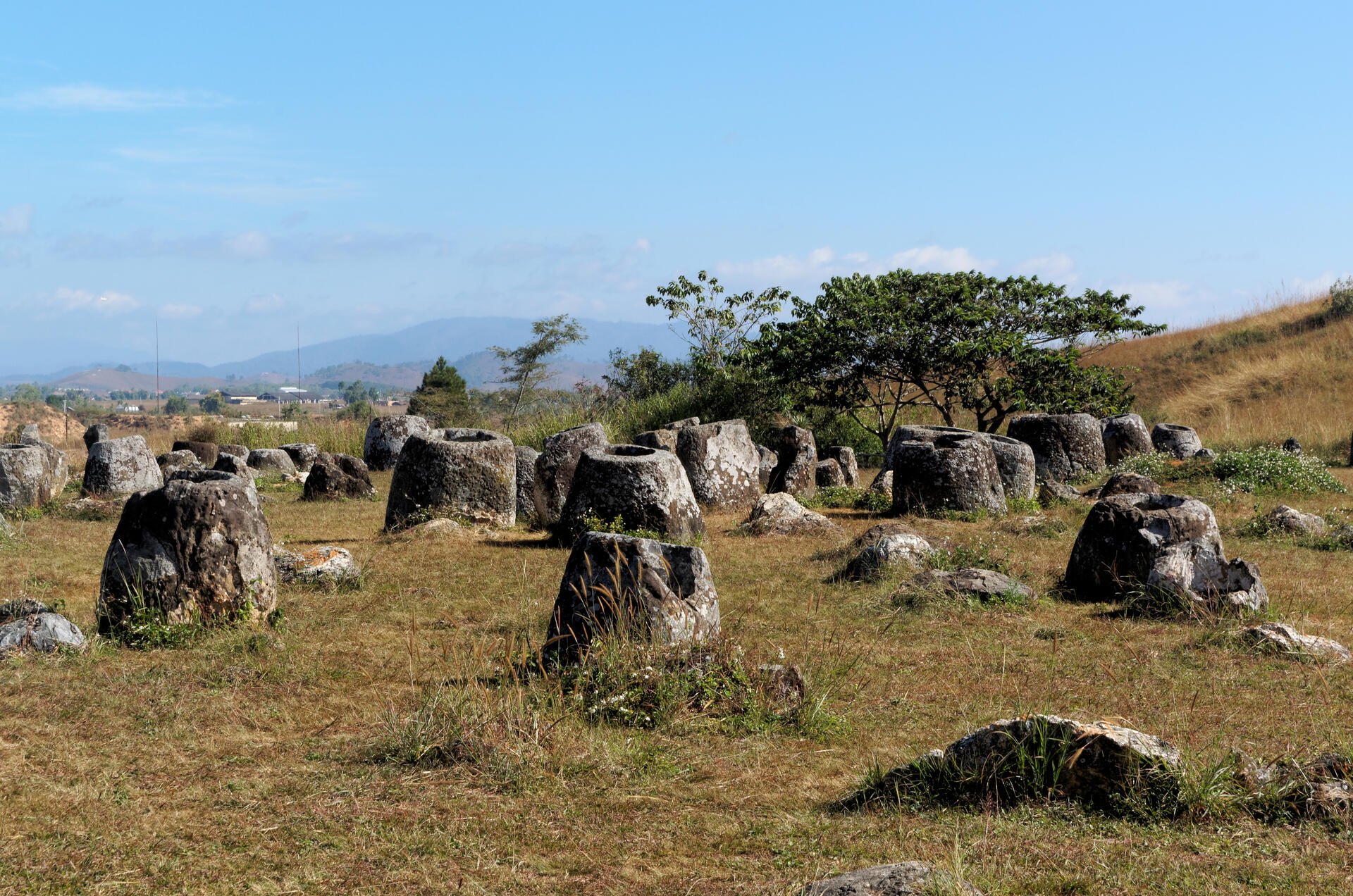
The Plain of Jars, officially recognized as a UNESCO World Heritage Site in 2019, offers a fascinating glimpse into the enigmatic past of central Laos. This megalithic archaeological landscape, situated on the Xiangkhoang Plateau, is characterized by over 2,100 tubular-shaped stone jars, primarily used for funerary purposes during the Iron Age (500 BCE to 500 CE).
More to come…UNESCO Description of the World Heritage Site
The Plain of Jars, located on a plateau in central Laos, gets its name from more than 2,100 tubular-shaped megalithic stone jars used for funerary practices in the Iron Age. This serial property of 15 components contains large carved stone jars, stone discs, secondary burials, tombstones, quarries and funerary objects dating from 500 BCE to 500 CE. The jars and associated elements are the most prominent evidence of the Iron Age civilization that made and used them until it disappeared, around 500 CE.
UNESCO Justification of the World Heritage Site
Criterion (iii): The Plain of Jars exhibits an exceptional testimony to the civilisation that made and used the jars for their funerary practices over a period from approximately 500 BCE to sometime after 500 CE. The size of the megalithic jars, and their large number and wide distribution within the Province of Xiengkhuang is remarkable, and the serial property of 15 components contains a range of sites that can attest to the quarrying, manufacturing, transportation and use of the funerary jars over this lengthy period of southeast Asian cultural histories.
Encyclopedia Record: Plain of Jars
The Plain of Jars is a megalithic archaeological landscape in Laos. It consists of thousands of stone jars scattered around the upland valleys and the lower foothills of the central plain of the Xiangkhoang Plateau. The jars are arranged in clusters ranging in number from one to several hundred.Additional Site Details
Area: 174.56 hectares
Number of Components: 15
Coordinates: 19.4310555556 , 103.1522222222
Image
© Jakub Hałun, CC BY-SA 4.0 Resized from original. (This derivative is under the same CC BY-SA license.)
