World Heritage Identification Number: 1438
World Heritage since: 2014
Category: Mixed Cultural Heritage and Natural Heritage
WHE Type: Natural Landscapes & Geographic Features
Transboundary Heritage: No
Endangered Heritage: No
Country: 🇻🇳 Viet Nam
Continent: Asia
UNESCO World Region: Asia and the Pacific
Map
Exploring the Trang An Landscape Complex: A Journey Through Time and Nature
The Trang An Landscape Complex, located near the southern margin of the Red River Delta in Ninh Binh Province, Vietnam, offers a unique blend of natural beauty and rich cultural heritage that makes it a must-visit destination. Inscribed as a UNESCO World Heritage Site in 2014, this breathtaking landscape is a testament to the region's long history and the resilience of its inhabitants.
More to come…UNESCO Description of the World Heritage Site
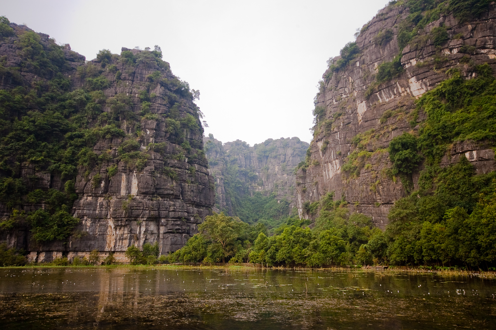
Situated near the southern margin of the Red River Delta, the Trang An Landscape Complex is a spectacular landscape of limestone karst peaks permeated with valleys, many of them partly submerged and surrounded by steep, almost vertical cliffs. Exploration of caves at different altitudes has revealed archaeological traces of human activity over a continuous period of more than 30,000 years. They illustrate the occupation of these mountains by seasonal hunter-gatherers and how they adapted to major climatic and environmental changes, especially the repeated inundation of the landscape by the sea after the last ice age. The story of human occupation continues through the Neolithic and Bronze Ages to the historical era. Hoa Lu, the ancient capital of Viet Nam, was strategically established here in the 10th and 11th centuries AD. The property also contains temples, pagodas, paddy-fields and small villages.
UNESCO Justification of the World Heritage Site
Criterion (v): Trang An is an outstanding locale within Southeast Asia, for demonstrating the way early humans interacted with the natural landscape and adapted to major changes in climatic, geographical and environmental conditions over a period of more than 30,000 years. The long cultural history is closely associated with geological evolution of the Trang An limestone massif in late Pleistocene and early Holocene times, when the inhabitants endured some of the most turbulent climatic and environmental changes in Earth history, including repeated submergence of the landscape due to oscillating sea levels. Within the one compact landscape there are many sites covering multiple periods and functions, comprising early human settlement systems.
Criterion (vii): The exceptionally beautiful tower-karst landscape of Trang An is dominated by a spectacular array of forest-mantled limestone rock towers up to 200m high, which are linked in places by sharp ridges enclosing deep depressions filled by waterways that are inter-connected by a myriad of subterranean cave passages. These features all contribute to a multi-sensory visitor experience that is heightened by contrasting and ever-changing colours - the deep green tropical rainforests, grey limestone rocks and cliffs, blue-green waters and the brilliant blue of the sky, and areas of human use including the green and yellow rice paddies. Visitors, conveyed in traditional sampans rowed by local guides, experience an intimate connection with the natural environment and a relaxing sense of serenity and security. The dramatic mountains, secretive caves and sacred places in Trang An have inspired people through countless generations.
Criterion (viii): Trang An is a superb geological property that displays, in a globally exceptional way, the final stages of tower-karst landscape evolution in a humid tropical environment. Deep dissection of an uplifted limestone massif over a period of five million years has produced a series of classical karst landforms, including cones, towers, enclosed depressions (cockpits), interior-draining valleys (poljes), foot- caves and subterranean cave passages decorated with speleothems. The presence of transitional forms between ‘fengcong’ karst with ridges connecting towers, and ‘fenglin’ karst where towers stand isolated on alluvial plains, is an extremely significant feature of the property. Trang An is an unusual autogenic karst system, being rain-fed only and hydrologically isolated from rivers in the surrounding terrain. Former inundation by the sea transformed the massif into an archipelago for some periods, though it is fully emergent on land today. Fluctuations of sea level are evidenced by an altitudinal series of erosion notches in cliffs, with associated caves, wave-cut platforms, beach deposits and marine shell layers.
Encyclopedia Record: Tràng An Scenic Landscape Complex
Tràng An is a scenic area near Hoa Lư, Vietnam renowned for its boat cave tours. On 23 June 2014, at the 38th session of the World Heritage Committee in Doha, the Trang An Scenic Landscape Complex was inscribed as a UNESCO World Heritage Site.Additional Site Details
Area: 6,226 hectares
Number of Components: 1
(vii) — Contains superlative natural phenomena or beauty
(viii) — Outstanding example representing major earth stages
Coordinates: 20.2566666667 , 105.8963888889
IUCN World Heritage Outlook
The 2025 Conservation Outlook on Trang An Landscape Complex reports the following assessment:
Source: International Union for Conservation of Nature (IUCN) · View assessment
Image
© [Tycho], http://shansov.net, CC BY-SA 3.0 Resized from original. (This derivative is under the same CC BY-SA license.)
