World Heritage Identification Number: 1444
World Heritage since: 2014
Category: Cultural Heritage
WHE Type: Archaeological Sites
Transboundary Heritage: No
Endangered Heritage: No
Country: 🇲🇲 Myanmar
Continent: Asia
UNESCO World Region: Asia and the Pacific
Map
Pyu Ancient Cities: A Thousand Years of Civilization in Myanmar
The Pyu Ancient Cities, inscribed as a UNESCO World Heritage Site in 2014, offer a captivating glimpse into the rich history and culture of Myanmar. Located in the dry zone of the Ayeyarwady (Irrawaddy) River basin, these ancient cities - Halin, Beikthano, and Sri Ksetra - provide valuable insights into the Pyu Kingdoms that thrived for over a millennium between 200 BC and AD 900.
More to come…UNESCO Description of the World Heritage Site
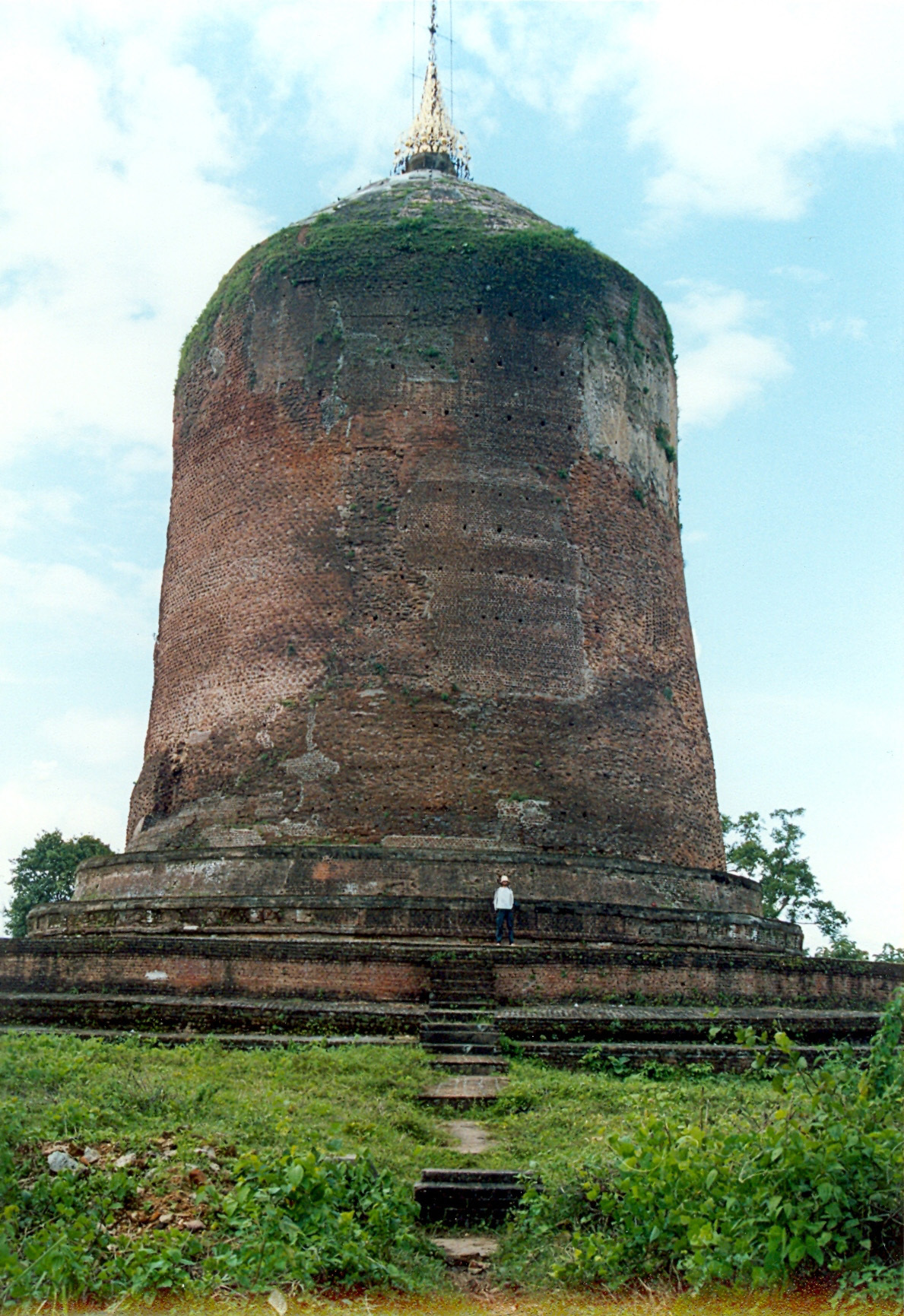
Pyu Ancient Cities includes the remains of three brick, walled and moated cities of Halin, Beikthano and Sri Ksetra located in vast irrigated landscapes in the dry zone of the Ayeyarwady (Irrawaddy) River basin. They reflect the Pyu Kingdoms that flourished for over 1,000 years between 200 BC and AD 900. The three cities are partly excavated archaeological sites. Remains include excavated palace citadels, burial grounds and manufacture sites, as well as monumental brick Buddhist stupas, partly standing walls and water management features – some still in use – that underpinned the organized intensive agriculture.
UNESCO Justification of the World Heritage Site
Criterion (ii): Due to interaction between indigenous Pyu societies with Indic cultures from the 2nd century BCE, Buddhism achieved its first permanent foothold in Southeast Asia among the Pyu cities, where it was embraced by all classes of society from the ruling elite to agrarian labourers. Marked by imposing memorial stupas and other sophisticated forms of brick ritual structures, the Pyu Ancient Cities provide the earliest evidence of the emergence of these innovative architectural forms in the region, some of which have no known prototypes. The development of Pyu Buddhist urban culture had widespread and enduring impact throughout Southeast Asia, providing stimulus for later state formation after the 5th century CE following the onward transmission of Buddhist teaching and monastic practice into other parts of mainland Southeast Asia.
Criterion (iii): The Pyu Ancient Cities marked the emergence of the first historically-documented Buddhist urban civilization in Southeast Asia. The establishment of literate Buddhist monastic communities arose in tandem with the re-organization of agricultural production, based on expert management of seasonally-scarce water resources and the specialized production of manufactured goods in terracotta, iron, gold, silver and semi-precious stones both for veneration and for trade. Buddhism underpinned the construction of religious monuments in brick through royal and common public patronage, marked by the shift to permanent materials from earlier timber building techniques. The Pyu developed unique mortuary practices using burial urns to store cremated remains in communal funerary structures. Trading networks linked the Pyu ancient cities with commercial centres in Southeast Asia, China and India. Through this network Buddhist missionaries carried their Pali-based teaching into other areas of mainland Southeast Asia.
Criterion (iv): Technological innovations in resource management, agriculture and manufacturing of brick and iron at the Pyu Ancient Cities created the preconditions leading to significant advances in urban planning and building construction. These innovations resulted in the rise of the three earliest, largest, and most long-lived Buddhist urban settlements in all of Southeast Asia. The Pyu cities’ urban morphology set a new template of extended urban format characterized by massive gated walls surrounded by moats; a network of roads and canals linking urban space within the walls with extensive areas of extramural development, containing civic amenities, monumental religious structures defined by towering stupas and sacred water bodies. At or near the centre of each ancient city was an administrative compound containing the palace marking the cosmic hub of the Pyu political and social universe.
Encyclopedia Record: Pyu city-states
The Pyu city-states were a group of city-states that existed from about the 2nd century BCE to the mid-11th century in present-day Upper Myanmar. These city-states were founded as part of the migration of the Pyu people from Tibet to Mainland Southeast Asia by the Tibeto-Burman-speaking Pyu settlers, the earliest inhabitants of Burma of whom records are extant. The thousand-year period, often referred to as the Pyu millennium, linked the Bronze Age to the beginning of the classical states period when the Pagan Kingdom emerged in the late 9th century.Additional Site Details
Area: 5,809 hectares
Number of Components: 3
(iii) — Unique or exceptional testimony to a cultural tradition
(iv) — Outstanding example of a type of building or landscape
Coordinates: 22.47 , 95.8186111111
Image
© Doron, CC BY-SA 3.0 Resized from original. (This derivative is under the same CC BY-SA license.)
