World Heritage Identification Number: 1456
World Heritage since: 2014
Category: Cultural Heritage
WHE Type: Archaeological Sites
Transboundary Heritage: No
Endangered Heritage: No
Country: 🇮🇷 Iran (Islamic Republic of)
Continent: Asia
UNESCO World Region: Asia and the Pacific
Map
Shahr-i Sokhta: A Window into the Emergence of Complex Societies in Eastern Iran
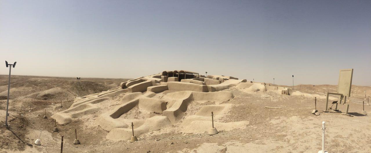
Shahr-i Sokhta, translating to 'Burnt City', is a significant archaeological site located at the intersection of ancient trade routes traversing the Iranian plateau. Inscribed as a UNESCO World Heritage Site in 2014, this mudbrick city offers valuable insights into the development of the earliest complex societies in eastern Iran. Founded around 3200 BC, the city experienced four primary periods of occupation that extended up to 1800 BC.
More to come…UNESCO Description of the World Heritage Site
Shahr-i Sokhta, meaning ‘Burnt City’, is located at the junction of Bronze Age trade routes crossing the Iranian plateau. The remains of the mudbrick city represent the emergence of the first complex societies in eastern Iran. Founded around 3200 BC, it was populated during four main periods up to 1800 BC, during which time there developed several distinct areas within the city: those where monuments were built, and separate quarters for housing, burial and manufacture. Diversions in water courses and climate change led to the eventual abandonment of the city in the early second millennium. The structures, burial grounds and large number of significant artefacts unearthed there, and their well-preserved state due to the dry desert climate, make this site a rich source of information regarding the emergence of complex societies and contacts between them in the third millennium BC.
UNESCO Justification of the World Heritage Site
Criterion (ii): Shahr-i Sokhta exhibits a transition from village habitation to an urbanized community with significant cultural, social and economic achievements and developments from the late Calcolithic to the early Bronze Age. The site is a rich source of information regarding the emergence of complex societies and some contact between them in the third millennium BCE.
Criterion (iii): Shahr-i Sokhta bears exceptional testimony to a peculiar civilization and cultural tradition that entertained trade and cultural relations with ancient sites and cultures on the Indus Plain, southern shores of the Persian Gulf, the Oman Sea and South-west Iran, and Central Asia. Archaeological remains and finds indicate the key role of the city on a very large scale in terms of working with metals, stone vessels, gems and pottery.
Criterion (iv): The ancient site of Shahr-i Sokhta is an outstanding example of early urban planning: excavations have brought to light well-preserved evidence in the form of its mud-brick structures, burial grounds, workshops and artefacts that testify to its size, organisation, the source of its wealth and its trade and social structures. The city was separated into various parts according to different functions - residential, industrial and burial; it therefore represents an important stage in urban planning in the region.
Encyclopedia Record: Shahr-e Sukhteh
Shahr-e Sukhteh, c. 3550–2300 BC, also spelled as Shahr-e Sūkhté and Shahr-i Sōkhta, is an archaeological site of a sizable Bronze Age urban settlement, associated with the Helmand culture. It is located in Sistan and Baluchistan Province, the southeastern part of Iran, on the bank of the Helmand River, near the Zahedan-Zabol road. It was placed on the UNESCO World Heritage List in June 2014.Additional Site Details
Area: 275 hectares
Number of Components: 1
(iii) — Unique or exceptional testimony to a cultural tradition
(iv) — Outstanding example of a type of building or landscape
Coordinates: 30.5938888889 , 61.3277777778
Image
© Saeedrahdari (سعید راهداری), CC BY-SA 4.0 Resized from original. (This derivative is under the same CC BY-SA license.)
