World Heritage Identification Number: 179
World Heritage since: 1982
Category: Mixed Cultural Heritage and Natural Heritage
WHE Type: Archaeological Sites
Transboundary Heritage: No
Endangered Heritage: No
Country: 🇩🇿 Algeria
Continent: Africa
UNESCO World Region: Arab States
Map
Exploring the Prehistoric Art of Tassili n'Ajjer: A Unique UNESCO World Heritage Site
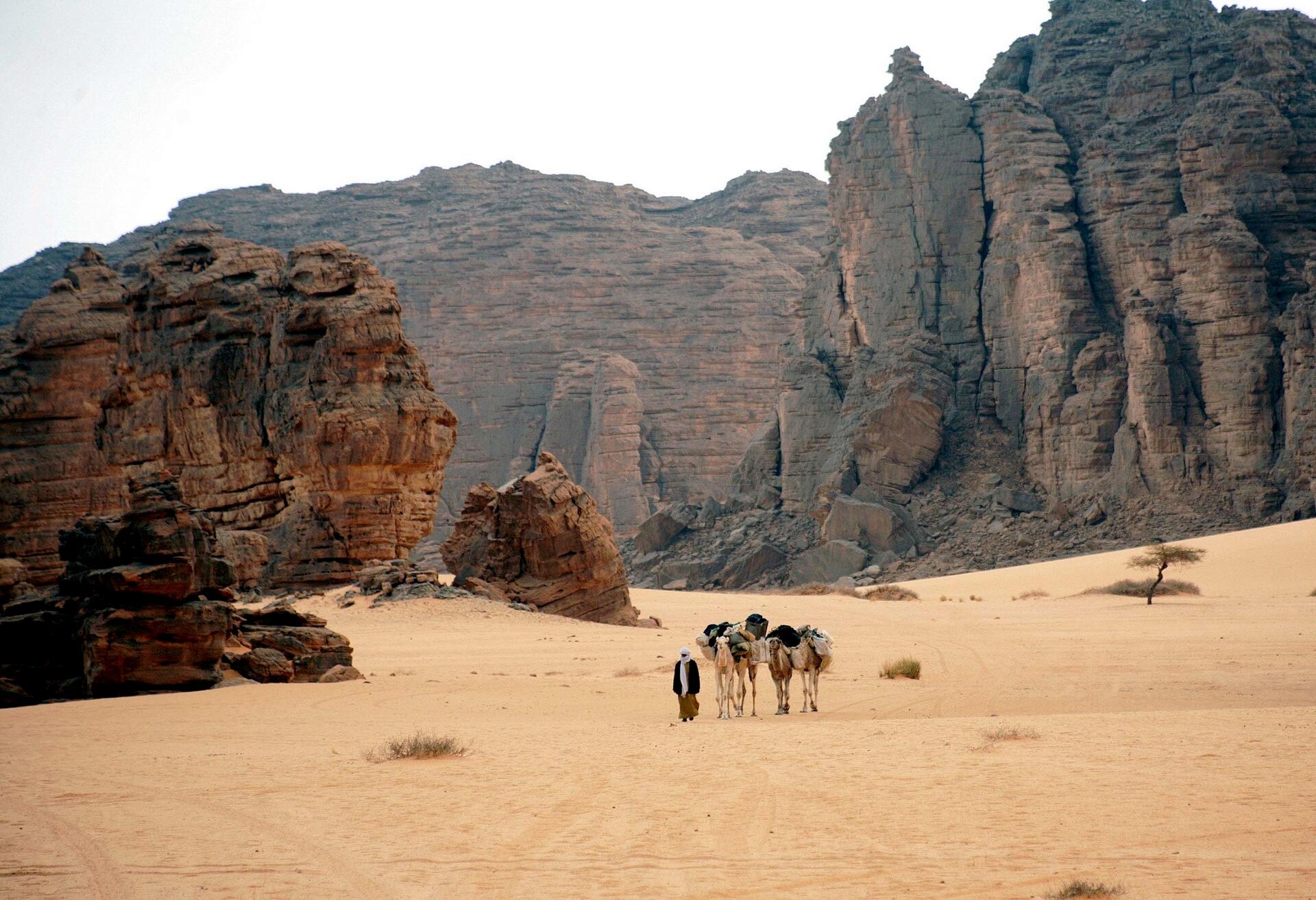
The Tassili n'Ajjer mountain range, situated in the heart of the Sahara Desert, spans over 72,000 square miles (28,000 square kilometers) of southeastern Algeria. This extraordinary landscape, inscribed as a UNESCO World Heritage Site in 1982, boasts some of the most significant prehistoric cave art found worldwide.
More to come…UNESCO Description of the World Heritage Site
Located in a strange lunar landscape of great geological interest, this site has one of the most important groupings of prehistoric cave art in the world. More than 15,000 drawings and engravings record the climatic changes, the animal migrations and the evolution of human life on the edge of the Sahara from 6000 BC to the first centuries of the present era. The geological formations are of outstanding scenic interest, with eroded sandstones forming ‘forests of rock’.
UNESCO Justification of the World Heritage Site
Criterion (i): The impressive array of paintings and rock engravings of various periods gives world recognition to the property. The representations of the Round Heads Period evoke possible magic-religious practices some 10,000 years old, whereas the representations of the Cattle Period depicting daily and social life, and which are amongst the most famous prehistoric parietal art, have an aesthetic naturalistic realism. The last images represent the taming of horses and camels.
Criterion (iii): The rock art images cover a period of about 10,000 years. With the archaeological remains, they testify in a particularly lively manner to climate changes, changes in fauna and flora, and particularly to possibilities provided for farming and pastoral life linked to impregnable defensive sites during certain prehistoric periods.
Criterion (vii): With the eroded sandstone forming rock forests, the property is of remarkable scenic interest. The sandstone has kept intact the traces and marks of the major geological and climatic events. The corrosive effects of water, and then wind, have contributed to the formation of a particular morphology, that of a plateau carved by water and softened by the wind.
Criterion (viii): The geological conformation of Tassili n'Ajjer includes Precambrian crystalline elements and sedimentary sandstone successions of great paleo-geographical and paleo-ecological interest. Humans lived in this area by developing cultural and physiological behaviour adapted to the harsh climate; their vestiges date back to several hundreds of thousands of years. The rock art of Tassili n'Ajjer, is the most eloquent expression of relationships between humans and the environment, with more than 15,000 drawings and engravings testifying to climate changes, wildlife migrations, and the evolution of humankind on the edge of the Sahara. This art depicts water-dependent species like the hippopotamus, and species which have been extinct in the region for thousands of years. This combination of geological, ecological and cultural elements is a highly representative example of a testimony to life.
Encyclopedia Record: Tassili n'Ajjer
Tassili n'Ajjer is a mountain range in the Sahara desert, located in south-eastern Algeria. It holds one of the most important groupings of prehistoric cave art in the world and covers an area of more than 72,000 km2 (28,000 sq mi).Additional Site Details
Area: 7,200,000 hectares
Number of Components: 1
(iii) — Unique or exceptional testimony to a cultural tradition
(vii) — Contains superlative natural phenomena or beauty
(viii) — Outstanding example representing major earth stages
Coordinates: 25.5 , 9
IUCN World Heritage Outlook
The 2025 Conservation Outlook on Tassili n'Ajjer reports the following assessment:
Source: International Union for Conservation of Nature (IUCN) · View assessment