World Heritage Identification Number: 1532
World Heritage since: 2017
Category: Cultural Heritage
WHE Type: Archaeological Sites
Transboundary Heritage: No
Endangered Heritage: No
Country: 🇰🇭 Cambodia
Continent: Asia
UNESCO World Region: Asia and the Pacific
Map
Exploring the Temple Zone of Sambor Prei Kuk: A Glimpse into Ancient Ishanapura
The Temple Zone of Sambor Prei Kuk, officially recognized as the Archaeological Site of Ancient Ishanapura, offers a captivating window into the rich history of the Chenla Empire, which thrived during the late 6th and early 7th centuries AD. Located in Kampong Thom Province, approximately 30 kilometers north of Kampong Thom and 176 kilometers east of Angkor, this remarkable site was designated a UNESCO World Heritage Site in 2017.
More to come…UNESCO Description of the World Heritage Site
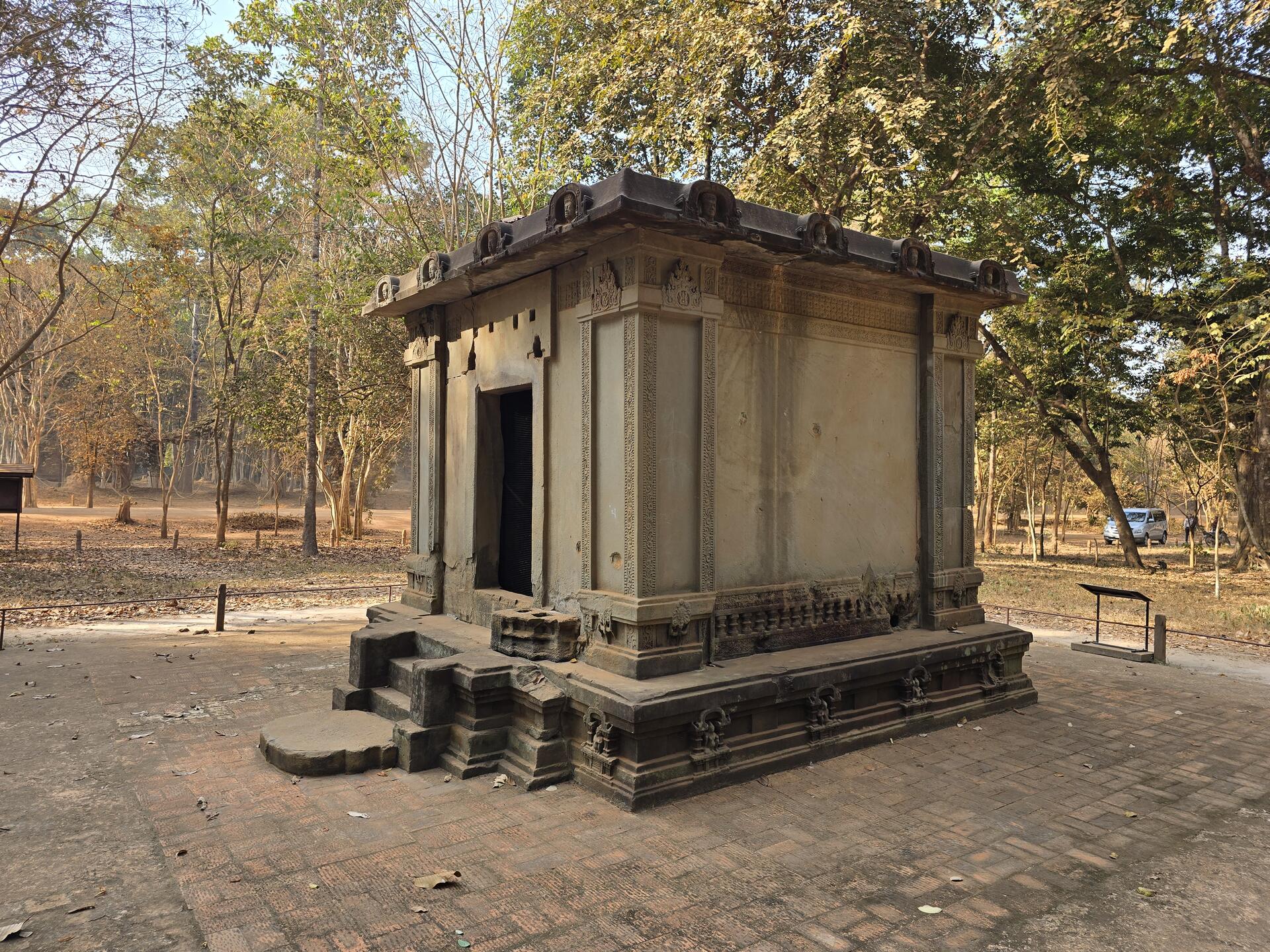
The archaeological site of Sambor Prei Kuk, “the temple in the richness of the forest” in the Khmer language, has been identified as Ishanapura, the capital of the Chenla Empire that flourished in the late 6th and early 7th centuries AD. The property comprises more than a hundred temples, ten of which are octagonal, unique specimens of their genre in South-East Asia. Decorated sandstone elements in the site are characteristic of the pre-Angkor decorative idiom, known as the Sambor Prei Kuk Style. Some of these elements, including lintels, pediments and colonnades, are true masterpieces. The art and architecture developed here became models for other parts of the region and lay the ground for the unique Khmer style of the Angkor period.
UNESCO Justification of the World Heritage Site
Criterion (ii): The Sambor Prei Kuk architectural and artistic style of the Temple Zone of Ishanapura, as exemplified in the layout, architectural forms and sculptured reflects on 186 fired bricks temples with sandstone detailing, presents a vivid convergence of spiritual and technical influences between Hindu cults predominantly from India and Persia and elements of animism and Buddhism, which became a model that spread to other parts of the region and eventually led to the crystallization of the unique Khmer style of the Angkorian period.
Criterion (iii): The Temple Zone of Sambor Prei Kuk of Ancient Ishanapura, in terms of the scale and scope of its surviving buildings and watercourses, is an outstanding testimony to the cultural traditions of the Chenla Kingdom, which flourished over much of Southeast Asia in the late 6th and early 7th centuries AD, and whose architectural achievements laid the foundations for those of the later Khmer civilization in the Angkorian period.
Criterion (vi): The temple inscriptions in the Khmer language of the Temple Zone of Sambor Prei Kuk reflect the concept of the God-King, which according to legends originated in Vat Phou, was further developed during the Angkor period, and then much later influenced Thailand’s four pillared administrative system in Ayutthaya. It remained a concept that was fundamental to the political and governance systems of Cambodia and Thailand until the beginning of the 20th century.
Encyclopedia Record: Sambor Prei Kuk
Sambor Prei Kuk (Isanapura) is an archaeological site in Cambodia located in Kampong Thom Province, 30 km (19 mi) north of Kampong Thom, the provincial capital, 176 km (109 mi) east of Angkor and 206 km (128 mi) north of Phnom Penh. The now ruined complex dates back to the Pre-Angkorian Chenla Kingdom, established by king Isanavarman I as central royal sanctuary and capital, known then as "Isanapura". In 2017, Sambor Prei Kuk was declared a UNESCO World Heritage Site.Additional Site Details
Area: 840.03 hectares
Number of Components: 1
(iii) — Unique or exceptional testimony to a cultural tradition
(vi) — Directly associated with events or living traditions
Coordinates: 12.8725 , 105.0430555556