World Heritage Identification Number: 1662
World Heritage since: 2023
Category: Cultural Heritage
WHE Type: Archaeological Sites
Transboundary Heritage: No
Endangered Heritage: No
Country: 🇹🇭 Thailand
Continent: Asia
UNESCO World Region: Asia and the Pacific
Map
Exploring the Ancient Town of Si Thep and Its Associated Dvaravati Monuments: A Journey Through Time
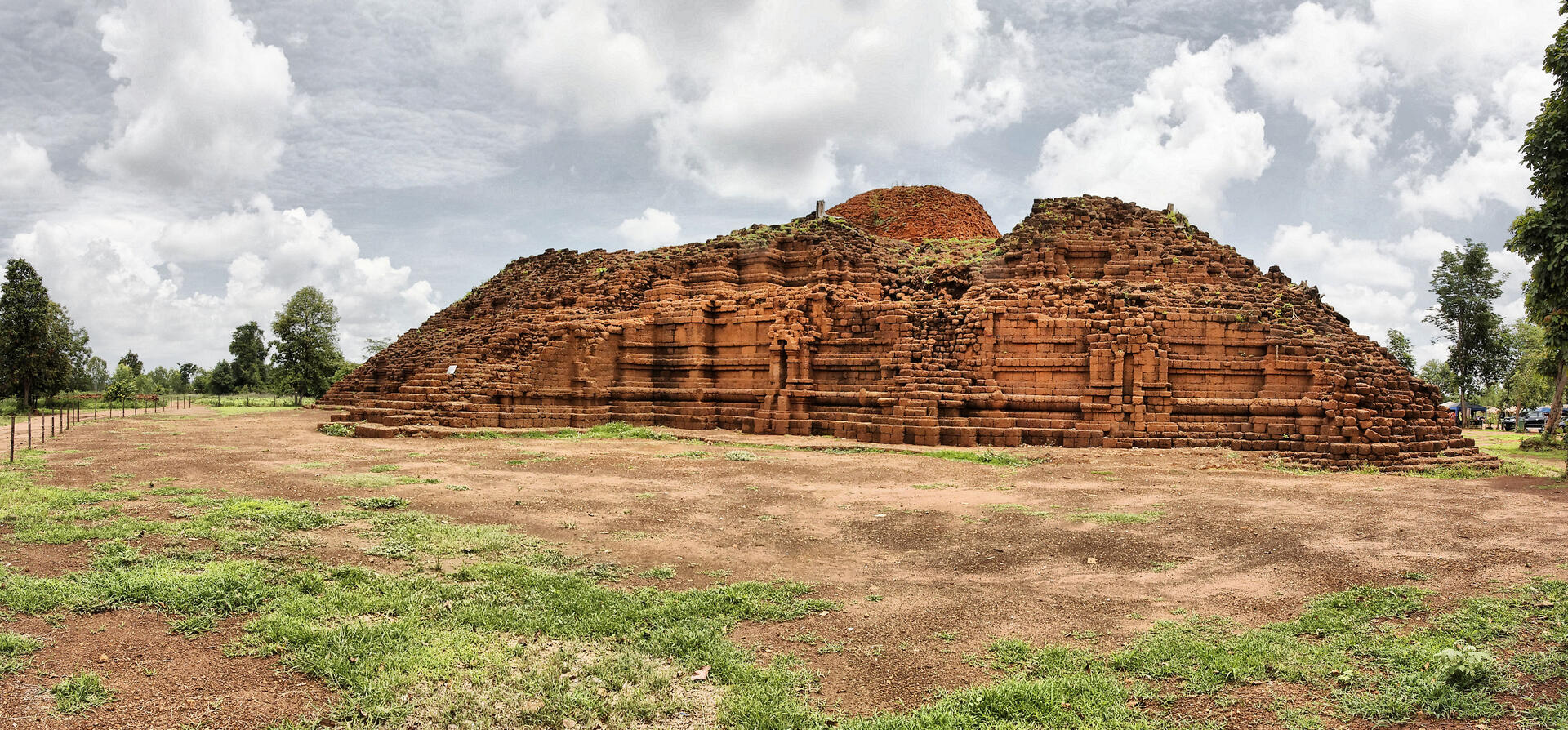
The Ancient Town of Si Thep and its Associated Dvaravati Monuments, inscribed as a UNESCO World Heritage Site in 2023, offers a captivating glimpse into the rich history and cultural diversity of the Dvaravati Empire that flourished in Central Thailand between the 6th and 10th centuries. This serially inscribed property comprises three distinct components: the unique twin-town site, featuring an Inner and Outer Town encircled by moats; the colossal Khao Klang Nok ancient monument; and the Khao Thamorrat Cave ancient monument.
More to come…UNESCO Description of the World Heritage Site
This is a serial property of three component parts: a distinctive twin-town site, featuring an Inner and Outer Town surrounded by moats; the massive Khao Klang Nok ancient monument; and the Khao Thamorrat Cave ancient monument. Together these sites represent the architecture, artistic traditions and religious diversity of the Dvaravati Empire that thrived in Central Thailand from the 6th to the 10th centuries, demonstrating the influences from India. The local adaptation of these traditions resulted in a distinctive artistic tradition known as the Si Thep School of Art which later influenced other civilizations in Southeast Asia.UNESCO Justification of the World Heritage Site
Criterion (ii): The Ancient Town of Si Thep demonstrates important interchanges of cultural and religious traditions that originated in India and were adapted by the Dvaravati Empire between the 6th and 10th centuries. Through these interactions, the town developed a distinctive identity expressed in its artistic and architectural traditions. The Si Thep School of Art subsequently influenced the art and architecture of other areas in Thailand. The cohabitation of Theravada and Mahayana Buddhism and Hinduism is a distinctive characteristic of Dvaravati architecture, town planning and art, and these are demonstrated by the three component parts.
Criterion (iii): The Ancient Town of Si Thep, the Khao Klang Nok ancient monument and the Khao Thamorrat Cave ancient monument bear an exceptional testimony to the Dvaravati culture and civilisation. Together, these sites demonstrate the complexity and the specific artistic and cultural characteristics of the Dvaravati period in terms of urban planning, religious architecture, and monasticism. The architectural and artistic forms of Si Thep are not found elsewhere, particularly the unique twin-town lay-out, and distinctive Dvaravati forms of sculpture such as the standing Tribhanga posture depicting body movement. The Khao Klang Nok ancient monument is the largest monument of Dvaravati art, influenced by South Indian and Indonesian artistic traditions; and the Khao Thamorrat Cave ancient monument is located in a sacred mountain and the only known cave monastery in Mahayana Buddhism in Southeast Asia.
Encyclopedia Record: Si Thep Historical Park
Si Thep Historical Park is an archaeological site in Thailand's Phetchabun province. It covers the ancient city of Si Thep, a site inhabited from around the third to fifth century CE until the thirteenth century, spanning cultural periods from late prehistory, through Dvaravati, to the golden age of the Khmer Empire. Si Thep was one of the largest known city-states that emerged around the plains of central Thailand in the first millennium, but became abandoned around the time the Thai-speaking cities of Sukhothai and later Ayutthaya emerged as new centres of power in the Chao Phraya River basin.Additional Site Details
Area: 866.471 hectares
Number of Components: 3
(iii) — Unique or exceptional testimony to a cultural tradition
Coordinates: 15.4658166667 , 101.1511138889
Image
© Ddalbiez, CC BY-SA 3.0 Resized from original. (This derivative is under the same CC BY-SA license.)
