World Heritage Identification Number: 1481
World Heritage since: 2016
Category: Mixed Cultural Heritage and Natural Heritage
WHE Type: Natural Landscapes & Geographic Features
Transboundary Heritage: No
Endangered Heritage: No
Country: 🇮🇶 Iraq
Continent: Asia
UNESCO World Region: Arab States
Map
The Ahwar of Southern Iraq: A Unique Blend of History and Biodiversity
The Ahwar of Southern Iraq, officially recognized as "The Ahwar of Southern Iraq: Refuge of Biodiversity and the Relict Landscape of the Mesopotamian Cities," is a remarkable UNESCO World Heritage Site situated in the south of Iraq. This designation encompasses seven distinct components, including three archaeological sites and four wetland marsh areas.
More to come…UNESCO Description of the World Heritage Site
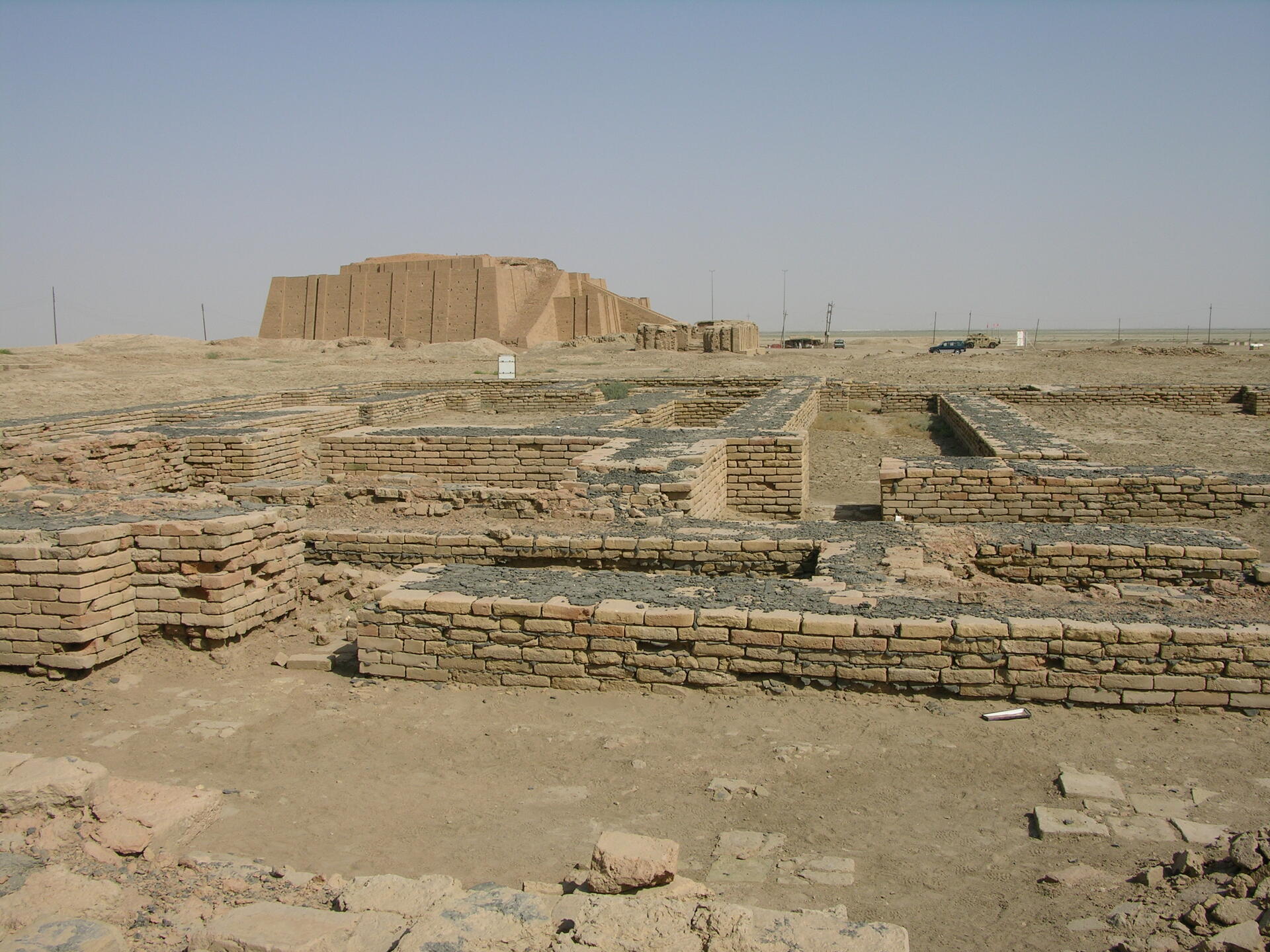
The Ahwar is made up of seven components: three archaeological sites and four wetland marsh areas in southern Iraq. The archaeological cities of Uruk and Ur and the Tell Eridu archaeological site form part of the remains of the Sumerian cities and settlements that developed in southern Mesopotamia between the 4th and the 3rd millennium BCE in the marshy delta of the Tigris and Euphrates rivers. The Ahwar of Southern Iraq – also known as the Iraqi Marshlands – are unique, as one of the world’s largest inland delta systems, in an extremely hot and arid environment.
UNESCO Justification of the World Heritage Site
Criterion (iii): The remains of the Mesopotamian cities of Uruk, Ur and Eridu offer an outstanding testimony to the growth and subsequent decline of southern Mesopotamian urban centres and societies from the Ubaid and Sumerian periods until the Babylonian and Hellenistic periods. The three cities were major religious, political, economic and cultural centres which emerged and grew during a period of profound change in human history. These three components of the property bear witness to the contribution of southern Mesopotamian cultures to the development of ancient Near Eastern urbanized societies and the history of mankind as a whole: the construction of monumental public works and structures in the form of ziggurats, temples, palaces, city walls, and hydraulic works; a class structured society reflected in the urban layout which included royal tombs and palaces, sacred precincts, public storehouses, areas dedicated to industries, and extensive residential neighbourhoods; the centralized control of resources and surplus which gave rise to the first writing system and administrative archives; and conspicuous consumption of imported goods. This exceptionally creative period in human history left its marks across place and time.
Criterion (v): The remains of the ancient cities of Uruk, Ur and Eridu, today in the desert but originally situated near freshwater marshes which receded or became saline before drying up, best exemplify the impact of the unstable deltaic landscape of the Tigris and Euphrates upon the rise and fall of large urban centres. Testimonies of this relict wetland landscape are found today in the cities' topography as traces of shallow depressions which held permanent or seasonal marshes, dry waterways and canal beds, and settlement mounds formed upon what were once islets surrounded by marsh water. Architectural elements, archaeological evidence and an important corpus of cuneiform texts further document how the landscape of wetlands contributed to shaping the religious beliefs, cultic practices, and literary and artistic expressions of successive cultures in southern Mesopotamia.
Criterion (ix): The Huwaizah, East and West Hammar and Central Marshes demonstrate internationally significant ecological succession processes in one of the most arid inland deltas in the world, and contain a high degree of speciation in a relatively young ecosystem. It is one of the largest West Eurasian-Caspian-Nile staging points and wintering grounds for ducks as well as a major stopover point for shorebirds flying along the West Asian-East African flyway. It is also significant for the migration of fish and shrimp species from the Persian Gulf to the marshlands, with most of the fish species demonstrating diadromous characteristics (migratory between salt and fresh waters).
Criterion (x): The Huwaizah, East and West Hammar and Central Marshes contain highly important and significant habitats for in-situ conservation of biological diversity, including endemic, and restricted range species, and numerous populations of threatened species. This includes bird species (e.g. the endemic Basra Reed Warbler and Iraq Babbler, restricted range subspecies of the Little Grebe, Black Francolin and Hooded Crow and the vulnerable Marbled Teal), mammals (e.g. the endemic Bunn’s Short-tailed Bandicot Rat, a subspecies of the Smooth-coated Otter, and the range-restricted Mesopotamian Gerbil and Euphrates Jerboa), as well as 6 range-restricted fish species. The property provides habitat for several reptiles including the Euphrates Soft-shell Turtle, an endangered species that is only known from a few localities in Iraq and Iran, and Murray's Comb-fingered Gecko which has a restricted range limited to the Ahwar, Shatt AI Arab and the Iranian western shores. The marshes also provide habitat for relict populations of three bird species (the African Darter, the Sacred Ibis, and the Goliath Heron) that are thousands of kilometres away from their core global populations in Africa.
Encyclopedia Record: Ahwar of Southern Iraq
The Ahwar of Southern Iraq: Refuge of Biodiversity and the Relict Landscape of the Mesopotamian Cities is a UNESCO World Heritage Site in Southern Iraq.Additional Site Details
Area: 211,544 hectares
Number of Components: 7
(v) — Outstanding example of traditional human settlement
(ix) — Outstanding example representing ecological and biological processes
(x) — Contains most important habitats for biodiversity
Coordinates: 31.5622222222 , 47.6577777778
IUCN World Heritage Outlook
The 2025 Conservation Outlook on The Ahwar of Southern Iraq: Refuge of Biodiversity and the Relict Landscape of the Mesopotamian Cities reports the following assessment:
Source: International Union for Conservation of Nature (IUCN) · View assessment
Image
© M.Lubinski from Iraq,USA., CC BY-SA 2.0 Resized from original. (This derivative is under the same CC BY-SA license.)
